1 Abraham Drive, St Georges, Telford, TF2 9FX
About 1 Abraham Drive
1 Abraham Drive is a detached house in St. Georges, Telford, Telford (TF2 9FX). It has a recorded floor area of 94 m² (around 1012 sq ft) and council tax band D. The latest certificate (April 2012) shows a C (score 78), near the top of the C band. The latest certificate is from April 2012, so improvements made since then won't be reflected.
It lags the bulk of the postcode on energy efficiency (less efficient than 89% of similar EPCs). Across 2021–2021, sale prices on this property compounded at 1.1% per year. Today's modelled estimate of £284,000 is 18.3% above the 2021 sale price. Most recent transfer: October 2021 at £240,000. That sale was during the post-pandemic price surge, when transactions cleared materially above pre-2020 trend.
Know exactly what you're buying at 1 Abraham Drive
Before you offer, see what the listing won't tell you, the true value, the red flags and the full history.
Already flagged here
Valuation
against the asking price
Risks
planning & flood
Sold prices
similar homes nearby
Trends
the local market
Energy performance
1 Abraham Drive's EPC is over a decade old — improvements since won't be reflected.
EPC Expired
This certificate is over 10 years old and is no longer valid.Expired 23 Apr 2022
EPC Rating
Planning history
1 Abraham Drive has no planning applications on record.
Notable planning nearby
1applications of note in the surrounding area
We flagged 1 thing worth checking at 1 Abraham Drive
Independent checks surfaced things a buyer would want to understand before offering. The report explains each one in full, with the underlying data and what to ask.
- Larger development activity nearby
30-day money-back guarantee
Sales history & valuation
1 Abraham Drive changed hands twice within eighteen months — unusual for the area.
£284,000
Modelled from EPC, postcode comparables and a sale-price growth of 1.1% per year over 1 year.
£240,000
Growth on file: 1.1% per year over 1 year.
Sales timeline
4 October 2021Most recent
£240,000
+1.1%14 September 2021
£237,500
Median price across the last 5 sales in TF2 9FX: £265,550 (2025–2023).
Nearby sales in TF2 9FX
9 Abraham Drive, St Georges, Telford, TF2 9FX
Sold Aug 2025
£345,00019 Abraham Drive, St Georges, Telford, TF2 9FX
Sold Jan 2025
£250,00021 Abraham Drive, St Georges, Telford, TF2 9FX
Sold Nov 2024
£241,80015 Abraham Drive, St Georges, Telford, TF2 9FX
Sold Jun 2024
£358,6255 Abraham Drive, St Georges, Telford, TF2 9FX
Sold Nov 2023
£265,550
Everything we know about 1 Abraham Drive, in one report
What it's really worth, what could be wrong, and the planning, sales and area data in full.
What we flagged
- Larger development activity nearby

Versus other Abraham Drive homes
EPC Rating for 1 Abraham Drive lags the street by a wide margin.
Price per m²
£2,553
Street avg £2,915
Floor Area
94 m²
Street avg 101 m²
CO₂ Emissions
2.1 t/year
Street avg 1.7 t/year
Years Held
5 years
Street avg 3 years
Similar properties nearby
1 Aldridge Close, Priorslee
TF2 9SB
1 Aldgate Close, Priorslee
TF2 9WG
1 Aralia Close, Priorslee
TF2 9TL
1 Board Close, St Georges
TF2 9PP
1 Bryony Way
TF2 9QU
1 Buttermere Drive, Priorslee
TF2 9RE
1 Alderslee Close, Priorslee
TF2 9GH
1 Birchlee Close, Priorslee
TF2 9GD
The neighbourhood at a glance
Crime
7/mo
Steady year-on-year across the wider district.
Nearest stop
0.4 km
Walker Crescent — bus stop.
Closest school
0.8 km
St George's Church of England Primary School. 17 schools nearby.
Go deeper on the local area
The full report breaks down crime, transport links, schools and air quality in depth.
Road noise across the postcode
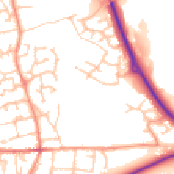
Daytime· 07:00 – 23:00
52.3dB
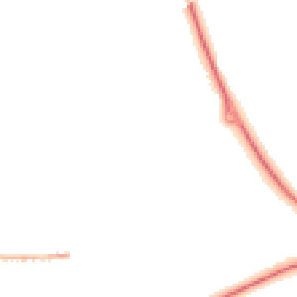
Night-time· 23:00 – 07:00
41.7dB