6 Tristram Drive, Creech St Michael, Taunton, TA3 5QU
About 6 Tristram Drive
6 Tristram Drive is a property in Creech St. Michael, Taunton, Taunton (TA3 5QU). It has council tax band C.
It hasn't traded since August 1999, a hold of 27 years that's notably long for the area. Only one transfer is on record with HM Land Registry, suggesting it has stayed in the same hands for a long time.
Everything you need to know about 6 Tristram Drive
The true value, the hidden risks and the full sale history, in one report.
Pick your report · every report is £14.99
One time fee only - money back guarantee

The data behind every report


Energy performance
No EPC on record
This property doesn't have an Energy Performance Certificate yet. An EPC is required to sell or let — and unlocks our automated valuation.
Get a survey for this property
Level 2 HomeBuyer Report
We've checked 10 risk factors against the available data for this property and believe a Level 2 HomeBuyer Report could be a suitable option for you.
Planning history
6 Tristram Drive has no planning applications on record.
But the area is active
1 notable application nearby — larger schemes and conversions that could reshape the street. The report maps them all.
Sales history & valuation
6 Tristram Drive has been held in the same hands since before 2000.
£72,500
Recorded with HM Land Registry.
Sales timeline
3 August 1999Most recent
£72,500
Median price across the last 5 sales in TA3 5QU: £255,000 (2025–2022).
Nearby sales in TA3 5QU
5 Tristram Drive, Creech St Michael, Taunton, TA3 5QU
Sold Apr 2025
£244,0004 Tristram Drive, Creech St Michael, Taunton, TA3 5QU
Sold Jan 2024
£267,0003 Tristram Drive, Creech St Michael, Taunton, TA3 5QU
Sold Nov 2023
£225,00021 Tristram Drive, Creech St Michael, Taunton, TA3 5QU
Sold Dec 2022
£255,0001 Tristram Drive, Creech St Michael, Taunton, TA3 5QU
Sold Feb 2022
£270,000
Everything you need to know about 6 Tristram Drive
The true value, the hidden risks and the full sale history, in one report.
Pick your report · every report is £14.99
One time fee only - money back guarantee
The data behind every report
Similar properties nearby
1 2 Elderberry Cottages, North End, Creech St Michael
TA3 5ED
1 Alexander Close, Creech St Michael
TA3 5DY
1 Alexevia Caravan Park, Ruishton
TA3 5LE
1 Anns Orchard, Creech St Michael
TA3 5PZ
1 Arundells Way, Creech St Michael
TA3 5QS
1 Arundels Cottages, Lower Henlade
TA3 5LY
1 Boons Orchard, Ruishton
TA3 5JH
1 Broad Close, West Hatch
TA3 5RG
The neighbourhood at a glance
Daytime road noise here sits well below conversation level — a quiet pocket of the postcode.
Crime
3/mo
Steady year-on-year across the wider district.
Nearest stop
0.2 km
Arundells Way — bus stop.
Closest school
0.2 km
Creech St Michael Church of England Primary School. 7 schools nearby.
Go deeper on the local area
A Local Area report breaks down crime, transport links, schools and air quality in depth.
Road noise across the postcode
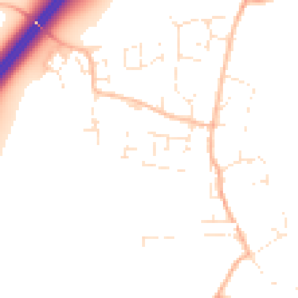
Daytime· 07:00 – 23:00
50.0dB

Night-time· 23:00 – 07:00
40.5dB