67 Monkmoor Road, Shrewsbury, SY2 5AT
About 67 Monkmoor Road
67 Monkmoor Road is a four-bedroom semi-detached house in Shrewsbury (SY2 5AT). It has a recorded floor area of 146 m² (around 1572 sq ft), construction records dating it to before 1900 and council tax band C. The latest certificate (November 2023) shows an E (score 51), well below the UK norm with real room to improve. When first surveyed in December 2018 the rating was F, the property has climbed 1 band since. Between certificates, window efficiency went from Very Poor to Average, hot-water efficiency went from Poor to Good and lighting went from Very Poor to Very Good; while wall efficiency dropped from Poor to Very Poor and roof efficiency dropped from Good to Very Poor. The recommended improvements would lift it to C (score 74), a 2-band jump. Other recorded features include a basement. Period features are noted in the property record. Records show the property has been extended at some point in its history. The home occupies a cul-de-sac position.
At 146 m² the property is well over the postcode median (93 m² across 3 EPCs), placing it in the larger end of the local stock. Across 2000–2024, sale prices on this property compounded at 5.4% per year. Today's modelled estimate of £384,000 is 11.3% above the 2024 sale price. On a £-per-square-foot basis, the last sale (£220/sq ft) was about 91.7% above the typical sold price in the postcode. Last sale on file: £345,000 in May 2024. One historical planning record sits against the property in 2020.
What this property has
Inside
- Bedrooms4
- Utility roomYes
- CloakroomYes
- EnsuiteYes
- BasementYes
Outside
- Private gardenRear
- ParkingOff street
- Cul-de-sacYes
Building
- Period featuresYes
- Previously extendedYes
Everything you need to know about 67 Monkmoor Road
The true value, the hidden risks and the full sale history, in one report.
30-day money-back guarantee

The data behind every report


Energy performance
67 Monkmoor Road's carbon output runs well above what efficient homes in the postcode produce.
EPC Rating
Property Improvements
Changes detected from historical EPC data
Heating controls upgraded for better temperature management
Hot water system upgraded
Windows upgraded, improving insulation
Floor insulation added or improved
More low energy lighting installed
Planning history
- Oct 2020RenovationFullIn report
Formation of new vehicular crossover and block paved driveway
- Documents
- 5 docs on file
- Reference
- 20/02414/FUL
We flagged 1 thing worth checking at 67 Monkmoor Road
Independent checks surfaced things a buyer would want to understand before offering. The report explains each one in full, with the underlying data and what to ask.
- Larger development activity nearby
30-day money-back guarantee
Sales history & valuation
Latest sale on 67 Monkmoor Road was the highest on Land Registry record across the postcode.
£384,000
Modelled from EPC, postcode comparables and a sale-price growth of 5.4% per year over 24 years.
£345,000
Growth on file: 5.4% per year over 24 years.
Sales timeline
27 May 2024Most recent
£345,000
+86.5%over 5 years26 February 2019
£185,000
+85.9%over 18 years30 July 2000
£99,500
Median price across the last 5 sales in SY2 5AT: £235,000 (2024–2003).
Everything you need to know about 67 Monkmoor Road
The true value, the hidden risks and the full sale history, in one report.
30-day money-back guarantee
The data behind every report
Similar properties nearby
1 Burkitt Close
SY2 5WN
1 Burnham Avenue
SY2 5LL
1 Belgrave Place
SY2 5LJ
1 Abbots Place
SY2 5PY
1 Brighton Terrace, Bradford Street
SY2 5DS
1 Abbots Road
SY2 5PX
1 Allness Close
SY2 5XH
1 Alvaston Way
SY2 5TT
The neighbourhood at a glance
Rail-style transport is unusually close for this postcode.
Crime
1/mo
Steady year-on-year across the wider district.
Nearest stop
0.9 km
Shrewsbury Rail Station — railway station.
Closest school
0.7 km
Crowmoor Primary School. 20 schools nearby.
Go deeper on the local area
The full report breaks down crime, transport links, schools and air quality in depth.
Road noise across the postcode
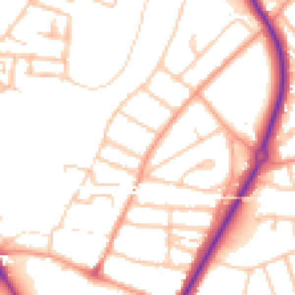
Daytime· 07:00 – 23:00
50.8dB

Night-time· 23:00 – 07:00
40.7dB