3 All Saints Close, Lambeth, London, SW8 2PW
4 planning records
About 3 All Saints Close
A plain-English summary derived from public records, EPC certificates, sold prices and local data.
3 All Saints Close is a three-bedroom mid-terrace house in Lambeth, London, London (SW8 2PW). It has a recorded floor area of 236 m² (around 2540 sq ft), construction records dating it to before 1900 and council tax band G. Tenure is freehold. At 236 m² this is the largest unit on EPC record across the building (110–236 m²). The building's EPC ratings span D to C, with this unit at the top. The latest certificate (March 2021) shows a C (score 73).
Sale prices here have outpaced London HPI: 5% per year against 0% for the wider region. Today's modelled estimate of £1,770,000 is 27.3% above the 2021 sale price. At 236 m² the property is well over the postcode median (175 m² across 4 EPCs), placing it in the larger end of the local stock. 4 planning records sit against the property, 4 approved, 0 refused. Past consents include tree works, meaningful when judging how the property has evolved. Sold June 2021 for £1,390,000. That sale was during the post-pandemic price surge, when transactions cleared materially above pre-2020 trend.
What this property has
Pulled from EPC certificates, claim submissions and our property model. Empty categories are hidden — we only show what's known.
Inside
- Bedrooms3
- Bathrooms3
- Open-plan layoutYes
- EnsuiteYes
Energy performance
Every EPC certificate filed against this property — current rating, recorded improvements, and where there's headroom to reach a higher band.
EPC Rating
A
B
C
C73
D
E
F
G
Main Heating
Gas
Main Fuel
Gas
Hot Water
Good
Windows
Average
CO2 Emissions
5.8 t/year
Occupancy
Owner Occupied
Planning history
Applications and permits filed against 3 All Saints Close, Lambeth, London, SW8 2PW, sourced from the PlanIt planning register.
3 All Saints Close has been through 4 approved planning applications — a well-evolved property.
- Jun 2014ConditionsGrant Permission
Approval of details pursuant to condition 3 (Approved drawings) of Planning Permission Ref: 14/00169/FUL (Installation of two roof lights to the South East elevation.) Granted on 26.03.2014
Sales history & valuation
Recorded transactions, our model's current estimate, and a quick read on what neighbouring properties have sold for.
Sale price has at least doubled since 2000.
Current estimate
See how we calculated this£1,770,000
Modelled from EPC, postcode comparables and a sale-price growth of 5.0% per year over 21 years.
Last sold (2021)
£1,390,000
Growth on file: 5.0% per year over 21 years.
Sales timeline
Launch offer · 33% off
The complete analysis of 3 All Saints Close, Lambeth, London, SW8 2PW
Everything we know about this property, compiled into one in-depth, downloadable report.
Detailed analysis
A written breakdown of everything that matters
Similar properties nearby
A handful of close matches in the same postcode area, ranked by likeness on bedrooms, type and floor area.
The neighbourhood at a glance
A condensed read of the local area. Each tile links through to the full breakdown on the London district page.
Rail-style transport is unusually close for this postcode.
Crime
12/mo
Rising year-on-year across the wider district.
Nearest stop
0.2 km
Larkhall Park — bus stop.
Road noise across the postcode
Modelled day and night-time noise levels around SW8 2PW from Defra's strategic mapping. The pin marks this postcode's centroid.
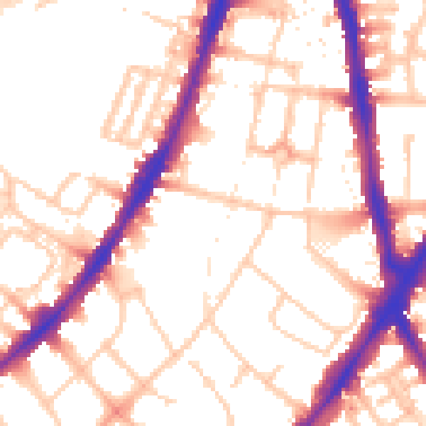
Daytime· 07:00 – 23:00
54.1dB

Everything within walking distance
Schools, transport stops and scenic spots near this property — 122 points of interest in total.
Common questions
The questions buyers, sellers and homeowners most often ask about 3 All Saints Close, Lambeth, London, SW8 2PW. Each answer is also embedded as structured data for search engines.
