9 Aldrin Close, Stafford, ST16 3SZ
About 9 Aldrin Close
9 Aldrin Close is an end-of-terrace house in Stafford (ST16 3SZ). It has a recorded floor area of 59 m² (around 635 sq ft), construction records dating it to 1991-1995 and council tax band B. The latest certificate (March 2016) shows a C (score 70). The recommended improvements would push it to B (score 86). The latest certificate is from March 2016, so improvements made since then won't be reflected.
Most recent transfer was May 2025 at £180,000 — fresh data. Across 1996–2025, sale prices on this property compounded at 4.9% per year. On a £-per-square-foot basis, the last sale (£283/sq ft) was about 145.8% above the typical sold price in the postcode. One historical planning record sits against the property in 2019.
Everything you need to know about 9 Aldrin Close
The true value, the hidden risks and the full sale history, in one report.
Pick your report · every report is £14.99
One time fee only - money back guarantee

The data behind every report


Energy performance
EPC Expired
This certificate is over 10 years old and is no longer valid.Expired 04 Mar 2026
EPC Rating
Get a survey for this property
Level 2 HomeBuyer Report
We've checked 10 risk factors against the available data for this property and believe a Level 2 HomeBuyer Report could be a suitable option for you.
From £495 · Includes VAT
Planning history
Planning history includes recorded demolition works, indicating a major rebuild phase at this address.
1 application on record at 9 Aldrin Close, Stafford, ST16 3SZ
- Jan 2019DemolitionFullOutcome in report
Extension: Two storey · Rear of property
Two-storey rear extension and demolition of the existing conservatory
Extension- Documents
- 24 docs on file
- Reference
- 18/29556/HOU
Unlock 9 Aldrin Close, Stafford, ST16 3SZ's full planning history
You're seeing the shape of it. The report has the substance.
- Every decision — granted, refused or withdrawn (1 on record)
- All 1 application on this property in full, plus 8 notable nearby
- The 24 documents, officer reports & conditions
- What the pattern means for extending or converting here
One time fee only - money back guarantee
Sales history & valuation
Latest sale on 9 Aldrin Close was the highest on Land Registry record across the postcode.
£187,000
Modelled from EPC, postcode comparables and a sale-price growth of 4.9% per year over 29 years.
£180,000
Growth on file: 4.9% per year over 29 years.
Sales timeline
29 May 2025Most recent
£180,000
-10.0%23 December 2024
£200,000
+81.0%over 19 years13 October 2005
£110,500
+75.4%over 3 years1 March 2002
£63,000
+40.8%over 5 years2 April 1996
£44,750
Median price across the last 5 sales in ST16 3SZ: £140,000 (2023–2020).
Nearby sales in ST16 3SZ
Versus other Aldrin Close homes
On years held, 9 Aldrin Close runs well behind the street norm.
Price per m²
£3,051
Street avg £2,015
Floor Area
59 m²
Street avg 60 m²
Habitable Rooms
3 rooms
Street avg 4 rooms
CO₂ Emissions
2.4 t/year
Street avg 2.5 t/year
Everything you need to know about 9 Aldrin Close
The true value, the hidden risks and the full sale history, in one report.
Pick your report · every report is £14.99
One time fee only - money back guarantee
The data behind every report
Similar properties nearby
The neighbourhood at a glance
Crime
7/mo
Steady year-on-year across the wider district.
Nearest stop
0.2 km
Grocery Store — bus stop.
Closest school
0.4 km
St John's CofE Primary Academy. 17 schools nearby.
Go deeper on the local area
A Local Area report breaks down crime, transport links, schools and air quality in depth.
Road noise across the postcode
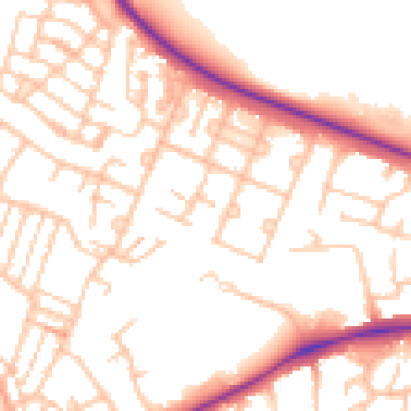
Daytime· 07:00 – 23:00
52.8dB

Night-time· 23:00 – 07:00
42.4dB