21 Rutland Street, Stoke On Trent, ST1 5JG
About 21 Rutland Street
21 Rutland Street is a two-bedroom mid-terrace house in Stoke On Trent (ST1 5JG). It has a recorded floor area of 68 m² (around 732 sq ft), construction records dating it to 1900-1929 and council tax band A. The latest certificate (November 2019) shows a D (score 65), on the cusp of jumping into the C band. Earlier certificates rated it C (August 2009); the latest reading is one band lower. Between certificates, wall efficiency dropped from Poor to Very Poor and window efficiency dropped from Good to Average. The recommended improvements would lift it to B (score 85), a 2-band jump. Our model identifies extension potential, subject to local planning policy. The home occupies a corner plot.
Across 2004–2022, sale prices on this property compounded at 2.6% per year. Today's modelled estimate of £106,000 sits 82.8% above the 2022 sale of £58,000. On a £-per-square-foot basis, the last sale (£79/sq ft) was about 18.7% above the typical sold price in the postcode. Most recent transfer: July 2022 at £58,000. That sale was during the post-pandemic price surge, when transactions cleared materially above pre-2020 trend.
What this property has
Inside
- Bedrooms2
- Bathrooms1
Outside
- Corner plotYes
Building
- Extension potentialPossible
Everything you need to know about 21 Rutland Street
The true value, the hidden risks and the full sale history, in one report.
Pick your report · every report is £14.99
One time fee only - money back guarantee

The data behind every report


Energy performance
Recommended upgrades on file would lift this property by multiple EPC bands.
EPC Rating
Get a survey for this property
Level 3 Building Survey
Because the property was built before 1919 and has solid (non-cavity) walls, we believe a Level 3 building survey should be considered.
From £820 · Includes VAT
Planning history
21 Rutland Street has no planning applications on record.
But the area is active
1 notable application nearby — larger schemes and conversions that could reshape the street. The report maps them all.
Sales history & valuation
The latest sale landed in the post-pandemic price surge — useful context when reading the figure.
£106,000
Modelled from EPC, postcode comparables and a sale-price growth of 2.6% per year over 18 years.
£58,000
Growth on file: 2.6% per year over 18 years.
Sales timeline
20 July 2022Most recent
£58,000
+56.8%over 17 years15 November 2004
£37,000
Median price across the last 5 sales in ST1 5JG: £82,000 (2025–2025).
Nearby sales in ST1 5JG
45 Rutland Street, Stoke On Trent, ST1 5JG
Sold Aug 2025
£82,00054 Rutland Street, Stoke On Trent, ST1 5JG
Sold Aug 2025
£85,00044 Rutland Street, Stoke On Trent, ST1 5JG
Sold Jul 2025
£91,0009 Rutland Street, Stoke On Trent, ST1 5JG
Sold May 2025
£62,00015 Rutland Street, Stoke On Trent, ST1 5JG
Sold May 2025
£50,000
Versus other Rutland Street homes
On habitable rooms, 21 Rutland Street runs well behind the street norm.
Price per m²
£853
Street avg £900
Floor Area
68 m²
Street avg 63 m²
Habitable Rooms
3 rooms
Street avg 4 rooms
CO₂ Emissions
3.3 t/year
Street avg 2.9 t/year
Everything you need to know about 21 Rutland Street
The true value, the hidden risks and the full sale history, in one report.
Pick your report · every report is £14.99
One time fee only - money back guarantee
The data behind every report
Similar properties nearby
1 Denbigh Street
ST1 5JA
1 Pebble Mill Street
ST1 5RG
1 Rosevean Close
ST1 5QU
1 Lowther Street
ST1 5JE
1 Cape Street
ST1 5AZ
1 Boundary Street
ST1 5BA
1 James Broomhall Place
ST1 5FE
1 Ernest Tyrer Avenue
ST1 5FB
The neighbourhood at a glance
Crime
27/mo
Falling year-on-year across the wider district.
Nearest stop
0.2 km
Portland Street — bus stop.
Closest school
0.3 km
Forest Park Primary School. 34 schools nearby.
Go deeper on the local area
A Local Area report breaks down crime, transport links, schools and air quality in depth.
Road noise across the postcode
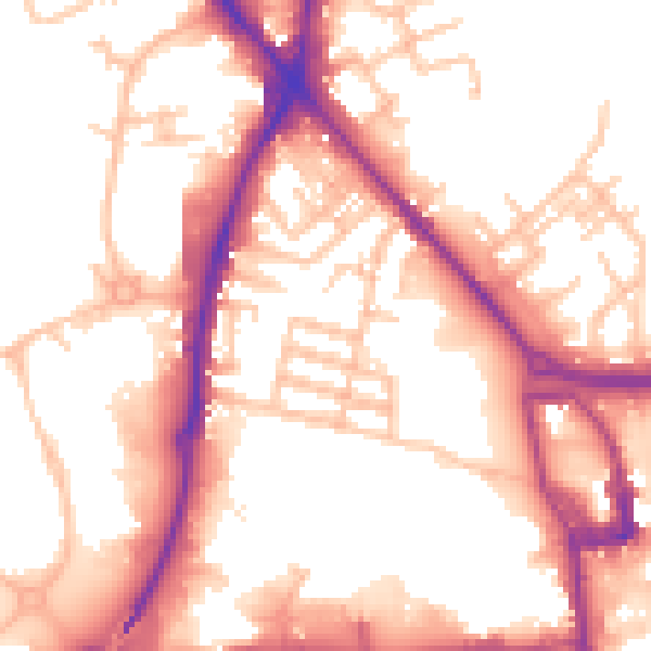
Daytime· 07:00 – 23:00
55.2dB

Night-time· 23:00 – 07:00
46.1dB