35 Denbigh Street, Stoke On Trent, ST1 5JA
About 35 Denbigh Street
35 Denbigh Street is a three-bedroom end-of-terrace house in Stoke On Trent (ST1 5JA). It has a recorded floor area of 82 m² (around 883 sq ft), construction records dating it to before 1900 and council tax band A. The latest certificate (June 2016) shows a D (score 65), on the cusp of jumping into the C band. The recommended improvements would lift it to B (score 83), a 2-band jump. The home occupies a corner plot.
Across 2000–2017, sale prices on this property compounded at 4.9% per year. Today's modelled estimate of £119,000 sits 138% above the 2017 sale of £50,000. 8 years since the last transfer (December 2017). Across the public record there are 5 sales, relatively high churn for a single property. At 82 m² it's 24.2% larger than the typical home in the postcode (66 m² median across 36 EPCs).
What this property has
Inside
- Bedrooms3
- Bathrooms1
Outside
- Corner plotYes
Building
- Heating systemGas
Everything you need to know about 35 Denbigh Street
The true value, the hidden risks and the full sale history, in one report.
Pick your report · every report is £14.99
One time fee only - money back guarantee

The data behind every report


Energy performance
Recommended upgrades on file would lift this property by multiple EPC bands.
EPC Expired
This certificate is over 10 years old and is no longer valid.Expired 26 Jun 2026
EPC Rating
Get a survey for this property
Level 3 Building Survey
Because the property was built before 1919, has been extended more than once, and has solid (non-cavity) walls, we believe a Level 3 building survey should be considered.
From £820 · Includes VAT
Planning history
35 Denbigh Street has no planning applications on record.
But the area is active
1 notable application nearby — larger schemes and conversions that could reshape the street. The report maps them all.
Sales history & valuation
Sale price has at least doubled since 2000.
£119,000
Modelled from EPC, postcode comparables and a sale-price growth of 4.9% per year over 17 years.
£50,000
Growth on file: 4.9% per year over 17 years.
Sales timeline
8 December 2017Most recent
£50,000
+11.1%over 12 months15 December 2016
£45,000
-19.6%over 10 years20 August 2006
£56,000
+60.0%over 1 year26 August 2004
£35,000
+59.1%over 3 years8 December 2000
£22,000
Median price across the last 5 sales in ST1 5JA: £84,000 (2025–2024).
Nearby sales in ST1 5JA
25 Denbigh Street, Stoke On Trent, ST1 5JA
Sold Jun 2025
£83,00013 Denbigh Street, Stoke On Trent, ST1 5JA
Sold Jun 2025
£84,00067 Denbigh Street, Stoke On Trent, ST1 5JA
Sold Mar 2025
£90,00023 Denbigh Street, Stoke On Trent, ST1 5JA
Sold Nov 2024
£92,00083 Denbigh Street, Stoke On Trent, ST1 5JA
Sold Sept 2024
£67,000
Versus other Denbigh Street homes
On floor area, 35 Denbigh Street stands well clear of the street.
Price per m²
£610
Street avg £857
Floor Area
82 m²
Street avg 69 m²
Habitable Rooms
5 rooms
Street avg 4 rooms
CO₂ Emissions
3.8 t/year
Street avg 2.9 t/year
Everything you need to know about 35 Denbigh Street
The true value, the hidden risks and the full sale history, in one report.
Pick your report · every report is £14.99
One time fee only - money back guarantee
The data behind every report
Similar properties nearby
1 Cape Street
ST1 5AZ
1 Boundary Street
ST1 5BA
1 James Broomhall Place
ST1 5FE
1 Ernest Tyrer Avenue
ST1 5FB
1 Pebble Mill Street
ST1 5RG
1 Rosevean Close
ST1 5QU
1 Denbigh Street
ST1 5JA
1 Boatman Drive
ST1 5PD
The neighbourhood at a glance
Crime
27/mo
Falling year-on-year across the wider district.
Nearest stop
0.3 km
Vale Place — bus stop.
Closest school
0.4 km
Forest Park Primary School. 36 schools nearby.
Go deeper on the local area
A Local Area report breaks down crime, transport links, schools and air quality in depth.
Road noise across the postcode
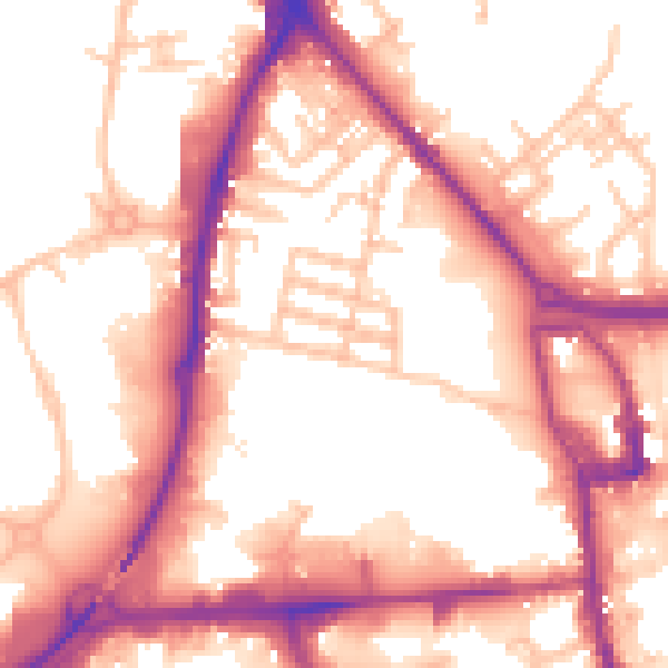
Daytime· 07:00 – 23:00
56.4dB

Night-time· 23:00 – 07:00
47.5dB