41 Ethelburt Avenue, Southampton, SO16 3DG
About 41 Ethelburt Avenue
41 Ethelburt Avenue is a three-bedroom end-of-terrace house in Southampton (SO16 3DG). It has a recorded floor area of 94 m² (around 1012 sq ft), construction records dating it to 1900-1929 and council tax band D. The latest certificate (September 2022) shows a D (score 64), on the cusp of jumping into the C band. When first surveyed in February 2015 the rating was E, the property has climbed 1 band since. Between certificates, roof efficiency went from Average to Good, hot-water efficiency went from Average to Good and lighting went from Good to Very Good. The recommended improvements would lift it to B (score 84), a 2-band jump. The home occupies a corner plot.
3 planning records sit against the property, 1 approved, 0 refused. Past consents include an extension, meaningful when judging how the property has evolved. Across 2015–2023, sale prices on this property compounded at 7% per year. On a £-per-square-foot basis, the last sale (£420/sq ft) was about 83.3% above the typical sold price in the postcode. At 94 m² it's 22.3% smaller than the typical home in the postcode (121 m² median across 14 EPCs). Last sale on file: £425,000 in April 2023.
What this property has
Inside
- Bedrooms3
- Bathrooms1
- Open-plan layoutYes
- Dining roomYes
- FireplaceYes
Outside
- GarageDetached
- Corner plotYes
Building
- RefurbishedYes
Everything you need to know about 41 Ethelburt Avenue
The true value, the hidden risks and the full sale history, in one report.
Pick your report · from £14.99
One time fee only - money back guarantee

The data behind every report







Energy performance
Recommended upgrades on file would lift this property by multiple EPC bands.
EPC Rating
Certificate validity
Valid until 22 September 2032
Property Improvements
Changes detected from historical EPC data
Hot water efficiency improved
Low energy lighting percentage decreased
Heating controls upgraded for better temperature management
Roof insulation improved
More low energy lighting installed

Get a survey for this property
Level 3 Building Survey
Because the property was built before 1919, we believe a Level 3 building survey should be considered.
From £1,020 · Includes VAT
Planning history
41 Ethelburt Avenue has an approved single-storey side extension on the planning record.
3 applications on record at 41 Ethelburt Avenue, Southampton, SO16 3DG
- Aug 2015Tree WorksTreesOutcome in report
Tree Works
- Documents
- 2 docs on file
- Reference
- 15/00025/TCA
- More recent applications — locked
- ConditionsJun 2025Decision
- ExtensionFeb 2025Decision
Unlock 41 Ethelburt Avenue, Southampton, SO16 3DG's full planning history
You're seeing the shape of it. The report has the substance.
- Every decision — granted, refused or withdrawn (3 on record)
- All 3 applications on this property in full, plus 11 notable nearby
- The 12 documents, officer reports & conditions
- What the pattern means for extending or converting here
One time fee only - money back guarantee
Sales history & valuation
41 Ethelburt Avenue valuation sits well clear of the typical sold price in this postcode.
£436,000
Modelled from EPC, postcode comparables and a sale-price growth of 7.0% per year over 8 years.
£425,000
Growth on file: 7.0% per year over 8 years.
Sales timeline
26 April 2023Most recent
£425,000
+69.3%over 7 years5 July 2015
£251,000
Median price across the last 5 sales in SO16 3DG: £405,000 (2026–2021).
Nearby sales in SO16 3DG
3 Ethelburt Avenue, Southampton, SO16 3DG
Sold May 2026
£565,00049 Ethelburt Avenue, Southampton, SO16 3DG
Sold Mar 2026
£405,00033 Ethelburt Avenue, Southampton, SO16 3DG
Sold Dec 2023
£405,00037 Ethelburt Avenue, Southampton, SO16 3DG
Sold Oct 2021
£430,00013 Ethelburt Avenue, Southampton, SO16 3DG
Sold May 2021
£405,000
Versus other Ethelburt Avenue homes
Floor Area for 41 Ethelburt Avenue lags the street by a wide margin.
Price per m²
£4,521
Street avg £3,351
Floor Area
94 m²
Street avg 118 m²
Habitable Rooms
5 rooms
Street avg 6 rooms
CO₂ Emissions
3.8 t/year
Street avg 4.9 t/year
Everything you need to know about 41 Ethelburt Avenue
The true value, the hidden risks and the full sale history, in one report.
Pick your report · from £14.99
One time fee only - money back guarantee
The data behind every report
Similar properties nearby
1 Bassett Green Road
SO16 3DJ
1 Field Close
SO16 3DY
1 Bassett Green Village
SO16 3ND
1 Chetwynd Drive
SO16 3HY
1 Bracken Hall, Bracken Place, Chilworth
SO16 3ET
1 Bassett Green Drive
SO16 3QN
1 Carnation Road
SO16 3JY
1 Bembridge Close
SO16 3EL
The neighbourhood at a glance
Rail-style transport is unusually close for this postcode.
Crime
536/mo
Steady year-on-year across the wider district.
Nearest stop
0.1 km
Leaside Way — bus stop.
Closest school
0.4 km
Saint George Catholic Voluntary Aided College Southampton. 22 schools nearby.
Go deeper on the local area
A Local Area report breaks down crime, transport links, schools and air quality in depth.
Road noise across the postcode
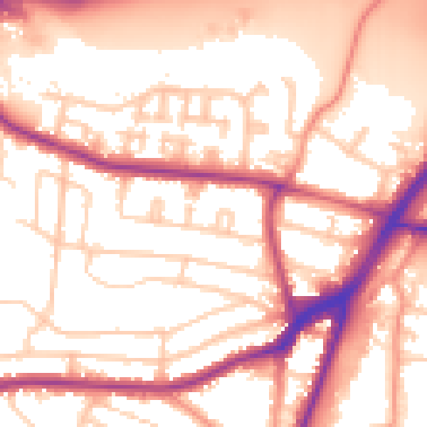
Daytime· 07:00 – 23:00
55.9dB

Night-time· 23:00 – 07:00
48.5dB