8 Broomloan Lane, Sutton, SM1 2PL
About 8 Broomloan Lane
8 Broomloan Lane is a three-bedroom end-of-terrace house in Sutton (SM1 2PL). It has a recorded floor area of 95 m² (around 1023 sq ft), construction records dating it to 1930-1949 and council tax band D. The latest certificate (August 2018) shows an E (score 48), well below the UK norm with real room to improve. The recommended improvements would lift it to B (score 82), a 3-band jump. Our model identifies extension potential, subject to local planning policy.
It lags the bulk of the postcode on energy efficiency (less efficient than 73% of similar EPCs). Across 1999–2024, sale prices on this property compounded at 7.1% per year. On a £-per-square-foot basis, the last sale (£586/sq ft) was about 129.5% above the typical sold price in the postcode. Last sale on file: £599,000 in July 2024.
What this property has
Inside
- Bedrooms3
- Bathrooms2
- Dining roomYes
- CloakroomYes
Outside
- Private gardenRear
- GarageDetached
Building
- RefurbishedYes
- Extension potentialPossible
Everything you need to know about 8 Broomloan Lane
The true value, the hidden risks and the full sale history, in one report.
30-day money-back guarantee

The data behind every report


Energy performance
Recommended upgrades on file would lift this property by multiple EPC bands.
EPC Rating
Planning history
8 Broomloan Lane has no planning applications on record.
Notable planning nearby
12applications of note in the surrounding area
We flagged 2 things worth checking at 8 Broomloan Lane
Independent checks surfaced things a buyer would want to understand before offering. The report explains each one in full, with the underlying data and what to ask.
- Signs of HMO activity in the area
- Larger development activity nearby
30-day money-back guarantee
Sales history & valuation
8 Broomloan Lane has more than quadrupled in price since its earliest registered sale in 1999.
£612,000
Modelled from EPC, postcode comparables and a sale-price growth of 7.1% per year over 25 years.
£599,000
Growth on file: 7.1% per year over 25 years.
Sales timeline
14 July 2024Most recent
£599,000
+444.5%over 24 years12 November 1999
£110,000
Median price across the last 5 sales in SM1 2PL: £507,000 (2024–2021).
Versus other Broomloan Lane homes
Years Held for 8 Broomloan Lane lags the street by a wide margin.
Price per m²
£6,305
Street avg £4,524
Floor Area
95 m²
Street avg 90 m²
Habitable Rooms
6 rooms
Street avg 5 rooms
CO₂ Emissions
5.6 t/year
Street avg 3.9 t/year
Everything you need to know about 8 Broomloan Lane
The true value, the hidden risks and the full sale history, in one report.
30-day money-back guarantee
The data behind every report
Similar properties nearby
1 Denbigh Close, Cheam
SM1 2HS
1 Alexandra Avenue
SM1 2NZ
1 Elizabeth Close, Cheam
SM1 2JW
1 Burford Road
SM1 2NJ
1 Dibdin Close
SM1 2PJ
1 Ashton Close
SM1 2HJ
1 Bourne Way, Cheam
SM1 2EN
1 Elmbrook Road, Cheam
SM1 2JF
The neighbourhood at a glance
Rail-style transport is unusually close for this postcode.
Crime
9/mo
Rising year-on-year across the wider district.
Nearest stop
0.1 km
Broomloan Lane — bus stop.
Closest school
0.5 km
Glenthorne High School. 46 schools nearby.
Go deeper on the local area
The full report breaks down crime, transport links, schools and air quality in depth.
Road noise across the postcode
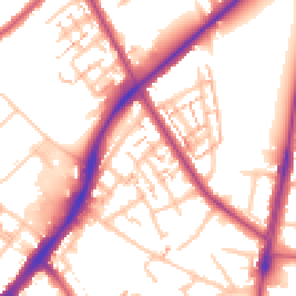
Daytime· 07:00 – 23:00
54.9dB

Night-time· 23:00 – 07:00
45.8dB