27 High Street, Burnham, Slough, SL1 7JD
About 27 High Street
27 High Street is a three-bedroom detached house in Burnham, Slough, Slough (SL1 7JD). It has a recorded floor area of 132 m² (around 1421 sq ft), construction records dating it to before 1900 and council tax band G. It is a listed building, which means external alterations are tightly controlled but it may qualify for heritage tax reliefs. Other recorded features include a self-contained annexe and attached land beyond the plot. The home occupies a cul-de-sac position. The latest certificate (April 2012) shows a G (score 20), near the bottom of the EPC scale. The recommended improvements would lift it to D (score 63), a 3-band jump. The latest certificate is from April 2012, so improvements made since then won't be reflected.
At 132 m² the property is well over the postcode median (68 m² across 12 EPCs), placing it in the larger end of the local stock. On energy efficiency it sits in the bottom 10% of properties in this postcode — significant headroom for improvement. 11 planning records sit against the property, 0 approved, 2 refused. The record references listed-building consent and conservation-area consent, which constrain future alterations. Across 2001–2020, sale prices on this property compounded at 2.9% per year. Today's modelled estimate of £859,000 is 30.2% above the 2020 sale price. On a £-per-square-foot basis, the last sale (£465/sq ft) was about 44.7% above the typical sold price in the postcode. Sold August 2020 for £660,000.
What this property has
Inside
- Bedrooms3
- Bathrooms3
Outside
- ParkingOff street
- LandYes
- Cul-de-sacYes
Building
- Listed buildingYes
Everything you need to know about 27 High Street
The true value, the hidden risks and the full sale history, in one report.
Pick your report · from £14.99
One time fee only - money back guarantee

The data behind every report


Energy performance
27 High Street sits at the bottom of the postcode for energy efficiency — meaningful headroom to improve.
EPC Expired
This certificate is over 10 years old and is no longer valid.Expired 13 Apr 2022
EPC Rating
Certificate validity
Expired on 13 April 2022

Get a survey for this property
Level 3 Building Survey
Because the property was built before 1919 and is a listed building, we believe a Level 3 building survey should be considered.
From £1,360 · Includes VAT
Planning history
A recent planning application at 27 High Street was refused — worth checking the council file.
11 applications on record at 27 High Street, Burnham, Slough, SL1 7JD
- Dec 2013Tree WorksTreesOutcome in report
Approx 7 Leylandii - Fell. (Burnham Conservation Area).
Conservation Area- Documents
- 4 docs on file
- Reference
- 13/01874/CAN
- More recent applications — locked
- AmendmentFeb 2023Decision
- ConditionsJan 2023Decision
+ 8 more applications in the report
Unlock 27 High Street, Burnham, Slough, SL1 7JD's full planning history
You're seeing the shape of it. The report has the substance.
- Every decision — granted, refused or withdrawn (11 on record)
- All 11 applications on this property in full, plus 2 notable nearby
- The 56 documents, officer reports & conditions
- What the pattern means for extending or converting here
One time fee only - money back guarantee
Sales history & valuation
The latest sale landed in the post-pandemic price surge — useful context when reading the figure.
£859,000
Modelled from EPC, postcode comparables and a sale-price growth of 2.9% per year over 19 years.
£660,000
Growth on file: 2.9% per year over 19 years.
Sales timeline
6 August 2020Most recent
£660,000
+3.1%over 7 years4 April 2013
£640,000
+66.2%over 11 years4 October 2001
£385,000
Median price across the last 5 sales in SL1 7JD: £300,000 (2025–2007).
Everything you need to know about 27 High Street
The true value, the hidden risks and the full sale history, in one report.
Pick your report · from £14.99
One time fee only - money back guarantee
The data behind every report
Similar properties nearby
1 Byways, Burnham
SL1 7EB
1 Aldbourne Road, Burnham
SL1 7NJ
1 Clonmel Way, Burnham
SL1 7DA
1 Mallard Close, Burnham
SL1 7DT
1 Church Walk, Burnham
SL1 7AN
1 Lent Green, Burnham
SL1 7AL
1 Church Street, Burnham
SL1 7HX
1 Gable Mews, Lent Green Lane, Burnham
SL1 7AQ
The neighbourhood at a glance
Daytime road noise here sits well below conversation level — a quiet pocket of the postcode.
Crime
656/mo
Falling year-on-year across the wider district.
Nearest stop
0.1 km
Garibaldi PH — bus stop.
Closest school
0.3 km
St Peter's Church of England Primary School. 13 schools nearby.
Go deeper on the local area
A Local Area report breaks down crime, transport links, schools and air quality in depth.
Road noise across the postcode
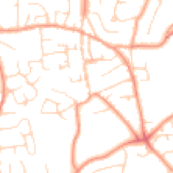
Daytime· 07:00 – 23:00
49.9dB

Night-time· 23:00 – 07:00
38.1dB