10 Deva Close, Hazel Grove, Stockport, SK7 6HH
About 10 Deva Close
10 Deva Close is a property in Hazel Grove, Stockport, Stockport (SK7 6HH). It has council tax band E.
Energy performance
No EPC on record
This property doesn't have an Energy Performance Certificate yet. An EPC is required to sell or let — and unlocks our automated valuation.
Get a survey for this property
Level 2 HomeBuyer Report
We've checked 10 risk factors against the available data for this property and believe a Level 2 HomeBuyer Report could be a suitable option for you.
Planning history
No planning applications are recorded against 10 Deva Close, Hazel Grove, Stockport, SK7 6HH. The full report also covers planning activity across the surrounding area.
Sales history & valuation
No sales recorded with HM Land Registry
That can mean the property has never traded since the registry began publishing in 1995, was a new build that hasn't been registered yet, or is held in the same hands long-term.
Median price across the last 5 sales in SK7 6HH: £320,000 (2023–2013).
Nearby sales in SK7 6HH
8 Deva Close, Hazel Grove, Stockport, SK7 6HH
Sold Dec 2023
£524,0001 Deva Close, Hazel Grove, Stockport, SK7 6HH
Sold May 2018
£352,25012 Deva Close, Hazel Grove, Stockport, SK7 6HH
Sold Mar 2014
£280,0007 Deva Close, Hazel Grove, Stockport, SK7 6HH
Sold Jun 2013
£264,6006 Deva Close, Hazel Grove, Stockport, SK7 6HH
Sold May 2012
£290,000
Similar properties nearby
1 Alderley Close, Hazel Grove
SK7 6BS
1 Alma Road, Hazel Grove
SK7 6AT
1 Ashbourne Road, Hazel Grove
SK7 6DX
1 Ayr Close, Hazel Grove
SK7 6NT
1 Bakewell Road, Hazel Grove
SK7 6JT
1 Baslow Drive, Hazel Grove
SK7 6DR
1 Belvoir Avenue, Hazel Grove
SK7 6DL
1 Birch Tree Avenue, Hazel Grove
SK7 6AP
The neighbourhood at a glance
Rail-style transport is unusually close for this postcode.
Crime
1/mo
Steady year-on-year across the wider district.
Nearest stop
0.1 km
Shepley Drive — bus stop.
Closest school
0.3 km
St Peter's Catholic Primary School. 20 schools nearby.
Road noise across the postcode
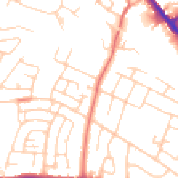
Daytime· 07:00 – 23:00
50.6dB

Night-time· 23:00 – 07:00
40.1dB