15 Catherine Road, Romiley, Stockport, SK6 3DQ
About 15 Catherine Road
15 Catherine Road is a property in Romiley, Stockport, Stockport (SK6 3DQ). It has council tax band D.
Held since November 1999 — that's 27 years off the open market, well above the local norm. Only one transfer is on record with HM Land Registry, suggesting it has stayed in the same hands for a long time.
Everything you need to know about 15 Catherine Road
The true value, the hidden risks and the full sale history, in one report.
Pick your report · every report is £14.99
One time fee only - money back guarantee

The data behind every report


Energy performance
No EPC on record
This property doesn't have an Energy Performance Certificate yet. An EPC is required to sell or let — and unlocks our automated valuation.
Get a survey for this property
Level 2 HomeBuyer Report
We've checked 10 risk factors against the available data for this property and believe a Level 2 HomeBuyer Report could be a suitable option for you.
Planning history
15 Catherine Road has no planning applications on record.
But the area is active
1 notable application nearby — larger schemes and conversions that could reshape the street. The report maps them all.
Sales history & valuation
15 Catherine Road has been held in the same hands since before 2000.
£78,000
Recorded with HM Land Registry.
Sales timeline
3 November 1999Most recent
£78,000
Median price across the last 5 sales in SK6 3DQ: £247,500 (2024–2016).
Nearby sales in SK6 3DQ
39 Catherine Road, Romiley, Stockport, SK6 3DQ
Sold Sept 2024
£250,00017 Catherine Road, Romiley, Stockport, SK6 3DQ
Sold Mar 2023
£280,00021 Catherine Road, Romiley, Stockport, SK6 3DQ
Sold Mar 2019
£247,50023 Catherine Road, Romiley, Stockport, SK6 3DQ
Sold Nov 2016
£197,50033 Catherine Road, Romiley, Stockport, SK6 3DQ
Sold Jul 2016
£310,000
Everything you need to know about 15 Catherine Road
The true value, the hidden risks and the full sale history, in one report.
Pick your report · every report is £14.99
One time fee only - money back guarantee
The data behind every report
Similar properties nearby
1 Agecroft Road, Romiley
SK6 3HT
1 Barrack Hill, Romiley
SK6 3AZ
1 Beacon Road, Romiley
SK6 3HZ
1 Begley Close, Romiley
SK6 3EX
1 Beverley Walk, Romiley
SK6 3HG
1 Bredbury Green, Romiley
SK6 3DN
1 Buckley Drive, Romiley
SK6 3EW
1 Bunkers Hill, Romiley
SK6 3DS
The neighbourhood at a glance
Daytime road noise here sits well below conversation level — a quiet pocket of the postcode.
Crime
1/mo
Steady year-on-year across the wider district.
Nearest stop
0.3 km
The Ridgeway — bus stop.
Closest school
0.1 km
Bredbury Green Primary School. 23 schools nearby.
Go deeper on the local area
A Local Area report breaks down crime, transport links, schools and air quality in depth.
Road noise across the postcode
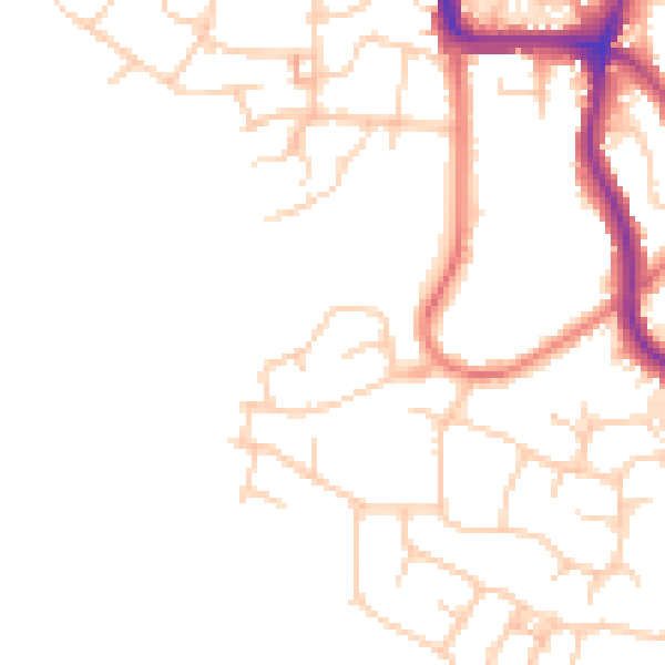
Daytime· 07:00 – 23:00
47.7dB

Night-time· 23:00 – 07:00
38.4dB