Holly Cottage, Pepper Street, Chelford, Macclesfield, SK11 9BE
About Holly Cottage
Holly Cottage is a three-bedroom detached house in Chelford, Macclesfield, Macclesfield (SK11 9BE). It has a recorded floor area of 53 m² (around 570 sq ft) and construction records dating it to 1996-2002. The latest certificate (July 2020) shows a C (score 69), just inside the C band. The recommended improvements would push it to B (score 86).
Held since February 2009 — that's 17 years off the open market, well above the local norm. That sale fell during the post-crash dip, which often skews comparisons against later neighbouring sales. At 53 m² it sits well below the postcode median (442 m² across 4 EPCs), making it one of the more compact homes locally. One planning record on file: an extension approved in 2020. Past consents include an extension and a porch, meaningful when judging how the property has evolved. Today's modelled estimate of £540,000 is 25.6% above the 2009 sale price.
What this property has
Inside
- Bedrooms3
Everything you need to know about Holly Cottage
The true value, the hidden risks and the full sale history, in one report.
30-day money-back guarantee

The data behind every report


Energy performance
EPC Rating
Planning history
- Oct 2020PorchFullIn report
Extension: Single storey · Rear of property
Demolition of single storey porch, and construction of a single storey residential kitchen extension to the rear of property with no change of use proposed.
Extension- Documents
- 11 docs on file
- Reference
- 20/2713M
We flagged 1 thing worth checking at Holly Cottage
Independent checks surfaced things a buyer would want to understand before offering. The report explains each one in full, with the underlying data and what to ask.
- Larger development activity nearby
30-day money-back guarantee
Sales history & valuation
The latest sale fell during the post-2008 dip, often a low-water mark in price comparisons.
£540,000
Modelled from EPC, postcode comparables.
£430,000
Recorded with HM Land Registry.
Sales timeline
17 February 2009Most recent
£430,000
Median price across the last 5 sales in SK11 9BE: £770,000 (2022–2007).
Nearby sales in SK11 9BE
Holly Tree House, Pepper Street, Chelford, Macclesfield, SK11 9BE
Sold Aug 2022
£5,600,000Lindale House, Pepper Street, Chelford, Macclesfield, SK11 9BE
Sold Nov 2018
£770,000Lindale Cottage, Pepper Street, Chelford, Macclesfield, SK11 9BE
Sold Jun 2015
£570,000Heath Wood, Pepper Street, Chelford, Macclesfield, SK11 9BE
Sold Jul 2007
£1,200,000
Versus other Pepper Street homes
Floor Area for Holly Cottage lags the street by a wide margin.
EPC Rating
69 (C)
Street avg 66 (D)
Floor Area
53 m²
Street avg 510 m²
CO₂ Emissions
2.4 t/year
Street avg 15.5 t/year
Habitable Rooms
3 rooms
Street avg 9 rooms
Everything you need to know about Holly Cottage
The true value, the hidden risks and the full sale history, in one report.
30-day money-back guarantee
The data behind every report
Similar properties nearby
1 Burnt Acre, Chelford
SK11 9SS
1 Chapel Croft, Chelford
SK11 9SU
1 Edgeway, Henbury
SK11 9PA
1 Forge Close, Gawsworth
SK11 9EW
1 Congleton Lane, Chelford
SK11 9AG
1 Fytton Close, Gawsworth
SK11 9RB
1 Chillingham Close, Chelford
SK11 9FZ
1 Clay Heyes, Chelford
SK11 9ST
The neighbourhood at a glance
Rail-style transport is unusually close for this postcode.
Crime
6/mo
Steady year-on-year across the wider district.
Nearest stop
0.4 km
Egerton Arms PH — bus stop.
Closest school
0.7 km
Chelford CofE Primary School. 2 schools nearby.
Go deeper on the local area
The full report breaks down crime, transport links, schools and air quality in depth.
Road noise across the postcode
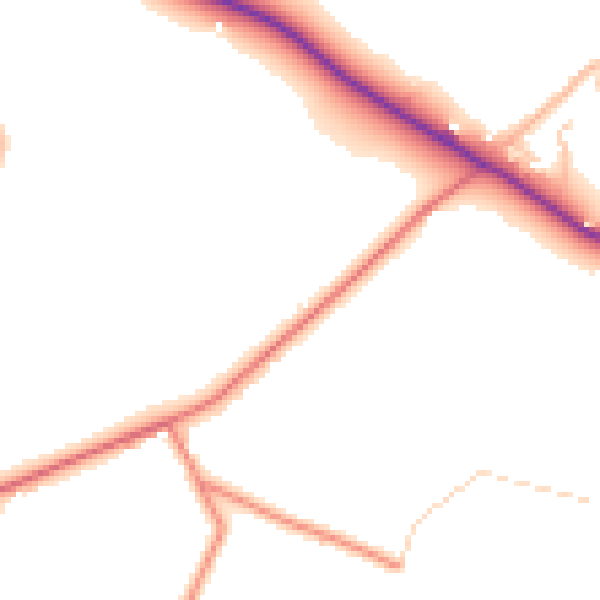
Daytime· 07:00 – 23:00
48.8dB

Night-time· 23:00 – 07:00
41.2dB