20 Shaw Street, Macclesfield, SK11 6QY
About 20 Shaw Street
20 Shaw Street is a mid-terrace house in Macclesfield (SK11 6QY). It has a recorded floor area of 48 m² (around 517 sq ft), construction records dating it to before 1900 and council tax band A. The latest certificate (April 2019) shows a C (score 71). The recommended improvements would push it to B (score 91).
Held since March 2002 — that's 24 years off the open market, well above the local norm. Across 2000–2002, sale prices on this property compounded at 19.7% per year. Today's modelled estimate of £138,000 sits 228.6% above the 2002 sale of £42,000. On a £-per-square-foot basis, the last sale (£81/sq ft) was about 39.1% below the postcode norm. At 48 m² it sits well below the postcode median (70 m² across 30 EPCs), making it one of the more compact homes locally.
Everything you need to know about 20 Shaw Street
The true value, the hidden risks and the full sale history, in one report.
30-day money-back guarantee

The data behind every report


Energy performance
EPC Rating
Planning history
20 Shaw Street has no planning applications on record.
Notable planning nearby
3applications of note in the surrounding area
We flagged 1 thing worth checking at 20 Shaw Street
Independent checks surfaced things a buyer would want to understand before offering. The report explains each one in full, with the underlying data and what to ask.
- Larger development activity nearby
30-day money-back guarantee
Sales history & valuation
20 Shaw Street's modelled value sits at over four times its earliest registered sale price (2000).
£138,000
Modelled from EPC, postcode comparables and a sale-price growth of 19.7% per year over 2 years.
£42,000
Growth on file: 19.7% per year over 2 years.
Sales timeline
21 March 2002Most recent
£42,000
-2.3%over 1 year12 October 2000
£43,000
+50.9%over 9 months24 January 2000
£28,500
Median price across the last 5 sales in SK11 6QY: £153,000 (2025–2024).
Nearby sales in SK11 6QY
Versus other Shaw Street homes
Years Held for 20 Shaw Street runs comfortably ahead of the street norm.
Price per m²
£875
Street avg £1,814
Floor Area
48 m²
Street avg 78 m²
Habitable Rooms
3 rooms
Street avg 4 rooms
CO₂ Emissions
2.0 t/year
Street avg 3.5 t/year
Everything you need to know about 20 Shaw Street
The true value, the hidden risks and the full sale history, in one report.
30-day money-back guarantee
The data behind every report
Similar properties nearby
The neighbourhood at a glance
Rail-style transport is unusually close for this postcode.
Crime
6/mo
Steady year-on-year across the wider district.
Nearest stop
0.1 km
Henderson Street — bus stop.
Closest school
0.2 km
Parkroyal Community School. 19 schools nearby.
Go deeper on the local area
The full report breaks down crime, transport links, schools and air quality in depth.
Road noise across the postcode
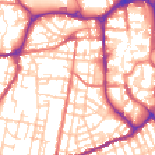
Daytime· 07:00 – 23:00
56.2dB

Night-time· 23:00 – 07:00
45.5dB