17 Monks Close, Bexley, London, SE2 0QJ
About 17 Monks Close
17 Monks Close is a property in Bexley, London, London (SE2 0QJ). It has council tax band C.
Untraded for 23 years, with the last transfer in February 2003. Across 1999–2003, sale prices on this property compounded at 18.5% per year.
Everything you need to know about 17 Monks Close
The true value, the hidden risks and the full sale history, in one report.
Pick your report · every report is £14.99
One time fee only - money back guarantee

The data behind every report


Energy performance
No EPC on record
This property doesn't have an Energy Performance Certificate yet. An EPC is required to sell or let — and unlocks our automated valuation.
Get a survey for this property
Level 2 HomeBuyer Report
We've checked 10 risk factors against the available data for this property and believe a Level 2 HomeBuyer Report could be a suitable option for you.
Planning history
17 Monks Close has no planning applications on record.
But the area is active
44 notable applications nearby — larger schemes and conversions that could reshape the street. The report maps them all.
Sales history & valuation
17 Monks Close has more than doubled in price since the earliest registered sale in 1999.
£146,000
Growth on file: 18.5% per year over 4 years.
Sales timeline
24 February 2003Most recent
£146,000
+101.4%over 4 years8 January 1999
£72,500
Median price across the last 5 sales in SE2 0QJ: £415,000 (2025–2021).
Nearby sales in SE2 0QJ
Everything you need to know about 17 Monks Close
The true value, the hidden risks and the full sale history, in one report.
Pick your report · every report is £14.99
One time fee only - money back guarantee
The data behind every report
Similar properties nearby
1 Dianthus Close, Greenwich
SE2 0UX
1 Duckworth Terrace, Greenwich
SE2 0BD
1 Harvel Crescent, Bexley
SE2 0PT
1 Alexander Terrace, Fuchsia Street, Greenwich
SE2 0TJ
1 Knee Hill Crescent, Greenwich
SE2 0YL
1 Dahlia Road, Greenwich
SE2 0SU
1 Carnation Street, Greenwich
SE2 0UZ
1 Bayley Walk, Bexley
SE2 0DL
The neighbourhood at a glance
Rail-style transport is unusually close for this postcode.
Crime
7/mo
Rising year-on-year across the wider district.
Nearest stop
0.1 km
Fossington Road — bus stop.
Closest school
0.7 km
Parkway Primary School. 47 schools nearby.
Go deeper on the local area
A Local Area report breaks down crime, transport links, schools and air quality in depth.
Road noise across the postcode
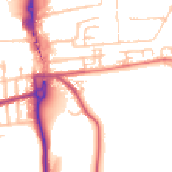
Daytime· 07:00 – 23:00
52.2dB
Night-time· 23:00 – 07:00
42.8dB