16 Brunel Close, Croydon, London, SE19 3AE
Solar panels
About 16 Brunel Close
A plain-English summary derived from public records, EPC certificates, sold prices and local data.
16 Brunel Close is a two-bedroom end-of-terrace house in Croydon, London, London (SE19 3AE). It has a recorded floor area of 57 m² (around 615 sq ft), construction records dating it to 1983-1990 and council tax band D. The latest certificate (February 2012) shows a C (score 69), just inside the C band. When first surveyed in March 2010 the rating was D, the property has climbed 1 band since. Between certificates, window efficiency went from Very Poor to Good. The latest certificate is from February 2012, so improvements made since then won't be reflected. The property has solar panels on record, all of which lower running costs and tend to lift resale appeal. Other recorded features include a conservatory.
Sale prices here have outpaced London HPI: 6.1% per year against 0% for the wider region. On a £-per-square-foot basis, the last sale (£829/sq ft) was about 66.8% above the typical sold price in the postcode. Most recent transfer: October 2021 at £510,000. Across the public record there are 4 sales, relatively high churn for a single property. That sale was during the post-pandemic price surge, when transactions cleared materially above pre-2020 trend.
Before you offer
Know exactly what you're buying at 16 Brunel Close
Before you offer, see what the listing won't tell you, the true value, the red flags and the full history.
£9.99£14.99
Launch offer · save £5
What this property has
Pulled from EPC certificates, claim submissions and our property model. Empty categories are hidden — we only show what's known.
Inside
- Bedrooms2
- Bathrooms1
- Dining roomYes
- ConservatoryYes
Energy performance
Every EPC certificate filed against this property — current rating, recorded improvements, and where there's headroom to reach a higher band.
16 Brunel Close's EPC is over a decade old — improvements since won't be reflected.
EPC Expired
This certificate is over 10 years old and is no longer valid.Expired 03 Feb 2022
Planning history
Applications and permits filed against 16 Brunel Close, Croydon, London, SE19 3AE, sourced from the PlanIt planning register.
16 Brunel Close has no planning applications on record.
Notable planning nearby
3applications of note in the surrounding area
Sales history & valuation
Recorded transactions, our model's current estimate, and a quick read on what neighbouring properties have sold for.
Latest sale on 16 Brunel Close was the highest on Land Registry record across the postcode.
Current estimate
See how we calculated this£533,000
Modelled from EPC, postcode comparables and a sale-price growth of 6.1% per year over 17 years.
Last sold (2021)
£510,000
Growth on file: 6.1% per year over 17 years.
Sales timeline
Before you offerLaunch offer · save £5
Everything we know about 16 Brunel Close, in one report
What it's really worth, what could be wrong, and the planning, sales and area data in full.
- Am I paying too much?
- Is something wrong with it?
Versus other Brunel Close homes
Four headline reads against 15 similar houses on this street, drawn from the latest EPC and Land Registry data.
16 Brunel Close outperforms the street on price per m² by a wide margin.
Price per m²
£8,927
Street avg £5,877
Floor Area
57 m²
Street avg 67 m²
Habitable Rooms
3 rooms
Similar properties nearby
A handful of close matches in the same postcode area, ranked by likeness on bedrooms, type and floor area.
The neighbourhood at a glance
A condensed read of the local area. Each tile links through to the full breakdown on the London district page.
Rail-style transport is unusually close for this postcode.
Crime
5/mo
Steady year-on-year across the wider district.
Nearest stop
0.1 km
Westow Hill — bus stop.
Road noise across the postcode
Modelled day and night-time noise levels around SE19 3AE from Defra's strategic mapping. The pin marks this postcode's centroid.
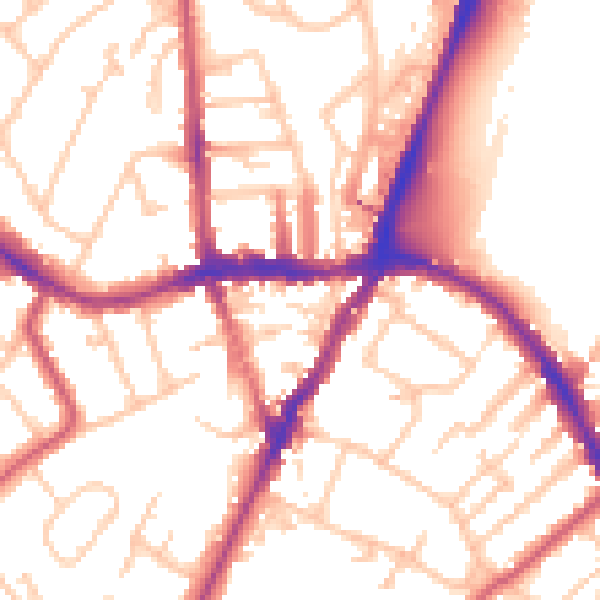
Daytime· 07:00 – 23:00
54.0dB

Everything within walking distance
Schools, transport stops and scenic spots near this property — 85 points of interest in total.
Common questions
The questions buyers, sellers and homeowners most often ask about 16 Brunel Close, Croydon, London, SE19 3AE. Each answer is also embedded as structured data for search engines.
