1 Augustus Terrace, Griffin Road, Greenwich, London, SE18 7AY
About 1 Augustus Terrace
1 Augustus Terrace is an end-of-terrace house in Greenwich, London, London (SE18 7AY). It has a recorded floor area of 90 m² (around 969 sq ft) and construction records dating it to 2022. The latest certificate (March 2022) returns a B (score 81), comfortably above the UK average. The recommended improvements would push it to A (score 92).
Sold May 2022 for £450,000. That sale was during the post-pandemic price surge, when transactions cleared materially above pre-2020 trend.
Everything you need to know about 1 Augustus Terrace
The true value, the hidden risks and the full sale history, in one report.
Pick your report · every report is £14.99
One time fee only - money back guarantee

The data behind every report


Energy performance
EPC Rating
Get a survey for this property
Level 2 HomeBuyer Report
We've checked 10 risk factors against the available data for this property and believe a Level 2 HomeBuyer Report could be a suitable option for you.
From £695 · Includes VAT
Planning history
1 Augustus Terrace has no planning applications on record.
But the area is active
59 notable applications nearby — larger schemes and conversions that could reshape the street. The report maps them all.
Sales history & valuation
The latest sale landed in the post-pandemic price surge — useful context when reading the figure.
£475,000
Modelled from EPC, postcode comparables.
£450,000
Recorded with HM Land Registry.
Sales timeline
15 May 2022Most recent
£450,000
Median price across the last 2 sales in SE18 7AY: £415,000 (2022–2022).
Everything you need to know about 1 Augustus Terrace
The true value, the hidden risks and the full sale history, in one report.
Pick your report · every report is £14.99
One time fee only - money back guarantee
The data behind every report
Similar properties nearby
1 Heavitree Road, Greenwich
SE18 7RA
1 Manthorp Road, Greenwich
SE18 7SZ
1 Blendon Terrace, Greenwich
SE18 7RS
1 Bramblebury Road, Greenwich
SE18 7TF
1 Burrage Grove, Greenwich
SE18 7LJ
1 Elmley Street, Greenwich
SE18 7NU
1 Burwash Road, Greenwich
SE18 7QY
1 Bloomfield Villas, Bloomfield Road, Greenwich
SE18 7JY
The neighbourhood at a glance
Rail-style transport is unusually close for this postcode.
Crime
13/mo
Rising year-on-year across the wider district.
Nearest stop
0.0 km
Griffin Road / Plumstead Station — bus stop.
Closest school
0.1 km
St Patrick's Catholic Primary School. 44 schools nearby.
Go deeper on the local area
A Local Area report breaks down crime, transport links, schools and air quality in depth.
Road noise across the postcode
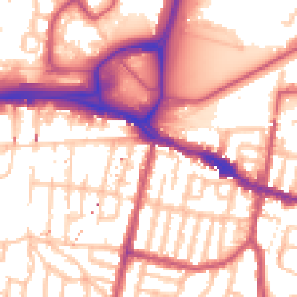
Daytime· 07:00 – 23:00
56.8dB

Night-time· 23:00 – 07:00
46.6dB