17c, Kings Grove, London, SE15 2LY
About 17c
17c is a mid-terrace house in London (SE15 2LY). It has a recorded floor area of 51 m² (around 549 sq ft), construction records dating it to 1900-1929 and council tax band B. At 51 m² this is the 3rd smallest of 4 units on EPC record in the building, where floor areas span 42–51 m². The building's EPC ratings span D to C, with this unit at the top. The latest certificate (July 2025) shows a C (score 72).
Held since November 1998 — that's 28 years off the open market, well above the local norm. Across 1998–1998, sale prices on this property compounded at 35% per year. Today's modelled estimate of £408,000 sits 655.6% above the 1998 sale of £54,000. On a £-per-square-foot basis, the last sale (£98/sq ft) was about 69.6% below the postcode norm.
Know exactly what you're buying at 17c
Before you offer, see what the listing won't tell you, the true value, the red flags and the full history.
Already flagged here
Launch offer · save £5
Valuation
against the asking price
Risks
planning & flood
Sold prices
similar homes nearby
Trends
the local market
Energy performance
17c's carbon output is low for the local stock.
EPC Rating
Planning history
17c has no planning applications on record.
Notable planning nearby
4applications of note in the surrounding area
We flagged 2 things worth checking at 17c
Independent checks surfaced things a buyer would want to understand before offering. The report explains each one in full, with the underlying data and what to ask.
- Signs of HMO activity in the area
- Recent ownership pattern worth a look
30-day money-back guarantee
Sales history & valuation
17c's modelled value sits at over four times its earliest registered sale price (1998).
£408,000
Modelled from EPC, postcode comparables and a sale-price growth of 35.0% per year over 1 year.
£54,000
Growth on file: 35.0% per year over 1 year.
Sales timeline
13 November 1998Most recent
£54,000
+35.0%31 May 1998
£40,000
Median price across the last 5 sales in SE15 2LY: £352,000 (2025–2023).
Nearby sales in SE15 2LY
19c, Kings Grove, Southwark, London, SE15 2LY
Sold Sept 2025
£443,0009a, Kings Grove, Southwark, London, SE15 2LY
Sold Oct 2023
£352,00013b, Kings Grove, Southwark, London, SE15 2LY
Sold Sept 2023
£340,00037a, Kings Grove, Southwark, London, SE15 2LY
Sold Mar 2023
£600,00037 Kings Grove, Southwark, London, SE15 2LY
Sold Nov 2022
£1,000,000
Everything we know about 17c, in one report
What it's really worth, what could be wrong, and the planning, sales and area data in full.
What we flagged
- Signs of HMO activity in the area
- Recent ownership pattern worth a look

Versus other Kings Grove homes
17c is notably below the street on price per m².
Price per m²
£1,059
Street avg £6,621
Floor Area
51 m²
Street avg 56 m²
Habitable Rooms
3 rooms
Street avg 3 rooms
CO₂ Emissions
1.5 t/year
Street avg 2.2 t/year
Similar properties nearby
1 Blanch Close, Southwark
SE15 2LD
1 Meeting House Lane, Southwark
SE15 2UN
1 Caroline Gardens, Asylum Road, Southwark
SE15 2SQ
1 Hooks Close, Southwark
SE15 2TP
1 Evelina Road, Southwark
SE15 2DX
1 Elven Mews, Southwark
SE15 2AN
1 Bath Close, Southwark
SE15 2JP
1 Clifton Crescent, Southwark
SE15 2RX
The neighbourhood at a glance
Rail-style transport is unusually close for this postcode.
Crime
11/mo
Rising year-on-year across the wider district.
Nearest stop
0.1 km
Queens Road Peckham Station — bus stop.
Closest school
0.2 km
John Donne Primary School. 86 schools nearby.
Go deeper on the local area
The full report breaks down crime, transport links, schools and air quality in depth.
Road noise across the postcode
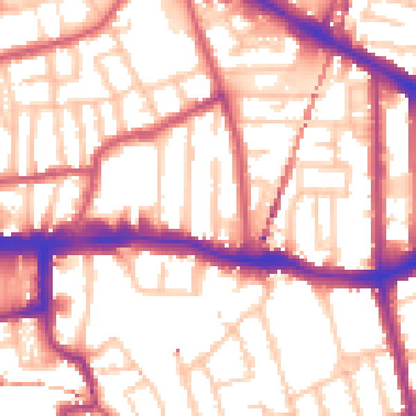
Daytime· 07:00 – 23:00
55.5dB

Night-time· 23:00 – 07:00
45.0dB