28 Talbot Crescent, Hasland, Chesterfield, S41 0AW
About 28 Talbot Crescent
28 Talbot Crescent is a semi-detached house in Hasland, Chesterfield, Chesterfield (S41 0AW). It has a recorded floor area of 153 m² (around 1647 sq ft), construction records dating it to 1930-1949 and council tax band A. The latest certificate (June 2026) shows a C (score 75), near the top of the C band. This certificate was lodged in the last six months, so the rating reflects current condition.
Held since September 2001 — that's 25 years off the open market, well above the local norm. At 153 m² the property is well over the postcode median (48 m² across 45 EPCs), placing it in the larger end of the local stock. Today's modelled estimate of £264,000 sits 355.6% above the 2001 sale of £57,950. On a £-per-square-foot basis, the last sale (£35/sq ft) was about 58% below the postcode norm. One historical planning record sits against the property in 2004.
Everything you need to know about 28 Talbot Crescent
The true value, the hidden risks and the full sale history, in one report.
Pick your report · from £14.99
One time fee only - money back guarantee

The data behind every report







Energy performance
The EPC has just been inspected, so the rating reflects current condition.
EPC Rating
Certificate validity
Valid until 22 June 2036

Get a survey for this property
Level 2 HomeBuyer Report
We've checked 10 risk factors against the available data for this property and believe a Level 2 HomeBuyer Report could be a suitable option for you.
From £545 · Includes VAT
Planning history
Council records include a two-storey rear extension at 28 Talbot Crescent.
1 application on record at 28 Talbot Crescent, Hasland, Chesterfield, S41 0AW
- Oct 2004ExtensionFullOutcome in report
Extension: Two storey · Rear of property
2 Storey rear extension
- Documents
- 1 doc on file
- Reference
- CHE/04/00682/FUL
Unlock 28 Talbot Crescent, Hasland, Chesterfield, S41 0AW's full planning history
You're seeing the shape of it. The report has the substance.
- Every decision — granted, refused or withdrawn (1 on record)
- All 1 application on this property in full, plus 5 notable nearby
- The 1 documents, officer reports & conditions
- What the pattern means for extending or converting here
One time fee only - money back guarantee
Sales history & valuation
28 Talbot Crescent's modelled value sits at over four times its earliest registered sale price (2001).
£264,000
Modelled from EPC, postcode comparables.
£57,950
Recorded with HM Land Registry.
Sales timeline
27 September 2001Most recent
£57,950
Median price across the last 5 sales in S41 0AW: £46,000 (2020–2002).
Nearby sales in S41 0AW
Versus other Talbot Crescent homes
28 Talbot Crescent is notably below the street on price per m².
Price per m²
£379
Street avg £1,208
Floor Area
153 m²
Street avg 87 m²
Habitable Rooms
6 rooms
Street avg 5 rooms
CO₂ Emissions
4.1 t/year
Street avg 3.7 t/year
Everything you need to know about 28 Talbot Crescent
The true value, the hidden risks and the full sale history, in one report.
Pick your report · from £14.99
One time fee only - money back guarantee
The data behind every report
Similar properties nearby
1 Coppice Close, Hasland
S41 0NA
1 Cragside Close
S41 0FH
1 Beacon Hill Way, Hasland
S41 0AF
1 Alum Chine Close, Hasland
S41 0PU
1 Challands Close, Hasland
S41 0ET
1 Brick Kiln Drive, Hasland
S41 0UJ
1 Broadoaks Close
S41 0EW
1 Burgess Close, Hasland
S41 0NP
The neighbourhood at a glance
Crime
270/mo
Steady year-on-year across the wider district.
Nearest stop
0.2 km
Meakin Street — bus stop.
Closest school
0.3 km
Outwood Academy Hasland Hall. 15 schools nearby.
Go deeper on the local area
A Local Area report breaks down crime, transport links, schools and air quality in depth.
Road noise across the postcode
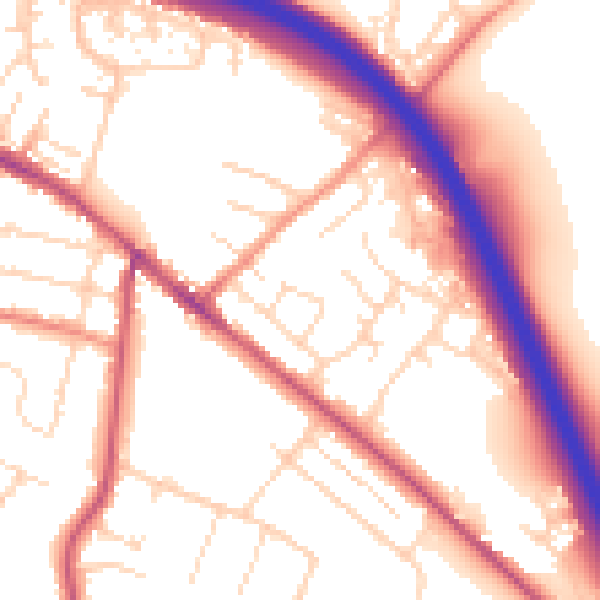
Daytime· 07:00 – 23:00
54.9dB

Night-time· 23:00 – 07:00
46.0dB