14 Linden Street, Romford, RM7 7DP
About 14 Linden Street
14 Linden Street is a three-bedroom end-of-terrace house in Romford (RM7 7DP). It has a recorded floor area of 106 m² (around 1141 sq ft), construction records dating it to 1983-1990 and council tax band D. The latest certificate (July 2018) shows a C (score 69), just inside the C band. The recommended improvements would push it to B (score 82).
Held since March 2006 — that's 20 years off the open market, well above the local norm. Across 1996–2006, sale prices on this property compounded at 10.3% per year. Today's modelled estimate of £423,000 sits 156.4% above the 2006 sale of £165,000. On a £-per-square-foot basis, the last sale (£145/sq ft) was about 30.4% below the postcode norm. Its energy rating outperforms most of the postcode (better than 85% of similar EPCs).
What this property has
Inside
- Bedrooms3
- Dining roomYes
- CloakroomYes
Outside
- ParkingOff road
Building
- RefurbishedYes
Everything you need to know about 14 Linden Street
The true value, the hidden risks and the full sale history, in one report.
30-day money-back guarantee

The data behind every report


Energy performance
EPC Rating
Planning history
14 Linden Street has no planning applications on record.
Notable planning nearby
12applications of note in the surrounding area
We flagged 1 thing worth checking at 14 Linden Street
Independent checks surfaced things a buyer would want to understand before offering. The report explains each one in full, with the underlying data and what to ask.
- Signs of HMO activity in the area
30-day money-back guarantee
Sales history & valuation
Sale price has at least doubled since 1996.
£423,000
Modelled from EPC, postcode comparables and a sale-price growth of 10.3% per year over 9 years.
£165,000
Growth on file: 10.3% per year over 9 years.
Sales timeline
7 March 2006Most recent
£165,000
+32.0%over 4 years12 February 2002
£125,000
+89.4%over 5 years20 October 1996
£66,000
Median price across the last 5 sales in RM7 7DP: £595,000 (2025–2024).
Versus other Linden Street homes
On co₂ emissions, 14 Linden Street stands well clear of the street.
Price per m²
£1,557
Street avg £3,469
Floor Area
106 m²
Street avg 140 m²
Habitable Rooms
6 rooms
Street avg 7 rooms
CO₂ Emissions
3.5 t/year
Street avg 6.1 t/year
Everything you need to know about 14 Linden Street
The true value, the hidden risks and the full sale history, in one report.
30-day money-back guarantee
The data behind every report
Similar properties nearby
1 Willow Street
RM7 7LJ
1 Cedar Road
RM7 7JR
1 Maple Street
RM7 7JX
1 Drummond Avenue
RM7 7EH
1 Marshalls Road
RM7 7EL
1 Cherry Street
RM7 7LL
1 Amanda Mews, Pretoria Road
RM7 7BL
10 Beech Street
RM7 7LA
The neighbourhood at a glance
Rail-style transport is unusually close for this postcode.
Crime
7/mo
Rising year-on-year across the wider district.
Nearest stop
0.1 km
North Street Romford — bus stop.
Closest school
0.2 km
The Mawney Foundation School. 35 schools nearby.
Go deeper on the local area
The full report breaks down crime, transport links, schools and air quality in depth.
Road noise across the postcode
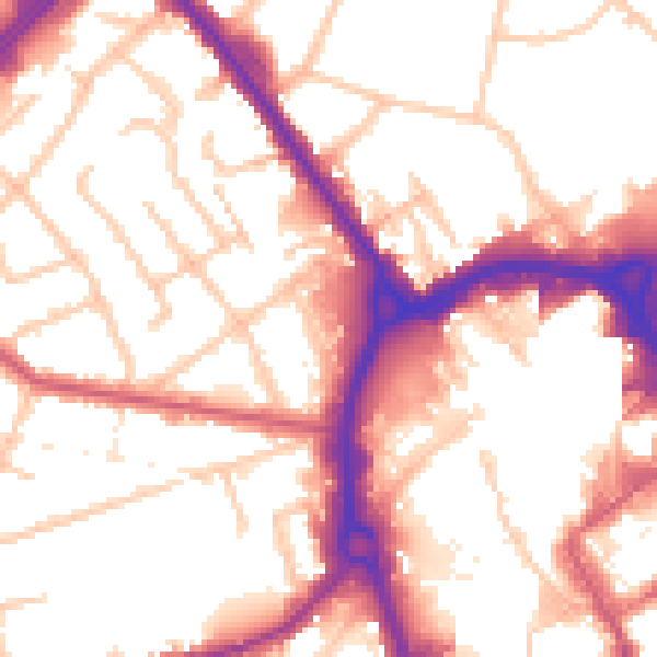
Daytime· 07:00 – 23:00
54.5dB
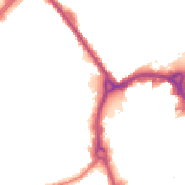
Night-time· 23:00 – 07:00
45.9dB