3 Baird Avenue, Basingstoke, RG22 6ED
About 3 Baird Avenue
3 Baird Avenue is a semi-detached house in Basingstoke (RG22 6ED). It has a recorded floor area of 88 m² (around 947 sq ft), construction records dating it to 1950-1966 and council tax band C. The latest certificate (June 2016) shows a D (score 67), on the cusp of jumping into the C band. The recommended improvements would lift it to B (score 86), a 2-band jump.
Held since November 2004 — that's 22 years off the open market, well above the local norm. Today's modelled estimate of £322,000 sits 168.3% above the 2004 sale of £120,000. On a £-per-square-foot basis, the last sale (£127/sq ft) was about 53.3% below the postcode norm. One planning record on file: an extension approved in 2005. Past consents include an extension and a porch, meaningful when judging how the property has evolved. It lags the bulk of the postcode on energy efficiency (less efficient than 71% of similar EPCs).
Everything you need to know about 3 Baird Avenue
The true value, the hidden risks and the full sale history, in one report.
30-day money-back guarantee

The data behind every report


Energy performance
Recommended upgrades on file would lift this property by multiple EPC bands.
EPC Rating
Planning history
3 Baird Avenue has an approved single-storey side extension on the planning record.
- Aug 2005PorchFullIn report
Extension: Single storey · Side of property
Erection of a single storey side extension and front porch
Extension- Documents
- 4 docs on file
- Reference
- BDB/61321
What's in 3 Baird Avenue, Basingstoke, RG22 6ED's planning history?
Refusals, disputes and full decisions on this property and nearby, in the report.
Sales history & valuation
3 Baird Avenue valuation sits well clear of the typical sold price in this postcode.
£322,000
Modelled from EPC, postcode comparables.
£120,000
Recorded with HM Land Registry.
Sales timeline
26 November 2004Most recent
£120,000
Median price across the last 5 sales in RG22 6ED: £280,000 (2021–2019).
Nearby sales in RG22 6ED
Versus other Baird Avenue homes
Price per m² for 3 Baird Avenue lags the street by a wide margin.
Price per m²
£1,364
Street avg £3,059
Floor Area
88 m²
Street avg 80 m²
Habitable Rooms
5 rooms
Street avg 5 rooms
CO₂ Emissions
3.6 t/year
Street avg 3.0 t/year
Everything you need to know about 3 Baird Avenue
The true value, the hidden risks and the full sale history, in one report.
30-day money-back guarantee
The data behind every report
Similar properties nearby
The neighbourhood at a glance
Crime
7/mo
Steady year-on-year across the wider district.
Nearest stop
0.1 km
Aldworth School — bus stop.
Closest school
0.3 km
The Blue Coat School Basingstoke. 31 schools nearby.
Go deeper on the local area
The full report breaks down crime, transport links, schools and air quality in depth.
Road noise across the postcode
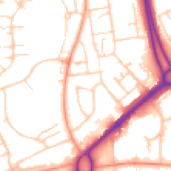
Daytime· 07:00 – 23:00
53.0dB

Night-time· 23:00 – 07:00
43.1dB