2 Chipping Avenue, Southport, PR8 2SG
About 2 Chipping Avenue
2 Chipping Avenue is a three-bedroom detached house in Southport (PR8 2SG). It has a recorded floor area of 97 m² (around 1044 sq ft), construction records dating it to 1967-1975 and council tax band D. The latest certificate (June 2021) shows a D (score 67), on the cusp of jumping into the C band. The recommended improvements would lift it to B (score 81), a 2-band jump. Records show the property has been extended at some point in its history. The home occupies a cul-de-sac position.
2 planning records sit against the property, 1 approved, 1 refused. Past consents include an extension, meaningful when judging how the property has evolved. Today's modelled estimate of £316,000 is 21% above the 2021 sale price. On a £-per-square-foot basis, the last sale (£250/sq ft) was about 36.9% above the typical sold price in the postcode. Last sale on file: £261,100 in September 2021. That sale was during the post-pandemic price surge, when transactions cleared materially above pre-2020 trend.
What this property has
Inside
- Bedrooms3
- Bathrooms1
- Dining roomYes
- Utility roomYes
Outside
- Cul-de-sacYes
Building
- Previously extendedYes
Everything you need to know about 2 Chipping Avenue
The true value, the hidden risks and the full sale history, in one report.
Pick your report · every report is £14.99
One time fee only - money back guarantee

The data behind every report


Energy performance
Recommended upgrades on file would lift this property by multiple EPC bands.
EPC Rating
Get a survey for this property
Level 2 HomeBuyer Report
We've checked 10 risk factors against the available data for this property and believe a Level 2 HomeBuyer Report could be a suitable option for you.
From £595 · Includes VAT
Planning history
A a porch application was refused at 2 Chipping Avenue in 2022.
2 applications on record at 2 Chipping Avenue, Southport, PR8 2SG
- Apr 2022PorchFullOutcome in report
Extension: Part single, part two storey · Side and rear of property
Erection of a part two/single storey extension to the rear/ side, a first floor extension to the side, a single storey porch to the front, alterations to front and side roof from flat to pitched, and insertion of 2 first floor windows and rooflight to side (west) elevation of the dwellinghouse
Extension- Documents
- 12 docs on file
- Reference
- DC/2022/00011
- More recent applications — locked
- ExtensionFeb 2023Decision
Unlock 2 Chipping Avenue, Southport, PR8 2SG's full planning history
You're seeing the shape of it. The report has the substance.
- Every decision — granted, refused or withdrawn (2 on record)
- All 2 applications on this property in full, plus 2 notable nearby
- The 19 documents, officer reports & conditions
- What the pattern means for extending or converting here
One time fee only - money back guarantee
Sales history & valuation
The latest sale landed in the post-pandemic price surge — useful context when reading the figure.
£316,000
Modelled from EPC, postcode comparables.
£261,100
Recorded with HM Land Registry.
Sales timeline
27 September 2021Most recent
£261,100
Median price across the last 5 sales in PR8 2SG: £209,000 (2023–2014).
Nearby sales in PR8 2SG
Versus other Chipping Avenue homes
2 Chipping Avenue is notably below the street on years held.
Price per m²
£2,692
Street avg £2,347
Floor Area
97 m²
Street avg 103 m²
Habitable Rooms
6 rooms
Street avg 6 rooms
CO₂ Emissions
3.9 t/year
Street avg 4.2 t/year
Everything you need to know about 2 Chipping Avenue
The true value, the hidden risks and the full sale history, in one report.
Pick your report · every report is £14.99
One time fee only - money back guarantee
The data behind every report
Similar properties nearby
The neighbourhood at a glance
Rail-style transport is unusually close for this postcode.
Crime
4/mo
Steady year-on-year across the wider district.
Nearest stop
0.3 km
Sevenoaks Avenue — bus stop.
Closest school
0.4 km
Shoreside Primary School. 5 schools nearby.
Go deeper on the local area
A Local Area report breaks down crime, transport links, schools and air quality in depth.
Road noise across the postcode
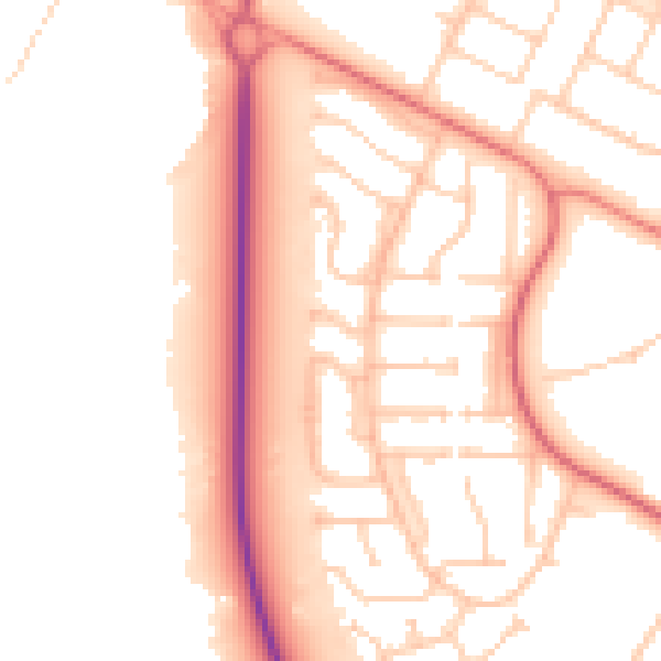
Daytime· 07:00 – 23:00
52.8dB

Night-time· 23:00 – 07:00
43.6dB