206 Ashton Bank Way, Ashton On Ribble, Preston, PR2 1BG
About 206 Ashton Bank Way
206 Ashton Bank Way is a detached house in Ashton-On-Ribble, Preston, Preston (PR2 1BG). It has a recorded floor area of 57 m² (around 614 sq ft) and council tax band B. The latest certificate (February 2013) returns a B (score 83), comfortably above the UK average. Main heating runs on electricity: electricity, unspecified tariff. The latest certificate is from February 2013, so improvements made since then won't be reflected. At 57 m² this is the 2nd smallest of 18 units on EPC record in the building, where floor areas span 55–87 m². The building's EPC ratings span C to B, with this unit at the top.
Across 2012–2019, sale prices on this property compounded at -4.1% per year. Today's modelled estimate of £118,000 sits 51.3% above the 2019 sale of £78,000. On a £-per-square-foot basis, the last sale (£127/sq ft) was about 18.8% below the postcode norm. Sold December 2019 for £78,000. Across the public record there are 4 sales, relatively high churn for a single property. At 57 m² it's 17.4% smaller than the typical home in the postcode (69 m² median across 17 EPCs). Its energy rating outperforms most of the postcode (better than 76% of similar EPCs).
Know exactly what you're buying at 206 Ashton Bank Way
Before you offer, see what the listing won't tell you, the true value, the red flags and the full history.
Already flagged here
Valuation
against the asking price
Risks
planning & flood
Sold prices
similar homes nearby
Trends
the local market
Energy performance
206 Ashton Bank Way's carbon output is low for the local stock.
EPC Expired
This certificate is over 10 years old and is no longer valid.Expired 14 Feb 2023
EPC Rating
Planning history
206 Ashton Bank Way has no planning applications on record.
Notable planning nearby
15applications of note in the surrounding area
We flagged 2 things worth checking at 206 Ashton Bank Way
Independent checks surfaced things a buyer would want to understand before offering. The report explains each one in full, with the underlying data and what to ask.
- Signs of HMO activity in the area
- Larger development activity nearby
30-day money-back guarantee
Sales history & valuation
Latest sale on 206 Ashton Bank Way was the lowest on Land Registry record across the postcode.
£118,000
Modelled from EPC, postcode comparables and a sale-price growth of -4.1% per year over 7 years.
£78,000
Growth on file: -4.1% per year over 7 years.
Sales timeline
20 December 2019Most recent
£78,000
-2.5%over 4 years11 June 2015
£80,000
-11.1%7 June 2015
£90,000
-14.2%over 2 years24 October 2012
£104,950
Median price across the last 5 sales in PR2 1BG: £136,000 (2024–2022).
Nearby sales in PR2 1BG
232 Ashton Bank Way, Ashton On Ribble, Preston, PR2 1BG
Sold Jun 2024
£160,000212 Ashton Bank Way, Ashton On Ribble, Preston, PR2 1BG
Sold May 2024
£143,000200 Ashton Bank Way, Ashton On Ribble, Preston, PR2 1BG
Sold Jul 2023
£80,000214 Ashton Bank Way, Ashton On Ribble, Preston, PR2 1BG
Sold Jan 2023
£136,000216 Ashton Bank Way, Ashton On Ribble, Preston, PR2 1BG
Sold Nov 2022
£104,000
Everything we know about 206 Ashton Bank Way, in one report
What it's really worth, what could be wrong, and the planning, sales and area data in full.
What we flagged
- Signs of HMO activity in the area
- Larger development activity nearby

Versus other Ashton Bank Way homes
Price per m² for 206 Ashton Bank Way lags the street by a wide margin.
Price per m²
£1,368
Street avg £1,654
Floor Area
57 m²
Street avg 57 m²
CO₂ Emissions
1.2 t/year
Street avg 1.3 t/year
Years Held
6 years
Street avg 9 years
Similar properties nearby
1 Ashford Road, Ashton On Ribble
PR2 1UB
1 Birkdale Drive, Ashton On Ribble
PR2 1UL
1 Brunswick Place, Ashton On Ribble
PR2 1DJ
1 Cartmel Place, Ashton On Ribble
PR2 1TY
1 Aldcliffe Road, Ashton On Ribble
PR2 1PR
1 Brampton Street, Ashton On Ribble
PR2 1DE
1 Ashtongate, Ashton On Ribble
PR2 1NF
1 Charlesway Court, Lea Road, Lea
PR2 1TL
The neighbourhood at a glance
Crime
6/mo
Steady year-on-year across the wider district.
Nearest stop
0.3 km
Terminus — bus stop.
Closest school
0.4 km
Lea Community Primary School. 22 schools nearby.
Go deeper on the local area
The full report breaks down crime, transport links, schools and air quality in depth.
Road noise across the postcode
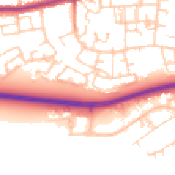
Daytime· 07:00 – 23:00
53.6dB

Night-time· 23:00 – 07:00
44.2dB