8 Second Avenue, Farlington, Portsmouth, PO6 1JS
About 8 Second Avenue
8 Second Avenue is a three-bedroom semi-detached house in Farlington, Portsmouth, Portsmouth (PO6 1JS). It has a recorded floor area of 156 m² (around 1679 sq ft), construction records dating it to 1950-1966 and council tax band B. The latest certificate (March 2021) shows a D (score 67), on the cusp of jumping into the C band. The recommended improvements would push it to C (score 78). Records show the property has been extended at some point in its history.
At 156 m² the property is well over the postcode median (88 m² across 25 EPCs), placing it in the larger end of the local stock. Across 1996–2021, sale prices on this property compounded at 8.2% per year. On a £-per-square-foot basis, the last sale (£238/sq ft) was about 24.5% above the typical sold price in the postcode. 2 planning records sit against the property, 0 approved, 0 refused. Last sale on file: £400,000 in June 2021. That sale was during the post-pandemic price surge, when transactions cleared materially above pre-2020 trend.
Know exactly what you're buying at 8 Second Avenue
Before you offer, see what the listing won't tell you, the true value, the red flags and the full history.
Already flagged here
Valuation
against the asking price
Risks
planning & flood
Sold prices
similar homes nearby
Trends
the local market
What this property has
Inside
- Bedrooms3
- Bathrooms1
- Dining roomYes
Outside
- Private gardenSouth-facing
Building
- Heating systemGas
- Previously extendedYes
Energy performance
EPC Rating
Planning history
Multiple extension applications run across more than a decade of planning history at 8 Second Avenue.
- May 2018ExtensionIn report
Extension: Single storey · Rear of property
Retrospective application for the construction of a single storey rear extension
Retrospective- Documents
- 6 docs on file
- Reference
- 18/00238/PLAREG
- Sept 2002ExtensionFullIn report
Extension: Two storey · Rear of property
CONSTRUCTION OF TWO STOREY EXTENSION WITH FORMATION OF FIRST FLOOR BALCONY TO REAR ELEVATION
- Documents
- 4 docs on file
- Reference
- A*38066/AA
We flagged 1 thing worth checking at 8 Second Avenue
Independent checks surfaced things a buyer would want to understand before offering. The report explains each one in full, with the underlying data and what to ask.
- Signs of HMO activity in the area
30-day money-back guarantee
Sales history & valuation
Latest sale on 8 Second Avenue was the highest on Land Registry record across the postcode.
£424,000
Modelled from EPC, postcode comparables and a sale-price growth of 8.2% per year over 25 years.
£400,000
Growth on file: 8.2% per year over 25 years.
Sales timeline
20 June 2021Most recent
£400,000
+589.7%over 24 years29 November 1996
£58,000
Median price across the last 5 sales in PO6 1JS: £300,000 (2025–2022).
Nearby sales in PO6 1JS
48 Second Avenue, Farlington, Portsmouth, PO6 1JS
Sold Feb 2025
£312,00024 Second Avenue, Farlington, Portsmouth, PO6 1JS
Sold Jan 2025
£270,00046 Second Avenue, Farlington, Portsmouth, PO6 1JS
Sold Jan 2025
£355,00060 Second Avenue, Farlington, Portsmouth, PO6 1JS
Sold Jul 2024
£300,00058 Second Avenue, Farlington, Portsmouth, PO6 1JS
Sold Sept 2022
£183,750
Everything we know about 8 Second Avenue, in one report
What it's really worth, what could be wrong, and the planning, sales and area data in full.
What we flagged
- Signs of HMO activity in the area

Versus other Second Avenue homes
Floor Area for 8 Second Avenue runs comfortably ahead of the street norm.
Price per m²
£2,564
Street avg £2,541
Floor Area
156 m²
Street avg 96 m²
Habitable Rooms
6 rooms
Street avg 5 rooms
CO₂ Emissions
4.6 t/year
Street avg 4.5 t/year
Similar properties nearby
1 Hardy Road
PO6 1JY
1 Copsey Close, Drayton
PO6 1NT
1 Copsey Grove, Drayton
PO6 1NA
1 Acorn Close
PO6 1AU
1 Elmtree Road
PO6 1AY
1 Copper Beech Drive
PO6 1AZ
1 Highlands Road, Drayton
PO6 1HL
1 Blake Road, Drayton
PO6 1ET
The neighbourhood at a glance
Crime
9/mo
Steady year-on-year across the wider district.
Nearest stop
0.2 km
First Avenue — bus stop.
Closest school
0.5 km
Solent Infant School. 19 schools nearby.
Go deeper on the local area
The full report breaks down crime, transport links, schools and air quality in depth.
Road noise across the postcode
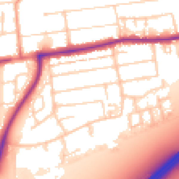
Daytime· 07:00 – 23:00
55.3dB

Night-time· 23:00 – 07:00
45.7dB