1 St Andrews Road, Farlington, Portsmouth, PO6 1AD
About 1 St Andrews Road
1 St Andrews Road is a three-bedroom detached house in Farlington, Portsmouth, Portsmouth (PO6 1AD). It has a recorded floor area of 172 m² (around 1849 sq ft), construction records dating it to 1930-1949 and council tax band E. The latest certificate (April 2010) shows an E (score 49), well below the UK norm with real room to improve. The recommended improvements would push it to D (score 63). The latest certificate is from April 2010, so improvements made since then won't be reflected. Other recorded features include a conservatory.
Untraded for 16 years, with the last transfer in September 2010. At 172 m² the property is well over the postcode median (105 m² across 22 EPCs), placing it in the larger end of the local stock. Today's modelled estimate of £557,000 sits 52.6% above the 2010 sale of £365,000.
Know exactly what you're buying at 1 St Andrews Road
Before you offer, see what the listing won't tell you, the true value, the red flags and the full history.
Already flagged here
Valuation
against the asking price
Risks
planning & flood
Sold prices
similar homes nearby
Trends
the local market
What this property has
Inside
- Bedrooms3
- Dining roomYes
- Utility roomYes
- CloakroomYes
- ConservatoryYes
Outside
- Private gardenYes
- GarageYes
Building
- Central heatingYes
Energy performance
1 St Andrews Road's carbon output runs well above what efficient homes in the postcode produce.
EPC Expired
This certificate is over 10 years old and is no longer valid.Expired 07 Apr 2020
EPC Rating
Planning history
1 St Andrews Road has no planning applications on record.
Notable planning nearby
4applications of note in the surrounding area
We flagged 1 thing worth checking at 1 St Andrews Road
Independent checks surfaced things a buyer would want to understand before offering. The report explains each one in full, with the underlying data and what to ask.
- Signs of HMO activity in the area
30-day money-back guarantee
Sales history & valuation
1 St Andrews Road valuation sits well clear of the typical sold price in this postcode.
£557,000
Modelled from EPC, postcode comparables.
£365,000
Recorded with HM Land Registry.
Sales timeline
26 September 2010Most recent
£365,000
Median price across the last 5 sales in PO6 1AD: £407,500 (2025–2018).
Nearby sales in PO6 1AD
3 St Andrews Road, Farlington, Portsmouth, PO6 1AD
Sold Aug 2025
£700,00011 St Andrews Road, Farlington, Portsmouth, PO6 1AD
Sold May 2025
£575,0002b, St Andrews Road, Farlington, Portsmouth, PO6 1AD
Sold Sept 2021
£330,00027 St Andrews Road, Farlington, Portsmouth, PO6 1AD
Sold Jun 2018
£310,00019 St Andrews Road, Farlington, Portsmouth, PO6 1AD
Sold Jan 2018
£400,000
Everything we know about 1 St Andrews Road, in one report
What it's really worth, what could be wrong, and the planning, sales and area data in full.
What we flagged
- Signs of HMO activity in the area

Versus other St Andrews Road homes
CO₂ Emissions for 1 St Andrews Road lags the street by a wide margin.
Price per m²
£2,125
Street avg £2,649
Floor Area
172 m²
Street avg 118 m²
Habitable Rooms
7 rooms
Street avg 6 rooms
CO₂ Emissions
8.8 t/year
Street avg 5.3 t/year
Similar properties nearby
1 Hardy Road
PO6 1JY
1 Copsey Close, Drayton
PO6 1NT
1 Copsey Grove, Drayton
PO6 1NA
1 Acorn Close
PO6 1AU
1 Elmtree Road
PO6 1AY
1 Highlands Road, Drayton
PO6 1HL
1 Blake Road, Drayton
PO6 1ET
1 Copper Beech Drive
PO6 1AZ
The neighbourhood at a glance
Crime
9/mo
Steady year-on-year across the wider district.
Nearest stop
0.2 km
St Andrews Church — bus stop.
Closest school
0.8 km
Solent Infant School. 19 schools nearby.
Go deeper on the local area
The full report breaks down crime, transport links, schools and air quality in depth.
Road noise across the postcode
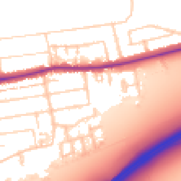
Daytime· 07:00 – 23:00
55.8dB

Night-time· 23:00 – 07:00
46.5dB