8 Montgomerie Road, Southsea, PO5 1ED
About 8 Montgomerie Road
8 Montgomerie Road is a mid-terrace house in Southsea (PO5 1ED). It has a recorded floor area of 194 m² (around 2088 sq ft), construction records dating it to 1930-1949 and council tax band B. The latest certificate (October 2025) shows a D (score 65), on the cusp of jumping into the C band. When first surveyed in March 2010 the rating was E, the property has climbed 1 band since. Between certificates, lighting went from Average to Good; while hot-water efficiency dropped from Good to Very Poor. The recommended improvements would push it to C (score 76).
Across 2010–2022, sale prices on this property compounded at 10.3% per year. Today's modelled estimate of £463,000 is 25.9% below the 2022 sale of £625,000, an unusual pattern given regional price growth and worth checking against the EPC condition. On a £-per-square-foot basis, the last sale (£299/sq ft) was about 92.1% above the typical sold price in the postcode. At 194 m² the property is well over the postcode median (109 m² across 39 EPCs), placing it in the larger end of the local stock. 4 planning records sit against the property, 1 approved, 1 refused. Past consents include new windows, meaningful when judging how the property has evolved. Sold November 2022 for £625,000. That sale was during the post-pandemic price surge, when transactions cleared materially above pre-2020 trend.
Know exactly what you're buying at 8 Montgomerie Road
Before you offer, see what the listing won't tell you, the true value, the red flags and the full history.
Already flagged here
Launch offer · save £5
Valuation
against the asking price
Risks
planning & flood
Sold prices
similar homes nearby
Trends
the local market
Energy performance
EPC Rating
Property Improvements
Changes detected from historical EPC data
Windows upgraded, improving insulation
More low energy lighting installed
Heating controls changed
Hot water system changed
Roof insulation improved
Planning history
- Oct 2017HMOFullIn report
Change of use from purposes falling within a C3 (dwelling house) or C4 (house in multiple occupation) to sui generis (house in multiple occupation) for seven or more people
- Agent
- FAO Mr Jonathan McDermott
- Documents
- 6 docs on file
- Reference
- 17/00867/FUL
- Jun 2017AmendmentIn report
Application for certificate of existing lawful development for external alterations to include the construction of a bay window (after removal of existing), new windows and render finish
- Agent
- FAO Mr Jonathan McDermott
RetrospectiveNew Windows- Documents
- 4 docs on file
- Reference
- 17/00731/CPE
We flagged 1 thing worth checking at 8 Montgomerie Road
Independent checks surfaced things a buyer would want to understand before offering. The report explains each one in full, with the underlying data and what to ask.
- Signs of HMO activity in the area
30-day money-back guarantee
Sales history & valuation
Latest sale on 8 Montgomerie Road was the highest on Land Registry record across the postcode.
£463,000
Modelled from EPC, postcode comparables and a sale-price growth of 10.3% per year over 12 years.
£625,000
Growth on file: 10.3% per year over 12 years.
Sales timeline
1 November 2022Most recent
£625,000
+162.6%over 6 years29 January 2016
£238,000
+29.3%over 5 years9 May 2010
£184,000
Median price across the last 5 sales in PO5 1ED: £280,000 (2025–2022).
Nearby sales in PO5 1ED
Everything we know about 8 Montgomerie Road, in one report
What it's really worth, what could be wrong, and the planning, sales and area data in full.
What we flagged
- Signs of HMO activity in the area

Versus other Montgomerie Road homes
8 Montgomerie Road outperforms the street on floor area by a wide margin.
Price per m²
£3,222
Street avg £1,849
Floor Area
194 m²
Street avg 121 m²
Habitable Rooms
10 rooms
Street avg 8 rooms
CO₂ Emissions
4.9 t/year
Street avg 4.1 t/year
Similar properties nearby
The neighbourhood at a glance
Rail-style transport is unusually close for this postcode.
Crime
11/mo
Steady year-on-year across the wider district.
Nearest stop
0.1 km
Bradford Junction — bus stop.
Closest school
0.2 km
Ark Ayrton Primary Academy. 36 schools nearby.
Go deeper on the local area
The full report breaks down crime, transport links, schools and air quality in depth.
Road noise across the postcode
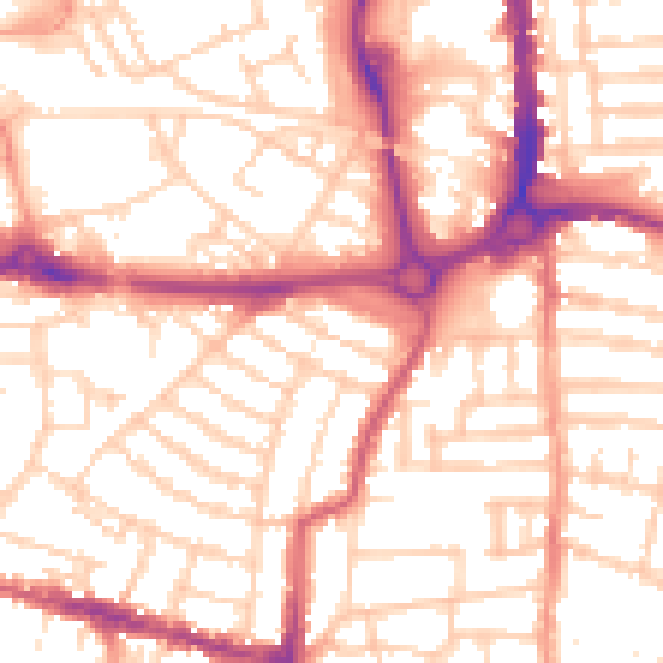
Daytime· 07:00 – 23:00
54.5dB

Night-time· 23:00 – 07:00
43.4dB