25 Blake House, Gunwharf Quays, Portsmouth, PO1 3TH
About 25 Blake House
25 Blake House is a three-bedroom end-of-terrace house in Portsmouth (PO1 3TH). It has a recorded floor area of 105 m² (around 1130 sq ft), construction records dating it to 1991-1995 and council tax band F. At 105 m² this is the 30th smallest of 43 units on EPC record in the building, where floor areas span 52–155 m². The building's EPC ratings span E to B across 43 units on file. The latest certificate (June 2009) shows a C (score 78), near the top of the C band. The latest certificate is from June 2009, so improvements made since then won't be reflected.
It hasn't traded since May 2010, a hold of 16 years that's notably long for the area. Today's modelled estimate of £703,000 is 17.2% above the 2010 sale price. On a £-per-square-foot basis, the last sale (£531/sq ft) was about 56.1% above the typical sold price in the postcode.
What this property has
Inside
- Bedrooms3
Everything you need to know about 25 Blake House
The true value, the hidden risks and the full sale history, in one report.
Pick your report · every report is £14.99
One time fee only - money back guarantee

The data behind every report


Energy performance
25 Blake House's EPC is over a decade old — improvements since won't be reflected.
EPC Expired
This certificate is over 10 years old and is no longer valid.Expired 21 Jun 2019
EPC Rating
Get a survey for this property
Level 2 HomeBuyer Report
We've checked 10 risk factors against the available data for this property and believe a Level 2 HomeBuyer Report could be a suitable option for you.
From £995 · Includes VAT
Planning history
25 Blake House has no planning applications on record.
But the area is active
3 notable applications nearby — larger schemes and conversions that could reshape the street. The report maps them all.
Sales history & valuation
25 Blake House valuation sits well clear of the typical sold price in this postcode.
£703,000
Modelled from EPC, postcode comparables.
£600,000
Recorded with HM Land Registry.
Sales timeline
13 May 2010Most recent
£600,000
Median price across the last 5 sales in PO1 3TH: £550,000 (2025–2022).
Nearby sales in PO1 3TH
11 Blake House, Gunwharf Quays, Portsmouth, PO1 3TH
Sold Mar 2025
£550,00040 Blake House, Gunwharf Quays, Portsmouth, PO1 3TH
Sold Jan 2025
£794,50039 Blake House, Gunwharf Quays, Portsmouth, PO1 3TH
Sold Feb 2024
£862,50053 Blake House, Gunwharf Quays, Portsmouth, PO1 3TH
Sold Oct 2023
£440,00029 Blake House, Gunwharf Quays, Portsmouth, PO1 3TH
Sold Aug 2022
£455,000
Versus other Gunwharf Quays homes
On years held, 25 Blake House stands well clear of the street.
Price per m²
£5,714
Street avg £4,433
Floor Area
105 m²
Street avg 92 m²
CO₂ Emissions
2.3 t/year
Street avg 2.3 t/year
Years Held
16 years
Street avg 12 years
Everything you need to know about 25 Blake House
The true value, the hidden risks and the full sale history, in one report.
Pick your report · every report is £14.99
One time fee only - money back guarantee
The data behind every report
Similar properties nearby
1 Blake House, Gunwharf Quays
PO1 3TH
1 Blackthorn Terrace, Cumberland Street
PO1 3JW
1 Centurion Court, The Canalside, Gunwharf Quays
PO1 3BQ
1 Dean Street
PO1 3BH
1 Admiralty Tower, Queen Street
PO1 3GA
1 Blossom Square
PO1 3JH
1 Jupiter Court, Gunwharf Quays
PO1 3TS
1 Godolphin House, Bonfire Corner
PO1 3GN
The neighbourhood at a glance
Rail-style transport is unusually close for this postcode.
Crime
9/mo
Steady year-on-year across the wider district.
Nearest stop
0.2 km
Portsmouth IOW Car Ferry Terminal — ferry terminal.
Closest school
0.6 km
St George's Beneficial Church of England (Voluntary Controlled) Primary School. 28 schools nearby.
Go deeper on the local area
A Local Area report breaks down crime, transport links, schools and air quality in depth.
Road noise across the postcode
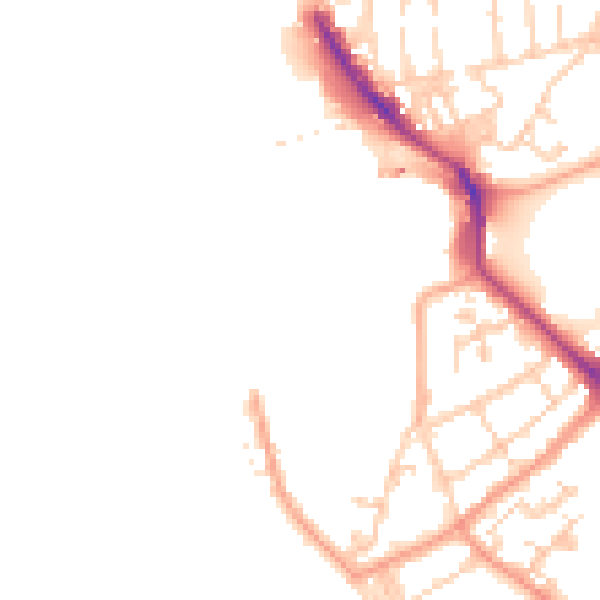
Daytime· 07:00 – 23:00
46.9dB

Night-time· 23:00 – 07:00
39.6dB