15 Percy Terrace, Plymouth, PL4 7HG
About 15 Percy Terrace
15 Percy Terrace is a four-bedroom mid-terrace house in Plymouth (PL4 7HG). It has a recorded floor area of 55 m² (around 592 sq ft), construction records dating it to 1900-1929 and council tax band A. At 55 m² this is the 46th smallest of 59 units on EPC record in the building, where floor areas span 20–146 m². The building's EPC ratings span G to C, with this unit at the top. The latest certificate (February 2016) shows a C (score 69), just inside the C band. The latest certificate is from February 2016, so improvements made since then won't be reflected.
One planning record on file: subdivision approved in 2007. Past consents include subdivision and change of use to residential, meaningful when judging how the property has evolved. Across 1999–2023, sale prices on this property compounded at 4.4% per year. Today's modelled estimate of £140,000 is 47.4% above the 2023 sale price. On a £-per-square-foot basis, the last sale (£160/sq ft) was about 28% above the typical sold price in the postcode. Last sale on file: £95,000 in September 2023.
What this property has
Inside
- Bedrooms4
- Bathrooms3
Outside
- ParkingOff road
Building
- Central heatingYes
Everything you need to know about 15 Percy Terrace
The true value, the hidden risks and the full sale history, in one report.
Pick your report · from £14.99
One time fee only - money back guarantee

The data behind every report





Energy performance
EPC Expired
This certificate is over 10 years old and is no longer valid.Expired 16 Feb 2026
EPC Rating
Certificate validity
Expired on 16 February 2026

Get a survey for this property
Level 3 Building Survey
Because the property was built before 1919 and has been extended more than once, we believe a Level 3 building survey should be considered.
From £820 · Includes VAT
Planning history
Council records show a subdivision application — the property's legal arrangement has been altered.
1 application on record at 15 Percy Terrace, Plymouth, PL4 7HG
- Aug 2007SubdivisionFullOutcome in report
Change of use and conversion of dwellinghouse to form three self-contained flats, with provision of rear external stairs
Change of Use- Documents
- 13 docs on file
- Reference
- 07/00286/FUL
Unlock 15 Percy Terrace, Plymouth, PL4 7HG's full planning history
You're seeing the shape of it. The report has the substance.
- Every decision — granted, refused or withdrawn (1 on record)
- All 1 application on this property in full, plus 76 notable nearby
- The 13 documents, officer reports & conditions
- What the pattern means for extending or converting here
One time fee only - money back guarantee
Sales history & valuation
15 Percy Terrace has more than doubled in price since the earliest registered sale in 1999.
£140,000
Modelled from EPC, postcode comparables and a sale-price growth of 4.4% per year over 24 years.
£95,000
Growth on file: 4.4% per year over 24 years.
Sales timeline
7 September 2023Most recent
£95,000
+26.7%over 21 years19 December 2001
£75,000
+121.2%over 1 year22 December 1999
£33,900
Median price across the last 5 sales in PL4 7HG: £94,000 (2025–2024).
Nearby sales in PL4 7HG
Basement Flat, 3 Percy Terrace, Plymouth, PL4 7HG
Sold Aug 2025
£94,000Ground Floor Flat, 3 Percy Terrace, Plymouth, PL4 7HG
Sold Aug 2024
£105,00014 Percy Terrace, Plymouth, PL4 7HG
Sold Jul 2024
£196,00011 Percy Terrace, Plymouth, PL4 7HG
Sold Apr 2024
£57,00026 Percy Terrace, Plymouth, PL4 7HG
Sold Apr 2024
£81,255
Versus other Percy Terrace homes
Years Held for 15 Percy Terrace lags the street by a wide margin.
Price per m²
£1,727
Street avg £1,695
Floor Area
55 m²
Street avg 49 m²
Habitable Rooms
3 rooms
Street avg 3 rooms
CO₂ Emissions
2.1 t/year
Street avg 2.4 t/year
Everything you need to know about 15 Percy Terrace
The true value, the hidden risks and the full sale history, in one report.
Pick your report · from £14.99
One time fee only - money back guarantee
The data behind every report
Similar properties nearby
1 Bute Road
PL4 7BQ
1 Hillsborough Villas, Elm Road, Mannamead
PL4 7AD
1 Dartmoor View
PL4 7QG
1 Arlington Road
PL4 7ER
1 Cheltenham Place
PL4 7DZ
1 Coleridge Gardens
PL4 7NY
1 Clinton Avenue
PL4 7HA
1 Cheltenham Villas
PL4 7DY
The neighbourhood at a glance
Crime
348/mo
Falling year-on-year across the wider district.
Nearest stop
0.1 km
Ashford Hill — bus stop.
Closest school
0.3 km
Lipson Vale Primary School. 35 schools nearby.
Go deeper on the local area
A Local Area report breaks down crime, transport links, schools and air quality in depth.
Road noise across the postcode
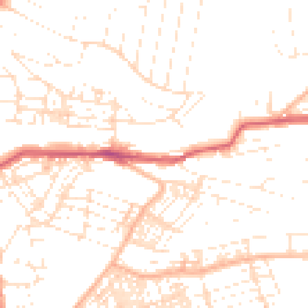
Daytime· 07:00 – 23:00
50.0dB

Night-time· 23:00 – 07:00
38.5dB