10 Blackbird Close, Crowland, Peterborough, PE6 0BF
About 10 Blackbird Close
10 Blackbird Close is a detached house in Crowland, Peterborough, Peterborough (PE6 0BF). It has a recorded floor area of 547 m² (around 5888 sq ft) and construction records dating it to 2022. The latest certificate (February 2022) returns a B (score 82), comfortably above the UK average.
Everything you need to know about 10 Blackbird Close
The true value, the hidden risks and the full sale history, in one report.
Pick your report · every report is £14.99
One time fee only - money back guarantee

The data behind every report


Energy performance
10 Blackbird Close's carbon output runs well above what efficient homes in the postcode produce.
EPC Rating
Get a survey for this property
Level 3 Building Survey
Because the property is a large detached home over 300m², we believe a Level 3 building survey should be considered.
From £1,495 · Includes VAT
Planning history
10 Blackbird Close has no planning applications on record.
But the area is active
2 notable applications nearby — larger schemes and conversions that could reshape the street. The report maps them all.
Sales history & valuation
10 Blackbird Close has no Land Registry sales on file, suggesting it has stayed in the same hands since registration began.
£930,000
Modelled from EPC, postcode comparables.
No sales recorded with HM Land Registry
That can mean the property has never traded since the registry began publishing in 1995, was a new build that hasn't been registered yet, or is held in the same hands long-term.
Median price across the last 1 sales in PE6 0BF: £400,000 (2005–2005).
Nearby sales in PE6 0BF
Everything you need to know about 10 Blackbird Close
The true value, the hidden risks and the full sale history, in one report.
Pick your report · every report is £14.99
One time fee only - money back guarantee
The data behind every report
Similar properties nearby
1 Beechcroft Gardens, Crowland
PE6 0DT
1 Causeway Lodge Close, Thorney
PE6 0GQ
1 Abbey Mews, Crowland
PE6 0EH
1 Barbers Drove North, Crowland
PE6 0BE
1 Belgravia Court, Thorney
PE6 0TT
1 Burghley Close, Crowland
PE6 0JY
1 Beech Close, Thorney
PE6 0QP
1 Beccelm Drive, Crowland
PE6 0AG
The neighbourhood at a glance
Crime
2/mo
Steady year-on-year across the wider district.
Nearest stop
0.2 km
Barbers Drove North — bus stop.
Closest school
0.9 km
South View Community Primary School. 1 school nearby.
Go deeper on the local area
A Local Area report breaks down crime, transport links, schools and air quality in depth.
Road noise across the postcode
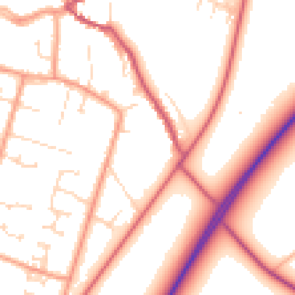
Daytime· 07:00 – 23:00
53.7dB
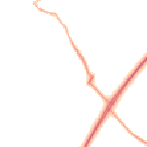
Night-time· 23:00 – 07:00
43.8dB