140 Victoria Street, Chadderton, Oldham, OL9 0DE
About 140 Victoria Street
140 Victoria Street is a mid-terrace house in Chadderton, Oldham, Oldham (OL9 0DE). It has a recorded floor area of 90 m² (around 969 sq ft) and council tax band B. The latest certificate (March 2014) returns a B (score 84), comfortably above the UK average. The latest certificate is from March 2014, so improvements made since then won't be reflected.
At 90 m² the property is well over the postcode median (69 m² across 13 EPCs), placing it in the larger end of the local stock. Its energy rating outperforms most of the postcode (better than 85% of similar EPCs).
Everything you need to know about 140 Victoria Street
The true value, the hidden risks and the full sale history, in one report.
Pick your report · every report is £14.99
One time fee only - money back guarantee

The data behind every report


Energy performance
140 Victoria Street's carbon output is low for the local stock.
EPC Expired
This certificate is over 10 years old and is no longer valid.Expired 25 Mar 2024
EPC Rating
Get a survey for this property
Level 2 HomeBuyer Report
We've checked 10 risk factors against the available data for this property and believe a Level 2 HomeBuyer Report could be a suitable option for you.
From £495 · Includes VAT
Planning history
140 Victoria Street has no planning applications on record.
But the area is active
2 notable applications nearby — larger schemes and conversions that could reshape the street. The report maps them all.
Sales history & valuation
140 Victoria Street has no Land Registry sales on file, suggesting it has stayed in the same hands since registration began.
£182,000
Modelled from EPC, postcode comparables.
No sales recorded with HM Land Registry
That can mean the property has never traded since the registry began publishing in 1995, was a new build that hasn't been registered yet, or is held in the same hands long-term.
Median price across the last 5 sales in OL9 0DE: £65,000 (2021–2011).
Nearby sales in OL9 0DE
166 Victoria Street, Chadderton, Oldham, OL9 0DE
Sold Dec 2021
£119,000160 Victoria Street, Chadderton, Oldham, OL9 0DE
Sold Sept 2018
£65,000154 Victoria Street, Chadderton, Oldham, OL9 0DE
Sold Feb 2017
£75,000174 Victoria Street, Chadderton, Oldham, OL9 0DE
Sold Sept 2012
£47,500172 Victoria Street, Chadderton, Oldham, OL9 0DE
Sold Jun 2011
£50,000
Versus other Victoria Street homes
140 Victoria Street outperforms the street on co₂ emissions by a wide margin.
EPC Rating
84 (B)
Street avg 60 (D)
Floor Area
90 m²
Street avg 84 m²
CO₂ Emissions
1.3 t/year
Street avg 4.2 t/year
Everything you need to know about 140 Victoria Street
The true value, the hidden risks and the full sale history, in one report.
Pick your report · every report is £14.99
One time fee only - money back guarantee
The data behind every report
Similar properties nearby
1 Daisy Street, Chadderton
OL9 0LB
1 Alasdair Close, Chadderton
OL9 0NE
1 Fern Street, Chadderton
OL9 0LA
1 Butterworth Street, Chadderton
OL9 0JL
1 Dart Close, Chadderton
OL9 0PJ
1 5, Victoria Street, Chadderton
OL9 0HH
1 Briar Grove, Chadderton
OL9 0EH
1 Ash Walk, Chadderton
OL9 0JP
The neighbourhood at a glance
Crime
1/mo
Steady year-on-year across the wider district.
Nearest stop
0.1 km
Eustace Street — bus stop.
Closest school
0.1 km
Burnley Brow Community School. 47 schools nearby.
Go deeper on the local area
A Local Area report breaks down crime, transport links, schools and air quality in depth.
Road noise across the postcode
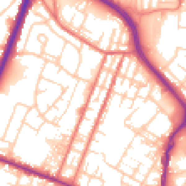
Daytime· 07:00 – 23:00
55.8dB

Night-time· 23:00 – 07:00
45.3dB