67 Brompton Street, Oldham, OL4 1AF
About 67 Brompton Street
67 Brompton Street is an end-of-terrace house in Oldham (OL4 1AF). It has a recorded floor area of 131 m² (around 1410 sq ft), construction records dating it to 1900-1929 and council tax band A. The latest certificate (December 2013) shows a D (score 55), a step below the typical UK home. The latest certificate is from December 2013, so improvements made since then won't be reflected.
It hasn't traded since February 2006, a hold of 20 years that's notably long for the area. Across 2004–2006, sale prices on this property compounded at 102.9% per year. Today's modelled estimate of £144,000 sits 85.8% above the 2006 sale of £77,500. On a £-per-square-foot basis, the last sale (£55/sq ft) was about 21.4% above the typical sold price in the postcode. At 131 m² it's 16.4% larger than the typical home in the postcode (113 m² median across 54 EPCs).
Everything you need to know about 67 Brompton Street
The true value, the hidden risks and the full sale history, in one report.
30-day money-back guarantee

The data behind every report


Energy performance
67 Brompton Street's carbon output runs well above what efficient homes in the postcode produce.
EPC Expired
This certificate is over 10 years old and is no longer valid.Expired 12 Dec 2023
EPC Rating
Get a survey for this property
Level 3 Building Survey
Because the property was built before 1919, we believe a Level 3 building survey should be considered.
From £820 · Includes VAT
Planning history
67 Brompton Street has no planning applications on record.
Notable planning nearby
5applications of note in the surrounding area
We flagged 2 things worth checking at 67 Brompton Street
Independent checks surfaced things a buyer would want to understand before offering. The report explains each one in full, with the underlying data and what to ask.
- Signs of HMO activity in the area
- Recent ownership pattern worth a look
30-day money-back guarantee
Sales history & valuation
67 Brompton Street has more than doubled in price since the earliest registered sale in 2004.
£144,000
Modelled from EPC, postcode comparables and a sale-price growth of 102.9% per year over 1 year.
£77,500
Growth on file: 102.9% per year over 1 year.
Sales timeline
28 February 2006Most recent
£77,500
+158.3%over 1 year26 October 2004
£30,000
Median price across the last 5 sales in OL4 1AF: £91,000 (2023–2021).
Nearby sales in OL4 1AF
Versus other Brompton Street homes
Price per m²
£592
Street avg £603
Floor Area
131 m²
Street avg 117 m²
Habitable Rooms
6 rooms
Street avg 6 rooms
CO₂ Emissions
6.6 t/year
Street avg 6.7 t/year
Everything you need to know about 67 Brompton Street
The true value, the hidden risks and the full sale history, in one report.
30-day money-back guarantee
The data behind every report
Similar properties nearby
The neighbourhood at a glance
Rail-style transport is unusually close for this postcode.
Nearest stop
0.1 km
Retford Street — bus stop.
Closest school
0.3 km
Glodwick Infant and Nursery School. 52 schools nearby.
Go deeper on the local area
The full report breaks down crime, transport links, schools and air quality in depth.
Road noise across the postcode
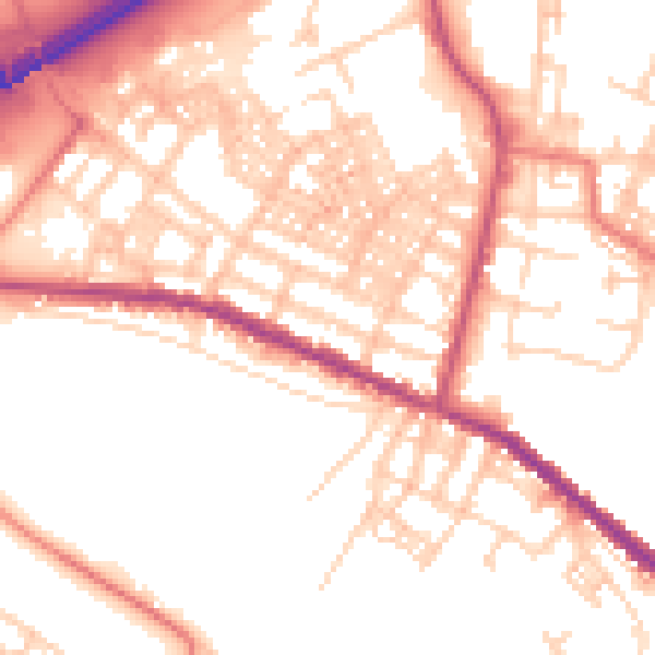
Daytime· 07:00 – 23:00
53.2dB

Night-time· 23:00 – 07:00
42.8dB