10 Bruce Street, Rochdale, OL11 3NH
About 10 Bruce Street
10 Bruce Street is an end-of-terrace house in Rochdale (OL11 3NH). It has a recorded floor area of 47 m² (around 506 sq ft), construction records dating it to 1976-1982 and council tax band A. The latest certificate (September 2012) shows a C (score 72). The latest certificate is from September 2012, so improvements made since then won't be reflected.
Today's modelled estimate of £114,000 sits 52% above the 2022 sale of £75,000. On a £-per-square-foot basis, the last sale (£148/sq ft) was about 59.6% above the typical sold price in the postcode. Sold February 2022 for £75,000. That sale was during the post-pandemic price surge, when transactions cleared materially above pre-2020 trend.
Everything you need to know about 10 Bruce Street
The true value, the hidden risks and the full sale history, in one report.
30-day money-back guarantee

The data behind every report


Energy performance
10 Bruce Street's EPC is over a decade old — improvements since won't be reflected.
EPC Expired
This certificate is over 10 years old and is no longer valid.Expired 19 Sept 2022
EPC Rating
Planning history
10 Bruce Street has no planning applications on record.
Notable planning nearby
4applications of note in the surrounding area
We flagged 1 thing worth checking at 10 Bruce Street
Independent checks surfaced things a buyer would want to understand before offering. The report explains each one in full, with the underlying data and what to ask.
- Signs of HMO activity in the area
30-day money-back guarantee
Sales history & valuation
The latest sale landed in the post-pandemic price surge — useful context when reading the figure.
£114,000
Modelled from EPC, postcode comparables.
£75,000
Recorded with HM Land Registry.
Sales timeline
21 February 2022Most recent
£75,000
Median price across the last 5 sales in OL11 3NH: £200,000 (2025–2022).
Nearby sales in OL11 3NH
Versus other Bruce Street homes
On price per m², 10 Bruce Street stands well clear of the street.
Price per m²
£1,596
Street avg £1,247
Floor Area
47 m²
Street avg 47 m²
Habitable Rooms
2 rooms
Street avg 2 rooms
CO₂ Emissions
1.6 t/year
Street avg 1.8 t/year
Everything you need to know about 10 Bruce Street
The true value, the hidden risks and the full sale history, in one report.
30-day money-back guarantee
The data behind every report
Similar properties nearby
The neighbourhood at a glance
Crime
1/mo
Steady year-on-year across the wider district.
Nearest stop
0.1 km
Sudden Street — bus stop.
Closest school
0.4 km
Marland Hill Community Primary School. 31 schools nearby.
Go deeper on the local area
The full report breaks down crime, transport links, schools and air quality in depth.
Road noise across the postcode
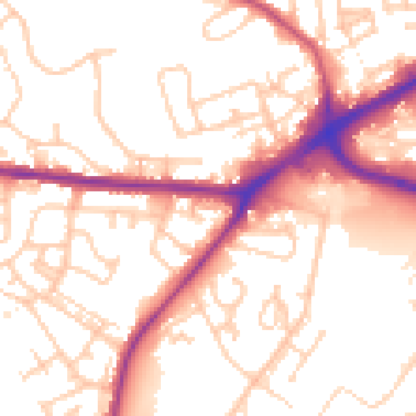
Daytime· 07:00 – 23:00
54.4dB

Night-time· 23:00 – 07:00
46.1dB