First Floor Flat, 9 Ulysses Road, London, NW6 1ED
About First Floor Flat
First Floor Flat is a mid-terrace house in London (NW6 1ED). It has a recorded floor area of 120 m² (around 1292 sq ft) and construction records dating it to 1900-1929. The latest certificate (January 2023) shows a C (score 73). When first surveyed in May 2012 the rating was E, the property has climbed 2 bands since. Between certificates, roof efficiency went from Average to Good, window efficiency went from Very Poor to Good and hot-water efficiency went from Poor to Good.
At 120 m² the property is well over the postcode median (89 m² across 25 EPCs), placing it in the larger end of the local stock. One planning record on file: an extension approved in 2022. Past consents include an extension, meaningful when judging how the property has evolved.
Everything you need to know about First Floor Flat
The true value, the hidden risks and the full sale history, in one report.
30-day money-back guarantee

The data behind every report


Energy performance
EPC Rating
Property Improvements
Changes detected from historical EPC data
Heating controls upgraded for better temperature management
Hot water efficiency improved
Single glazing replaced with double or better glazing
Roof insulation improved
Planning history
- Feb 2022ExtensionFullIn report
Extension: Rear of property
Erection of rear dormer extension, installation of three rooflights in front roof slope and window alterations in side of rear outrigger
- Documents
- 10 docs on file
- Reference
- 2021/5124/P
What's in First Floor Flat, 9 Ulysses Road, London, NW6 1ED's planning history?
Refusals, disputes and full decisions on this property and nearby, in the report.
Sales history & valuation
First Floor Flat has no Land Registry sales on file, suggesting it has stayed in the same hands since registration began.
£963,000
Modelled from EPC, postcode comparables.
No sales recorded with HM Land Registry
That can mean the property has never traded since the registry began publishing in 1995, was a new build that hasn't been registered yet, or is held in the same hands long-term.
Median price across the last 5 sales in NW6 1ED: £1,302,500 (2024–2021).
Nearby sales in NW6 1ED
Maisonette 1, 25 Ulysses Road, London, NW6 1ED
Sold Dec 2024
£1,100,000Maisonette 2, 25 Ulysses Road, London, NW6 1ED
Sold Oct 2024
£340,0005 Ulysses Road, Camden, London, NW6 1ED
Sold Jan 2024
£1,710,00035 Ulysses Road, Camden, London, NW6 1ED
Sold Mar 2023
£1,450,0009 Ulysses Road, Camden, London, NW6 1ED
Sold Mar 2021
£1,302,500
Versus other Ulysses Road homes
On floor area, First Floor Flat stands well clear of the street.
EPC Rating
73 (C)
Street avg 68 (D)
Floor Area
120 m²
Street avg 63 m²
CO₂ Emissions
3.3 t/year
Street avg 2.3 t/year
Habitable Rooms
4 rooms
Street avg 3 rooms
Everything you need to know about First Floor Flat
The true value, the hidden risks and the full sale history, in one report.
30-day money-back guarantee
The data behind every report
Similar properties nearby
148 150, Flat 1, West End Lane, Camden
NW6 1SD
148 150, Flat 5, West End Lane, Camden
NW6 1SD
14 West Cottages, Flat 1, West End Lane, Camden
NW6 1RJ
14 West Cottages, Flat 2, West End Lane, Camden
NW6 1RJ
150 152, Flat 8, West End Lane, Camden
NW6 1SD
158a, Flat 1, Mill Lane, Camden
NW6 1TF
14 West Cottages, Flat 3, West End Lane, Camden
NW6 1RJ
150 152, Flat 7, West End Lane, Camden
NW6 1SD
The neighbourhood at a glance
Rail-style transport is unusually close for this postcode.
Crime
8/mo
Rising year-on-year across the wider district.
Nearest stop
0.1 km
Fortune Green — bus stop.
Closest school
0.4 km
Emmanuel Church of England Primary School. 55 schools nearby.
Go deeper on the local area
The full report breaks down crime, transport links, schools and air quality in depth.
Road noise across the postcode
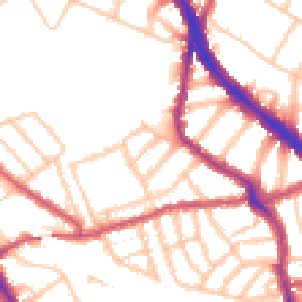
Daytime· 07:00 – 23:00
52.0dB

Night-time· 23:00 – 07:00
42.0dB