Greenfields, The Hurn, West Runton, Cromer, NR27 9QS
About Greenfields
Greenfields is a two-bedroom end-of-terrace house in West Runton, Cromer, Cromer (NR27 9QS). It has a recorded floor area of 64 m² (around 689 sq ft), construction records dating it to before 1900 and council tax band B. The latest certificate (January 2025) shows a D (score 61), on the cusp of jumping into the C band. The rating has held steady at D across 2 certificates since September 2013. Between certificates, wall efficiency went from Very Poor to Poor and roof efficiency went from Poor to Average; while lighting dropped from Very Good to Good. The recommended improvements would lift it to B (score 84), a 2-band jump. Period features are noted in the property record.
A recent sale: £232,500 in October 2025. At 64 m² it sits well below the postcode median (93 m² across 25 EPCs), making it one of the more compact homes locally. Across 2014–2025, sale prices on this property compounded at 4.4% per year. On a £-per-square-foot basis, the last sale (£337/sq ft) was about 68.9% above the typical sold price in the postcode. One historical planning record sits against the property in 2026.
Know exactly what you're buying at Greenfields
Before you offer, see what the listing won't tell you, the true value, the red flags and the full history.
Already flagged here
Valuation
against the asking price
Risks
planning & flood
Sold prices
similar homes nearby
Trends
the local market
What this property has
Inside
- Bedrooms2
- Bathrooms1
- Open-plan layoutYes
- Dining roomYes
- CloakroomYes
Outside
- Private gardenYes
Building
- Period featuresYes
Energy performance
Recommended upgrades on file would lift this property by multiple EPC bands.
EPC Rating
Property Improvements
Changes detected from historical EPC data
Wall insulation improved
Roof insulation improved
Low energy lighting percentage decreased
Planning history
- Jan 2026Tree WorksTreesIn report
T1 - Cotoneaster Coriaceus, reduce canopy to give 2m clearance of house, reduce remaining canopy 1.5m to maintain shape T2 - Staghorn Sumac, Fell. T3 - Eucalyptus Tree, Fell.
- Documents
- 3 docs on file
- Reference
- TW/25/2733
We flagged 1 thing worth checking at Greenfields
Independent checks surfaced things a buyer would want to understand before offering. The report explains each one in full, with the underlying data and what to ask.
- Larger development activity nearby
30-day money-back guarantee
Sales history & valuation
£249,000
Modelled from EPC, postcode comparables and a sale-price growth of 4.4% per year over 12 years.
£232,500
Growth on file: 4.4% per year over 12 years.
Sales timeline
31 October 2025Most recent
£232,500
+66.1%over 11 years31 January 2014
£140,000
Median price across the last 5 sales in NR27 9QS: £315,000 (2025–2022).
Nearby sales in NR27 9QS
The Barn, The Hurn, West Runton, Cromer, NR27 9QS
Sold Jun 2025
£300,000Old Farm Cottage, The Hurn, West Runton, Cromer, NR27 9QS
Sold Dec 2024
£315,0002 Charlottes Close, The Hurn, West Runton, Cromer, NR27 9QS
Sold Jul 2024
£425,000Roseacre Country House, The Hurn, West Runton, Cromer, NR27 9QS
Sold Dec 2023
£1,100,000Myrtle Cottage, The Hurn, West Runton, Cromer, NR27 9QS
Sold Jul 2022
£285,000
Everything we know about Greenfields, in one report
What it's really worth, what could be wrong, and the planning, sales and area data in full.
What we flagged
- Larger development activity nearby

Versus other The Hurn homes
On years held, Greenfields runs well behind the street norm.
Price per m²
£3,633
Street avg £2,867
Floor Area
64 m²
Street avg 107 m²
Habitable Rooms
4 rooms
Street avg 5 rooms
CO₂ Emissions
3.2 t/year
Street avg 5.2 t/year
Similar properties nearby
1 Charles Close
NR27 9JY
1 Clarence Mews, Brook Street
NR27 9BF
1 Alfred Court, Alfred Road
NR27 9AF
1 Chesterfield Villas, West Street
NR27 9EW
1 Brunswick Terrace, The Gangway
NR27 9EU
1 Arbor Road
NR27 9DW
1 Bond Street
NR27 9DA
1 Charlottes Close, The Hurn, West Runton
NR27 9QS
The neighbourhood at a glance
Rail-style transport is unusually close for this postcode.
Crime
3/mo
Steady year-on-year across the wider district.
Nearest stop
0.2 km
West Runton Rail Station — railway station.
Closest school
2.8 km
Sheringham Community Primary School. 2 schools nearby.
Go deeper on the local area
The full report breaks down crime, transport links, schools and air quality in depth.
Road noise across the postcode
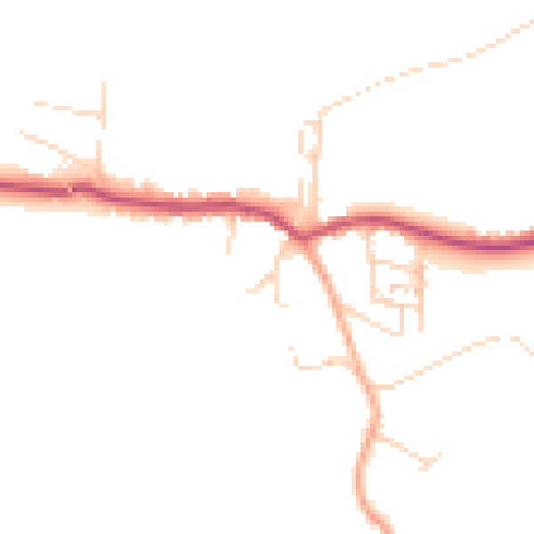
Daytime· 07:00 – 23:00
45.2dB

Night-time· 23:00 – 07:00
37.8dB