St Marys House, Flat 7, St Crispin Drive, Northampton, NN5 4BZ
About St Marys House
St Marys House is a one-bedroom end-of-terrace house in Northampton (NN5 4BZ). It has a recorded floor area of 44 m² (around 474 sq ft), construction records dating it to 2007-2011 and council tax band B. At 44 m² this is the smallest unit on EPC record across St Marys House (44–74 m²). The building's EPC ratings span C to A, with this unit at the bottom. Other recorded features include a balcony. The latest certificate (June 2022) shows a C (score 79), near the top of the C band. Earlier certificates rated it A (June 2012); the latest reading is 2 bands lower.
At 44 m² it sits well below the postcode median (66 m² across 11 EPCs), making it one of the more compact homes locally. Across 2013–2017, sale prices on this property compounded at 3.8% per year. Today's modelled estimate of £152,000 is 12.6% above the 2017 sale price. On a £-per-square-foot basis, the last sale (£285/sq ft) was about 52.2% above the typical sold price in the postcode. Last changed hands 9 years ago, in June 2017.
Know exactly what you're buying at St Marys House
Before you offer, see what the listing won't tell you, the true value, the red flags and the full history.
Already flagged here
Valuation
against the asking price
Risks
planning & flood
Sold prices
similar homes nearby
Trends
the local market
What this property has
Inside
- Bedrooms1
- Bathrooms1
- Open-plan layoutYes
Outside
- Communal gardenYes
- ParkingAllocated
- BalconyYes
Building
- RefurbishedYes
Energy performance
St Marys House's carbon output is low for the local stock.
EPC Rating
Property Improvements
Changes detected from historical EPC data
More low energy lighting installed
Planning history
St Marys House has no planning applications on record.
Notable planning nearby
13applications of note in the surrounding area
We flagged 2 things worth checking at St Marys House
Independent checks surfaced things a buyer would want to understand before offering. The report explains each one in full, with the underlying data and what to ask.
- Signs of HMO activity in the area
- Larger development activity nearby
30-day money-back guarantee
Sales history & valuation
£152,000
Modelled from EPC, postcode comparables and a sale-price growth of 3.8% per year over 4 years.
£135,000
Growth on file: 3.8% per year over 4 years.
Sales timeline
22 June 2017Most recent
£135,000
+17.4%over 4 years28 February 2013
£115,000
Median price across the last 5 sales in NN5 4BZ: £156,000 (2024–2017).
Nearby sales in NN5 4BZ
St Marys House, Flat 9, St Crispin Drive, Northampton, NN5 4BZ
Sold May 2024
£170,000St Marys House, Flat 6, St Crispin Drive, Northampton, NN5 4BZ
Sold Jan 2024
£165,000St Marys House, Flat 2, St Crispin Drive, Northampton, NN5 4BZ
Sold Aug 2023
£150,000St Marys House, Flat 10, St Crispin Drive, Northampton, NN5 4BZ
Sold Apr 2021
£145,000St Marys House, Flat 12, St Crispin Drive, Northampton, NN5 4BZ
Sold Feb 2017
£156,000
Everything we know about St Marys House, in one report
What it's really worth, what could be wrong, and the planning, sales and area data in full.
What we flagged
- Signs of HMO activity in the area
- Larger development activity nearby

Versus other St Crispin Drive homes
St Marys House outperforms the street on price per m² by a wide margin.
Price per m²
£3,068
Street avg £2,164
Floor Area
44 m²
Street avg 64 m²
Habitable Rooms
2 rooms
Street avg 3 rooms
CO₂ Emissions
1.1 t/year
Street avg 1.2 t/year
Similar properties nearby
Ashlar, Flat 14, South Meadow Road
NN5 4AP
Ashlar, Flat 22, South Meadow Road
NN5 4AP
Ashlar, Flat 11, South Meadow Road
NN5 4AP
Ashlar, Flat 20, South Meadow Road
NN5 4AP
Ashlar, Flat 1, South Meadow Road
NN5 4AP
Ashlar, Flat 2, South Meadow Road
NN5 4AP
Ashlar, Flat 19, South Meadow Road
NN5 4AP
Ashlar, Flat 16, South Meadow Road
NN5 4AP
The neighbourhood at a glance
Daytime road noise here sits well below conversation level — a quiet pocket of the postcode.
Crime
6/mo
Steady year-on-year across the wider district.
Nearest stop
0.0 km
St Mary's House — bus stop.
Closest school
0.4 km
St Luke's Church of England Primary School. 16 schools nearby.
Go deeper on the local area
The full report breaks down crime, transport links, schools and air quality in depth.
Road noise across the postcode
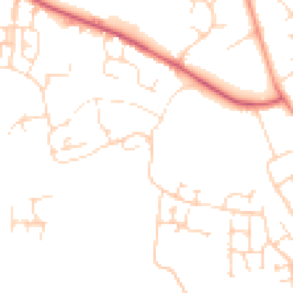
Daytime· 07:00 – 23:00
48.0dB

Night-time· 23:00 – 07:00
38.6dB