9 Broomhill Lane, Mansfield, NG19 6BN
About 9 Broomhill Lane
9 Broomhill Lane is a three-bedroom semi-detached house in Mansfield (NG19 6BN). It has a recorded floor area of 65 m² (around 700 sq ft), construction records dating it to 2003-2006 and council tax band A. The latest certificate (May 2022) shows a C (score 74). The rating has held steady at C across 2 certificates since May 2012. Between certificates, lighting went from Average to Very Good; while wall efficiency dropped from Very Good to Good and roof efficiency dropped from Very Good to Good. The recommended improvements would push it to B (score 88). Our model identifies extension potential, subject to local planning policy.
It hasn't traded since October 2005, a hold of 21 years that's notably long for the area. Across 2001–2005, sale prices on this property compounded at 21.5% per year. Today's modelled estimate of £153,000 sits 155% above the 2005 sale of £60,000. On a £-per-square-foot basis, the last sale (£86/sq ft) was about 36.5% below the postcode norm.
What this property has
Inside
- Bedrooms3
- Bathrooms1
- CloakroomYes
Outside
- Private gardenYes
Building
- RefurbishedYes
- Extension potentialPossible
Everything you need to know about 9 Broomhill Lane
The true value, the hidden risks and the full sale history, in one report.
Pick your report · every report is £14.99
One time fee only - money back guarantee

The data behind every report


Energy performance
EPC Rating
Property Improvements
Changes detected from historical EPC data
More low energy lighting installed
Get a survey for this property
Level 2 HomeBuyer Report
We've checked 10 risk factors against the available data for this property and believe a Level 2 HomeBuyer Report could be a suitable option for you.
From £495 · Includes VAT
Planning history
9 Broomhill Lane has no planning applications on record.
A planning report still maps activity across the surrounding area and reads this property's extension & conversion potential.
Sales history & valuation
9 Broomhill Lane has more than doubled in price since the earliest registered sale in 2001.
£153,000
Modelled from EPC, postcode comparables and a sale-price growth of 21.5% per year over 5 years.
£60,000
Growth on file: 21.5% per year over 5 years.
Sales timeline
9 October 2005Most recent
£60,000
+155.3%over 1 year7 January 2004
£23,500
-1.1%over 3 years3 January 2001
£23,750
Median price across the last 5 sales in NG19 6BN: £96,000 (2022–2011).
Nearby sales in NG19 6BN
Versus other Broomhill Lane homes
9 Broomhill Lane is notably below the street on price per m².
Price per m²
£923
Street avg £1,970
Floor Area
65 m²
Street avg 58 m²
Habitable Rooms
4 rooms
Street avg 5 rooms
CO₂ Emissions
2.1 t/year
Street avg 1.7 t/year
Everything you need to know about 9 Broomhill Lane
The true value, the hidden risks and the full sale history, in one report.
Pick your report · every report is £14.99
One time fee only - money back guarantee
The data behind every report
Similar properties nearby
The neighbourhood at a glance
Crime
3/mo
Steady year-on-year across the wider district.
Nearest stop
0.0 km
Marlborough Road — bus stop.
Closest school
0.1 km
All Saints' Catholic Voluntary Academy. 24 schools nearby.
Go deeper on the local area
A Local Area report breaks down crime, transport links, schools and air quality in depth.
Road noise across the postcode
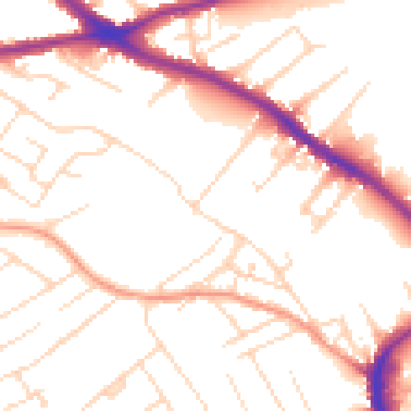
Daytime· 07:00 – 23:00
51.7dB

Night-time· 23:00 – 07:00
41.6dB