12 Attlee Avenue, Forest Town, Mansfield, NG19 0DL
About 12 Attlee Avenue
12 Attlee Avenue is a semi-detached house in Forest Town, Mansfield, Mansfield (NG19 0DL). It has a recorded floor area of 106 m² (around 1141 sq ft), construction records dating it to 1950-1966 and council tax band A. The latest certificate (December 2013) shows a D (score 58), a step below the typical UK home. When first surveyed in September 2012 the rating was E, the property has climbed 1 band since. Between certificates, lighting went from Poor to Good. The recommended improvements would push it to C (score 80). The latest certificate is from December 2013, so improvements made since then won't be reflected.
At 106 m² the property is well over the postcode median (76 m² across 10 EPCs), placing it in the larger end of the local stock. Across 2002–2013, sale prices on this property compounded at 9.1% per year. Today's modelled estimate of £192,000 sits 55.5% above the 2013 sale of £123,500. On a £-per-square-foot basis, the last sale (£108/sq ft) was about 30.8% above the typical sold price in the postcode. One planning record on file: an extension approved in 2020. Past consents include an extension, meaningful when judging how the property has evolved. On the market in February 2013 and unlisted since — roughly 13 years.
Everything you need to know about 12 Attlee Avenue
The true value, the hidden risks and the full sale history, in one report.
Pick your report · every report is £14.99
One time fee only - money back guarantee

The data behind every report


Energy performance
12 Attlee Avenue's EPC is over a decade old — improvements since won't be reflected.
EPC Expired
This certificate is over 10 years old and is no longer valid.Expired 23 Dec 2023
EPC Rating
Property Improvements
Changes detected from historical EPC data
More low energy lighting installed
Get a survey for this property
Level 2 HomeBuyer Report
We've checked 10 risk factors against the available data for this property and believe a Level 2 HomeBuyer Report could be a suitable option for you.
From £495 · Includes VAT
Planning history
12 Attlee Avenue has an approved extension on the planning record.
1 application on record at 12 Attlee Avenue, Forest Town, Mansfield, NG19 0DL
- Aug 2020ExtensionFullOutcome in report
SINGLE STOREY FRONT AND REAR EXTENSIONS
- Documents
- 5 docs on file
- Reference
- 2020/0362/HHA
Unlock 12 Attlee Avenue, Forest Town, Mansfield, NG19 0DL's full planning history
You're seeing the shape of it. The report has the substance.
- Every decision — granted, refused or withdrawn (1 on record)
- All 1 application on this property in full, plus 1 notable nearby
- The 5 documents, officer reports & conditions
- What the pattern means for extending or converting here
One time fee only - money back guarantee
Sales history & valuation
12 Attlee Avenue has more than doubled in price since the earliest registered sale in 2002.
£192,000
Modelled from EPC, postcode comparables and a sale-price growth of 9.1% per year over 11 years.
£123,500
Growth on file: 9.1% per year over 11 years.
Sales timeline
20 February 2013Most recent
£123,500
+160.0%over 10 years22 February 2002
£47,500
Median price across the last 5 sales in NG19 0DL: £135,000 (2024–2016).
Nearby sales in NG19 0DL
10 Attlee Avenue, Forest Town, Mansfield, NG19 0DL
Sold Apr 2024
£65,0005 Attlee Avenue, Forest Town, Mansfield, NG19 0DL
Sold Oct 2021
£160,00011 Attlee Avenue, Forest Town, Mansfield, NG19 0DL
Sold Mar 2021
£150,00015 Attlee Avenue, Forest Town, Mansfield, NG19 0DL
Sold Jun 2018
£135,0009 Attlee Avenue, Forest Town, Mansfield, NG19 0DL
Sold Apr 2016
£63,000
Versus other Attlee Avenue homes
On years held, 12 Attlee Avenue stands well clear of the street.
Price per m²
£1,165
Street avg £1,348
Floor Area
106 m²
Street avg 69 m²
Habitable Rooms
6 rooms
Street avg 4 rooms
CO₂ Emissions
5.0 t/year
Street avg 3.3 t/year
Everything you need to know about 12 Attlee Avenue
The true value, the hidden risks and the full sale history, in one report.
Pick your report · every report is £14.99
One time fee only - money back guarantee
The data behind every report
Similar properties nearby
1 Cardle Close, Forest Town
NG19 0PU
1 Attlee Avenue, Forest Town
NG19 0DL
1 Barton Close, Forest Town
NG19 0DD
1 Aylesbury Way, Forest Town
NG19 0GJ
1 Amberley Court, Forest Town
NG19 0JW
1 Beechwood Close, Forest Town
NG19 0NU
1 Baird Avenue, Forest Town
NG19 0SF
1 Butterwick Close, Forest Town
NG19 0QP
The neighbourhood at a glance
Crime
3/mo
Steady year-on-year across the wider district.
Nearest stop
0.2 km
School — bus stop.
Closest school
0.1 km
Holly Primary School. 24 schools nearby.
Go deeper on the local area
A Local Area report breaks down crime, transport links, schools and air quality in depth.
Road noise across the postcode
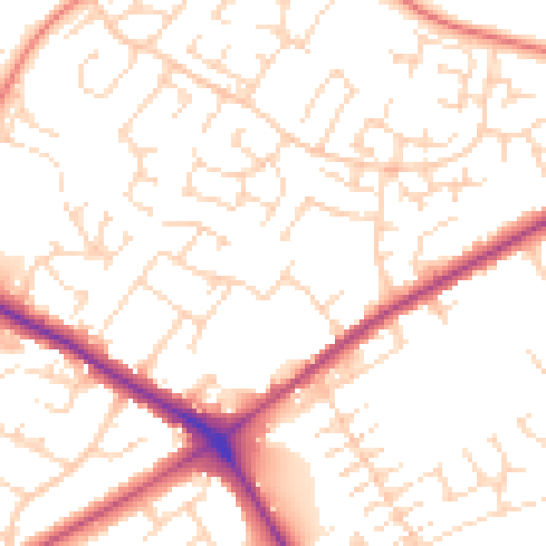
Daytime· 07:00 – 23:00
51.8dB

Night-time· 23:00 – 07:00
41.0dB