6 Colville Street, Nottingham, NG1 4HQ
About 6 Colville Street
6 Colville Street is a semi-detached house in Nottingham (NG1 4HQ). It has a recorded floor area of 254 m² (around 2734 sq ft), construction records dating it to 1900-1929 and council tax band C. The latest certificate (July 2019) shows a D (score 63), on the cusp of jumping into the C band. When first surveyed in May 2009 the rating was E, the property has climbed 1 band since. Between certificates, roof efficiency went from Very Poor to Good; while hot-water efficiency dropped from Very Good to Good and main heating dropped from Very Good to Good. The recommended improvements would push it to C (score 80).
At 254 m² the property is well over the postcode median (138 m² across 28 EPCs), placing it in the larger end of the local stock.
Everything you need to know about 6 Colville Street
The true value, the hidden risks and the full sale history, in one report.
Pick your report · every report is £14.99
One time fee only - money back guarantee

The data behind every report


Energy performance
6 Colville Street's carbon output runs well above what efficient homes in the postcode produce.
EPC Rating
Property Improvements
Changes detected from historical EPC data
Heating controls changed
Hot water system upgraded
Low energy lighting percentage decreased
Heating controls upgraded for better temperature management
Roof insulation improved
More low energy lighting installed
Get a survey for this property
Level 3 Building Survey
Because the property was built before 1919 and has solid (non-cavity) walls, we believe a Level 3 building survey should be considered.
From £885 · Includes VAT
Planning history
6 Colville Street has no planning applications on record.
But the area is active
16 notable applications nearby — larger schemes and conversions that could reshape the street. The report maps them all.
Sales history & valuation
6 Colville Street has no Land Registry sales on file, suggesting it has stayed in the same hands since registration began.
£219,000
Modelled from EPC, postcode comparables.
No sales recorded with HM Land Registry
That can mean the property has never traded since the registry began publishing in 1995, was a new build that hasn't been registered yet, or is held in the same hands long-term.
Median price across the last 5 sales in NG1 4HQ: £252,000 (2018–2015).
Nearby sales in NG1 4HQ
13 Colville Street, Nottingham, NG1 4HQ
Sold Sept 2018
£280,00014a, Colville Street, Nottingham, NG1 4HQ
Sold Jul 2018
£168,00025 Colville Street, Nottingham, NG1 4HQ
Sold Nov 2016
£252,00030 Colville Street, Nottingham, NG1 4HQ
Sold Jul 2015
£310,00011 Colville Street, Nottingham, NG1 4HQ
Sold May 2015
£200,000
Versus other Colville Street homes
6 Colville Street outperforms the street on floor area by a wide margin.
EPC Rating
63 (D)
Street avg 60 (D)
Floor Area
254 m²
Street avg 150 m²
CO₂ Emissions
9.9 t/year
Street avg 7.1 t/year
Habitable Rooms
7 rooms
Street avg 6 rooms
Everything you need to know about 6 Colville Street
The true value, the hidden risks and the full sale history, in one report.
Pick your report · every report is £14.99
One time fee only - money back guarantee
The data behind every report
Similar properties nearby
The neighbourhood at a glance
Rail-style transport is unusually close for this postcode.
Crime
39/mo
Rising year-on-year across the wider district.
Nearest stop
0.2 km
Forest Road — bus stop.
Closest school
0.6 km
Huntingdon Academy. 41 schools nearby.
Go deeper on the local area
A Local Area report breaks down crime, transport links, schools and air quality in depth.
Road noise across the postcode
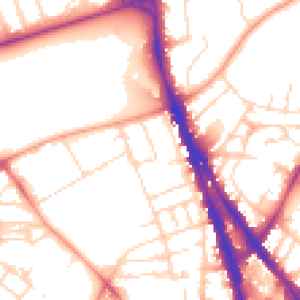
Daytime· 07:00 – 23:00
53.9dB
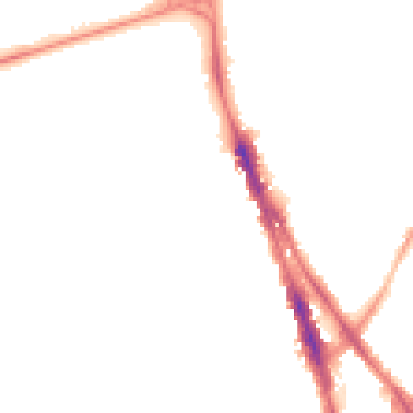
Night-time· 23:00 – 07:00
43.6dB