4 Colville Street, Nottingham, NG1 4HQ
About 4 Colville Street
4 Colville Street is a seven-bedroom mid-terrace house in Nottingham (NG1 4HQ). It has a recorded floor area of 225 m² (around 2422 sq ft), construction records dating it to 1900-1929 and council tax band C. The latest certificate (August 2019) shows a D (score 58), a step below the typical UK home. Earlier certificates rated it C (August 2009); the latest reading is one band lower. Between certificates, wall efficiency dropped from Good to Very Poor and hot-water efficiency dropped from Very Good to Good. The recommended improvements would push it to C (score 77). The home occupies a corner plot.
Held since May 1999 — that's 27 years off the open market, well above the local norm. Only one transfer is on record with HM Land Registry, suggesting it has stayed in the same hands for a long time. One planning application is currently pending a decision in 2022. At 225 m² the property is well over the postcode median (138 m² across 28 EPCs), placing it in the larger end of the local stock. Today's modelled estimate of £288,000 sits 238.8% above the 1999 sale of £85,000. On a £-per-square-foot basis, the last sale (£35/sq ft) was about 41.4% below the postcode norm.
What this property has
Inside
- Bedrooms7
- Bathrooms2
- EnsuiteYes
Outside
- Private gardenYes
- Corner plotYes
Everything you need to know about 4 Colville Street
The true value, the hidden risks and the full sale history, in one report.
Pick your report · every report is £14.99
One time fee only - money back guarantee

The data behind every report


Energy performance
4 Colville Street's carbon output runs well above what efficient homes in the postcode produce.
EPC Rating
Get a survey for this property
Level 3 Building Survey
Because the property was built before 1919, has been extended more than once, and has solid (non-cavity) walls, we believe a Level 3 building survey should be considered.
From £885 · Includes VAT
Planning history
1 application on record at 4 Colville Street, Nottingham, NG1 4HQ
- Feb 2022Tree WorksTreesOutcome in report
T1 - Crown raise Beech tree to 3m adjacent to rear garden area to let light in under the tree to open up the garden T2 - Fell White beam
- Documents
- 1 doc on file
- Reference
- 22/00579/PWC
Unlock 4 Colville Street, Nottingham, NG1 4HQ's full planning history
You're seeing the shape of it. The report has the substance.
- Every decision — granted, refused or withdrawn
- All 1 application on this property in full, plus 16 notable nearby
- The 1 documents, officer reports & conditions
- What the pattern means for extending or converting here
One time fee only - money back guarantee
Sales history & valuation
4 Colville Street's estimated value is more than triple its earliest registered sale price (1999).
£288,000
Modelled from EPC, postcode comparables.
£85,000
Recorded with HM Land Registry.
Sales timeline
6 May 1999Most recent
£85,000
Median price across the last 5 sales in NG1 4HQ: £252,000 (2018–2015).
Nearby sales in NG1 4HQ
13 Colville Street, Nottingham, NG1 4HQ
Sold Sept 2018
£280,00014a, Colville Street, Nottingham, NG1 4HQ
Sold Jul 2018
£168,00025 Colville Street, Nottingham, NG1 4HQ
Sold Nov 2016
£252,00030 Colville Street, Nottingham, NG1 4HQ
Sold Jul 2015
£310,00011 Colville Street, Nottingham, NG1 4HQ
Sold May 2015
£200,000
Versus other Colville Street homes
On price per m², 4 Colville Street runs well behind the street norm.
Price per m²
£378
Street avg £1,069
Floor Area
225 m²
Street avg 151 m²
Habitable Rooms
11 rooms
Street avg 6 rooms
CO₂ Emissions
10.0 t/year
Street avg 7.1 t/year
Everything you need to know about 4 Colville Street
The true value, the hidden risks and the full sale history, in one report.
Pick your report · every report is £14.99
One time fee only - money back guarantee
The data behind every report
Similar properties nearby
The neighbourhood at a glance
Rail-style transport is unusually close for this postcode.
Crime
39/mo
Rising year-on-year across the wider district.
Nearest stop
0.2 km
Forest Road — bus stop.
Closest school
0.6 km
Huntingdon Academy. 41 schools nearby.
Go deeper on the local area
A Local Area report breaks down crime, transport links, schools and air quality in depth.
Road noise across the postcode
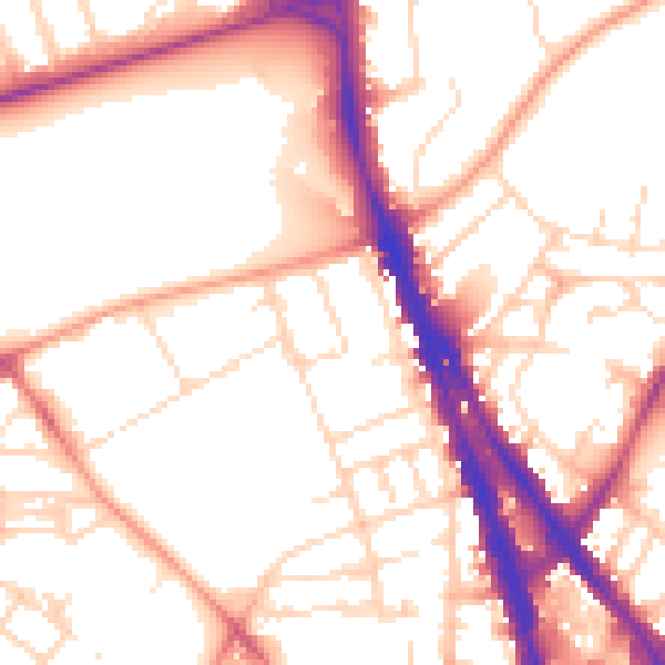
Daytime· 07:00 – 23:00
53.9dB
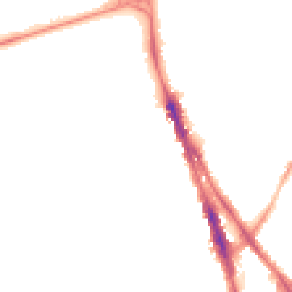
Night-time· 23:00 – 07:00
43.6dB