260 North Sherwood Street, Nottingham, NG1 4EN
About 260 North Sherwood Street
260 North Sherwood Street is a semi-detached house in Nottingham (NG1 4EN). It has a recorded floor area of 116 m² (around 1249 sq ft), construction records dating it to 2012 onwards and council tax band A. The latest certificate (August 2023) returns a B (score 81), comfortably above the UK average. The rating has held steady at B across 2 certificates since August 2013. Between certificates, window efficiency dropped from Very Good to Average.
Today's modelled estimate of £181,000 is 56.9% below the 2022 sale of £420,000, an unusual pattern given regional price growth and worth checking against the EPC condition. On a £-per-square-foot basis, the last sale (£336/sq ft) was about 68% above the typical sold price in the postcode. At 116 m² the property is well over the postcode median (82 m² across 38 EPCs), placing it in the larger end of the local stock. Sold March 2022 for £420,000. That sale was during the post-pandemic price surge, when transactions cleared materially above pre-2020 trend.
Everything you need to know about 260 North Sherwood Street
The true value, the hidden risks and the full sale history, in one report.
Pick your report · every report is £14.99
One time fee only - money back guarantee

The data behind every report


Energy performance
EPC Rating
Get a survey for this property
Level 2 HomeBuyer Report
We've checked 10 risk factors against the available data for this property and believe a Level 2 HomeBuyer Report could be a suitable option for you.
From £495 · Includes VAT
Planning history
260 North Sherwood Street has no planning applications on record.
But the area is active
16 notable applications nearby — larger schemes and conversions that could reshape the street. The report maps them all.
Sales history & valuation
Latest sale on 260 North Sherwood Street was the highest on Land Registry record across the postcode.
£181,000
Modelled from EPC, postcode comparables.
£420,000
Recorded with HM Land Registry.
Sales timeline
23 March 2022Most recent
£420,000
Median price across the last 5 sales in NG1 4EN: £242,425 (2022–2000).
Nearby sales in NG1 4EN
262 North Sherwood Street, Nottingham, NG1 4EN
Sold Mar 2022
£350,000240 North Sherwood Street, Nottingham, NG1 4EN
Sold Jul 2006
£242,425244 North Sherwood Street, Nottingham, NG1 4EN
Sold Jul 2006
£242,425242 North Sherwood Street, Nottingham, NG1 4EN
Sold Jul 2006
£242,425210a, North Sherwood Street, Nottingham, NG1 4EN
Sold Aug 2000
£25,000
Versus other North Sherwood Street homes
260 North Sherwood Street outperforms the street on price per m² by a wide margin.
Price per m²
£3,621
Street avg £1,461
Floor Area
116 m²
Street avg 79 m²
Habitable Rooms
7 rooms
Street avg 5 rooms
CO₂ Emissions
2.0 t/year
Street avg 1.6 t/year
Everything you need to know about 260 North Sherwood Street
The true value, the hidden risks and the full sale history, in one report.
Pick your report · every report is £14.99
One time fee only - money back guarantee
The data behind every report
Similar properties nearby
The neighbourhood at a glance
Rail-style transport is unusually close for this postcode.
Crime
39/mo
Rising year-on-year across the wider district.
Nearest stop
0.1 km
Forest Road — bus stop.
Closest school
0.6 km
Huntingdon Academy. 43 schools nearby.
Go deeper on the local area
A Local Area report breaks down crime, transport links, schools and air quality in depth.
Road noise across the postcode
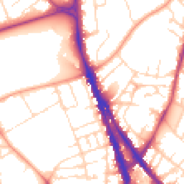
Daytime· 07:00 – 23:00
53.9dB
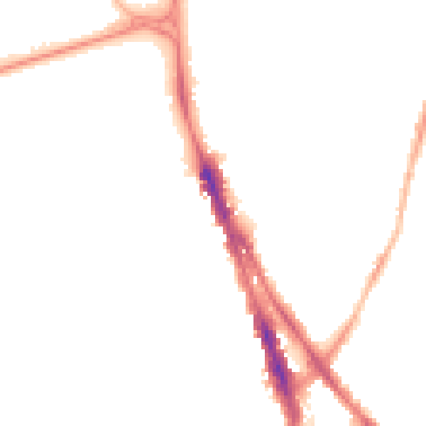
Night-time· 23:00 – 07:00
43.7dB