168b, North Sherwood Street, Nottingham, NG1 4EF
About 168b
168b is a mid-terrace house in Nottingham (NG1 4EF). It has a recorded floor area of 107 m² (around 1152 sq ft), construction records dating it to 2007 onwards and council tax band A. At 107 m² this is the 49th smallest of 53 units on EPC record in the building, where floor areas span 17–233 m². The building's EPC ratings span E to C, with this unit at the top. The latest certificate (November 2018) shows a C (score 69), just inside the C band. When first surveyed in November 2008 the rating was D, the property has climbed 1 band since. Between certificates, lighting went from Average to Very Good and main heating went from Poor to Average; while hot-water efficiency dropped from Poor to Very Poor. Main heating runs on electricity.
At 107 m² the property is well over the postcode median (50 m² across 52 EPCs), placing it in the larger end of the local stock.
Everything you need to know about 168b
The true value, the hidden risks and the full sale history, in one report.
Pick your report · every report is £14.99
One time fee only - money back guarantee

The data behind every report


Energy performance
EPC Rating
Property Improvements
Changes detected from historical EPC data
Hot water efficiency decreased
More low energy lighting installed
Get a survey for this property
Level 3 Building Survey
Because the property has no mains gas supply, we believe a Level 3 building survey should be considered.
From £820 · Includes VAT
Planning history
168b has no planning applications on record.
But the area is active
16 notable applications nearby — larger schemes and conversions that could reshape the street. The report maps them all.
Sales history & valuation
168b has no Land Registry sales on file, suggesting it has stayed in the same hands since registration began.
£149,000
Modelled from EPC, postcode comparables.
No sales recorded with HM Land Registry
That can mean the property has never traded since the registry began publishing in 1995, was a new build that hasn't been registered yet, or is held in the same hands long-term.
Median price across the last 3 sales in NG1 4EF: £85,000 (2016–2001).
Versus other North Sherwood Street homes
168b outperforms the street on floor area by a wide margin.
EPC Rating
69 (C)
Street avg 63 (D)
Floor Area
107 m²
Street avg 57 m²
CO₂ Emissions
4.5 t/year
Street avg 3.5 t/year
Habitable Rooms
5 rooms
Street avg 4 rooms
Everything you need to know about 168b
The true value, the hidden risks and the full sale history, in one report.
Pick your report · every report is £14.99
One time fee only - money back guarantee
The data behind every report
Similar properties nearby
The neighbourhood at a glance
Rail-style transport is unusually close for this postcode.
Crime
39/mo
Rising year-on-year across the wider district.
Nearest stop
0.0 km
Frogmore Street — bus stop.
Closest school
0.4 km
Huntingdon Academy. 43 schools nearby.
Go deeper on the local area
A Local Area report breaks down crime, transport links, schools and air quality in depth.
Road noise across the postcode
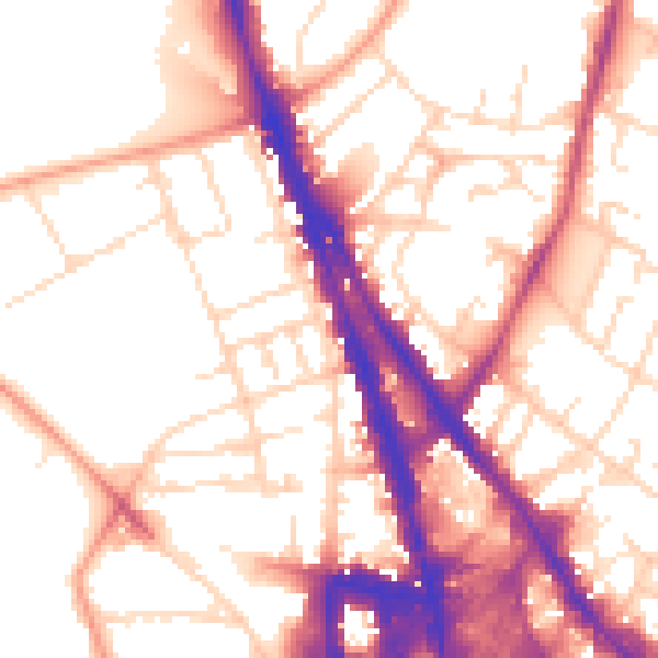
Daytime· 07:00 – 23:00
55.1dB
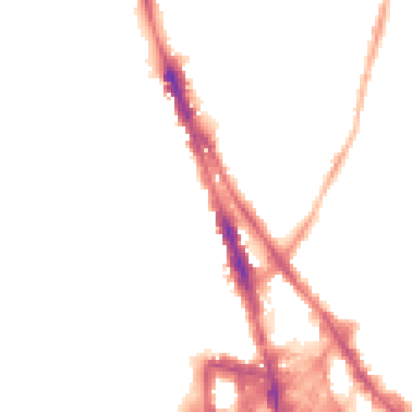
Night-time· 23:00 – 07:00
44.8dB