53 Rosebery Crescent, Newcastle Upon Tyne, NE2 1EX
About 53 Rosebery Crescent
53 Rosebery Crescent is a seven-bedroom mid-terrace house in Newcastle Upon Tyne (NE2 1EX). It has a recorded floor area of 173 m² (around 1862 sq ft), construction records dating it to 1900-1929 and council tax band D. The latest certificate (March 2023) shows a C (score 70). When first surveyed in December 2008 the rating was D, the property has climbed 1 band since. Between certificates, roof efficiency went from Very Poor to Average and lighting went from Good to Very Good. The recommended improvements would push it to B (score 84).
It hasn't traded since January 2007, a hold of 19 years that's notably long for the area. That sale landed at the peak of the pre-credit-crunch market, which is a useful reference point when interpreting the price. At 173 m² it's 26.3% larger than the typical home in the postcode (137 m² median across 17 EPCs). On energy efficiency it sits in the top 10% of properties in this postcode. 7 bedrooms is on the larger side for this postcode, where 4 is the typical count. Across 1999–2007, sale prices on this property compounded at 13.7% per year. Today's modelled estimate of £502,000 sits 59.4% above the 2007 sale of £315,000.
Know exactly what you're buying at 53 Rosebery Crescent
Before you offer, see what the listing won't tell you, the true value, the red flags and the full history.
Already flagged here
Valuation
against the asking price
Risks
planning & flood
Sold prices
similar homes nearby
Trends
the local market
What this property has
Inside
- Bedrooms7
- Bathrooms3
Building
- Central heatingYes
- RefurbishedYes
Energy performance
53 Rosebery Crescent ranks among the most efficient homes in the postcode for energy use.
EPC Rating
Property Improvements
Changes detected from historical EPC data
Heating controls upgraded for better temperature management
Window efficiency improved
Wall insulation improved
Roof insulation improved
More low energy lighting installed
Planning history
53 Rosebery Crescent has no planning applications on record.
Notable planning nearby
4applications of note in the surrounding area
We flagged 1 thing worth checking at 53 Rosebery Crescent
Independent checks surfaced things a buyer would want to understand before offering. The report explains each one in full, with the underlying data and what to ask.
- Signs of HMO activity in the area
30-day money-back guarantee
Sales history & valuation
53 Rosebery Crescent has more than doubled in price since the earliest registered sale in 1999.
£502,000
Modelled from EPC, postcode comparables and a sale-price growth of 13.7% per year over 8 years.
£315,000
Growth on file: 13.7% per year over 8 years.
Sales timeline
30 January 2007Most recent
£315,000
+162.5%over 7 years22 July 1999
£120,000
Median price across the last 5 sales in NE2 1EX: £356,000 (2021–2019).
Nearby sales in NE2 1EX
55 Rosebery Crescent, Newcastle Upon Tyne, NE2 1EX
Sold Jun 2021
£330,00059 Rosebery Crescent, Newcastle Upon Tyne, NE2 1EX
Sold Oct 2020
£297,00083 Rosebery Crescent, Newcastle Upon Tyne, NE2 1EX
Sold Sept 2020
£388,00077 Rosebery Crescent, Newcastle Upon Tyne, NE2 1EX
Sold Aug 2019
£356,00051 Rosebery Crescent, Newcastle Upon Tyne, NE2 1EX
Sold Jan 2019
£385,000
Everything we know about 53 Rosebery Crescent, in one report
What it's really worth, what could be wrong, and the planning, sales and area data in full.
What we flagged
- Signs of HMO activity in the area

Versus other Rosebery Crescent homes
On epc rating, 53 Rosebery Crescent stands well clear of the street.
Price per m²
£1,821
Street avg £2,153
Floor Area
173 m²
Street avg 140 m²
Habitable Rooms
7 rooms
Street avg 7 rooms
CO₂ Emissions
6.0 t/year
Street avg 7.4 t/year
Similar properties nearby
1 Dinsdale Villas, Dinsdale Place
NE2 1BD
1 Amble Grove
NE2 1NY
1 Chester Crescent
NE2 1DH
1 Ashgill, Clayton Road
NE2 1TL
1 Fernwood, Clayton Road
NE2 1TL
1 Granville Road, Jesmond
NE2 1TP
1 Lillico House, Sandyford Road
NE2 1BN
1 Greystoke Gardens
NE2 1PL
The neighbourhood at a glance
Rail-style transport is unusually close for this postcode.
Crime
5/mo
Steady year-on-year across the wider district.
Nearest stop
0.1 km
Cradlewell — bus stop.
Closest school
0.2 km
St Catherine's Catholic Primary School. 28 schools nearby.
Go deeper on the local area
The full report breaks down crime, transport links, schools and air quality in depth.
Road noise across the postcode
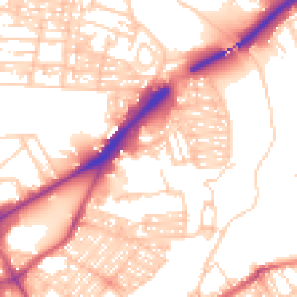
Daytime· 07:00 – 23:00
55.2dB

Night-time· 23:00 – 07:00
44.4dB