48 Beaconsfield Road, Barnet, London, N11 3AB
About 48 Beaconsfield Road
48 Beaconsfield Road is a mid-terrace house in Barnet, London, London (N11 3AB). It has a recorded floor area of 107 m² (around 1152 sq ft), construction records dating it to before 1900 and council tax band C. The latest certificate (July 2018) shows a D (score 61), on the cusp of jumping into the C band. The recommended improvements would push it to C (score 76).
Across 2019–2022, sale prices on this property compounded at 20.4% per year. Today's modelled estimate of £645,000 is 46.3% below the 2022 sale of £1,200,000, an unusual pattern given regional price growth and worth checking against the EPC condition. On a £-per-square-foot basis, the last sale (£1,042/sq ft) was about 340.7% above the typical sold price in the postcode. At 107 m² the property is well over the postcode median (60 m² across 41 EPCs), placing it in the larger end of the local stock. 3 planning records sit against the property, 2 approved, 1 refused. Past consents include an extension, a loft conversion and subdivision, meaningful when judging how the property has evolved. Most recent transfer: December 2022 at £1,200,000. That sale was during the post-pandemic price surge, when transactions cleared materially above pre-2020 trend.
Everything you need to know about 48 Beaconsfield Road
The true value, the hidden risks and the full sale history, in one report.
30-day money-back guarantee

The data behind every report


Energy performance
EPC Rating
Planning history
Council records show a subdivision application — the property's legal arrangement has been altered.
- Dec 2022ConditionsIn report
Submission of details of conditions 3 (Materials) 5 (Refuse and recycling storage) 8 (Pre-completion Sound Insulation Test Certificates) pursuant to planning permission 19/5520/FUL dated 15/10/2019
- Documents
- 9 docs on file
- Reference
- 22/5321/CON
- Dec 2019Loft ConversionFullIn report
Extension: Single storey · Rear of property
Rear extension to existing lower ground floor flat and upper ground floor. Roof extensions incorporating 2 side dormer windows to each elevation and conversion of upper ground floor, first floor and roofspace into 2 no. self-contained flats to provide a total of 3 no. self-contained flats. Associated amenity space, cycle store, refuse and recycling and alteration to rear facade including juliette doors to first floor.
- Agent
- Mr Stephen Richter
ExtensionSubdivision- Documents
- 20 docs on file
- Reference
- 19/5520/FUL
We flagged 1 thing worth checking at 48 Beaconsfield Road
Independent checks surfaced things a buyer would want to understand before offering. The report explains each one in full, with the underlying data and what to ask.
- Signs of HMO activity in the area
30-day money-back guarantee
Sales history & valuation
The latest sale landed in the post-pandemic price surge — useful context when reading the figure.
£645,000
Modelled from EPC, postcode comparables and a sale-price growth of 20.4% per year over 4 years.
£1,200,000
Growth on file: 20.4% per year over 4 years.
Sales timeline
22 December 2022Most recent
£1,200,000
+98.3%over 3 years14 April 2019
£605,000
Median price across the last 5 sales in N11 3AB: £375,000 (2024–2022).
Nearby sales in N11 3AB
Flat 3, 2 Beaconsfield Road, Barnet, London, N11 3AB
Sold Aug 2024
£375,00030 Beaconsfield Road, Barnet, London, N11 3AB
Sold Mar 2024
£450,00052 Beaconsfield Road, Barnet, London, N11 3AB
Sold Aug 2022
£325,000Flat C, 18 Beaconsfield Road, Barnet, London, N11 3AB
Sold Jun 2022
£337,00022 Beaconsfield Road, Barnet, London, N11 3AB
Sold Apr 2022
£1,000,000
Versus other Beaconsfield Road homes
Habitable Rooms for 48 Beaconsfield Road runs comfortably ahead of the street norm.
Price per m²
£11,215
Street avg £5,798
Floor Area
107 m²
Street avg 62 m²
Habitable Rooms
6 rooms
Street avg 3 rooms
CO₂ Emissions
4.7 t/year
Street avg 2.7 t/year
Everything you need to know about 48 Beaconsfield Road
The true value, the hidden risks and the full sale history, in one report.
30-day money-back guarantee
The data behind every report
Similar properties nearby
1 Glenthorne Road, Barnet
N11 3HU
1 Highgrove Close, Barnet
N11 3PT
1 Halton Close, Barnet
N11 3HQ
1 Hampton Close, Barnet
N11 3PR
1 Balmoral Avenue, Barnet
N11 3QA
1 Earl Close, Barnet
N11 3PY
1 Elm Way, Barnet
N11 3NP
1 Duchess Close, Barnet
N11 3PZ
The neighbourhood at a glance
Rail-style transport is unusually close for this postcode.
Crime
5/mo
Rising year-on-year across the wider district.
Nearest stop
0.2 km
Beaconsfield Road / New Southgate Station — bus stop.
Closest school
0.2 km
St Paul's CofE Primary School N11. 62 schools nearby.
Go deeper on the local area
The full report breaks down crime, transport links, schools and air quality in depth.
Road noise across the postcode
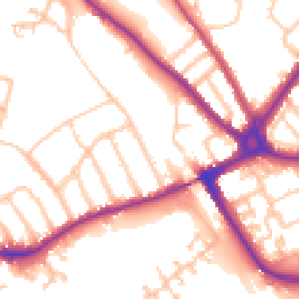
Daytime· 07:00 – 23:00
53.5dB

Night-time· 23:00 – 07:00
44.7dB