9 Bosworth Road, Enfield, London, N11 2SY
About 9 Bosworth Road
9 Bosworth Road is a one-bedroom mid-terrace house in Enfield, London, London (N11 2SY). It has a recorded floor area of 61 m² (around 657 sq ft), construction records dating it to 1900-1929 and council tax band C. The latest certificate (July 2020) shows a D (score 58), a step below the typical UK home. When first surveyed in November 2008 the rating was E, the property has climbed 1 band since. Between certificates, lighting went from Very Poor to Very Good. The recommended improvements would push it to C (score 73). At 61 m² this is the 4th smallest of 17 units on EPC record in the building, where floor areas span 53–148 m². The building's EPC ratings span E to C across 17 units on file.
Held since August 1997 — that's 29 years off the open market, well above the local norm. Only one transfer is on record with HM Land Registry, suggesting it has stayed in the same hands for a long time. Today's modelled estimate of £419,000 sits 256.6% above the 1997 sale of £117,500. On a £-per-square-foot basis, the last sale (£179/sq ft) was about 40.5% below the postcode norm. At 61 m² it sits well below the postcode median (109 m² across 16 EPCs), making it one of the more compact homes locally. 1 bedrooms is on the smaller side for this postcode, where 3 is the typical count. One planning record on file: subdivision refused in 2006.
What this property has
Inside
- Bedrooms1
Everything you need to know about 9 Bosworth Road
The true value, the hidden risks and the full sale history, in one report.
30-day money-back guarantee

The data behind every report


Energy performance
EPC Rating
Property Improvements
Changes detected from historical EPC data
Windows upgraded, improving insulation
More low energy lighting installed
Planning history
Council records show a subdivision application — the property's legal arrangement has been altered.
- Jul 2006SubdivisionFullIn report
Conversion of single family dwelling house into 2 self contained flats (comprising 1 x 1-bed and 1 x 2-bed) (retrospective).
Retrospective- Documents
- 21 docs on file
- Reference
- TP/06/0949
We flagged 2 things worth checking at 9 Bosworth Road
Independent checks surfaced things a buyer would want to understand before offering. The report explains each one in full, with the underlying data and what to ask.
- Signs of HMO activity in the area
- Larger development activity nearby
30-day money-back guarantee
Sales history & valuation
9 Bosworth Road's estimated value is more than triple its earliest registered sale price (1997).
£419,000
Modelled from EPC, postcode comparables.
£117,500
Recorded with HM Land Registry.
Sales timeline
5 August 1997Most recent
£117,500
Median price across the last 5 sales in N11 2SY: £710,000 (2025–2018).
Nearby sales in N11 2SY
18 Bosworth Road, Enfield, London, N11 2SY
Sold Mar 2025
£730,0004 Bosworth Road, Enfield, London, N11 2SY
Sold Sept 2024
£695,0001 Bosworth Road, Enfield, London, N11 2SY
Sold Feb 2024
£760,00017 Bosworth Road, Enfield, London, N11 2SY
Sold Jun 2018
£390,00012 Bosworth Road, Enfield, London, N11 2SY
Sold Mar 2018
£710,000
Versus other Bosworth Road homes
9 Bosworth Road outperforms the street on years held by a wide margin.
Price per m²
£1,926
Street avg £3,226
Floor Area
61 m²
Street avg 67 m²
Habitable Rooms
3 rooms
Street avg 3 rooms
CO₂ Emissions
3.4 t/year
Street avg 2.9 t/year
Everything you need to know about 9 Bosworth Road
The true value, the hidden risks and the full sale history, in one report.
30-day money-back guarantee
The data behind every report
Similar properties nearby
1 Beech Road, Enfield
N11 2DA
1 Evesham Road, Enfield
N11 2RR
1 Eleanor Road, Haringey
N11 2QS
1 Bexhill Road, Enfield
N11 2RG
1 Herbert Road, Haringey
N11 2QN
1 Maidstone Road, Haringey
N11 2TR
1 Lower Maidstone Road, Enfield
N11 2RU
1 Bosworth Road, Enfield
N11 2SY
The neighbourhood at a glance
Rail-style transport is unusually close for this postcode.
Crime
5/mo
Rising year-on-year across the wider district.
Nearest stop
0.2 km
Bowes Road — bus stop.
Closest school
0.2 km
Bowes Primary School. 53 schools nearby.
Go deeper on the local area
The full report breaks down crime, transport links, schools and air quality in depth.
Road noise across the postcode
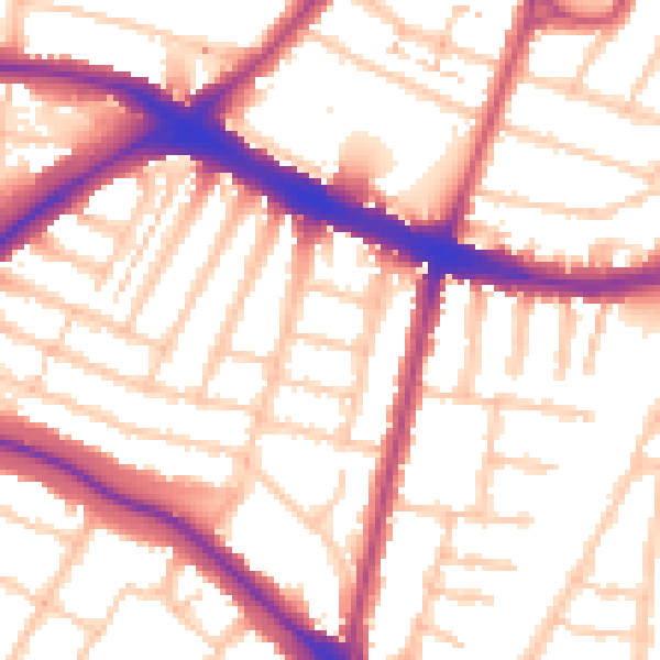
Daytime· 07:00 – 23:00
55.0dB

Night-time· 23:00 – 07:00
45.5dB