4 The Drive, Haringey, London, N11 2DY
About 4 The Drive
4 The Drive is a property in Haringey, London, London (N11 2DY). It has council tax band F.
Untraded for 30 years, with the last transfer in October 1996. Only one transfer is on record with HM Land Registry, suggesting it has stayed in the same hands for a long time. 6 planning records sit against the property, 1 approved, 1 refused. Past consents include an extension, meaningful when judging how the property has evolved.
Everything you need to know about 4 The Drive
The true value, the hidden risks and the full sale history, in one report.
30-day money-back guarantee

The data behind every report


Energy performance
No EPC on record
This property doesn't have an Energy Performance Certificate yet. An EPC is required to sell or let — and unlocks our automated valuation.
Planning history
Multiple extension applications run across more than a decade of planning history at 4 The Drive.
- Oct 2014ExtensionFullIn report
Extension: Single storey · Rear of property
Erection of rear first floor extension
- Documents
- 8 docs on file
- Reference
- HGY/2014/2494
- Nov 2011Loft ConversionOutlineIn report
Erection of rear dormer gable wall construction with insertion of 2 x rooflights to front/ 3 x rooflights to rear elevation
- Documents
- 4 docs on file
- Reference
- HGY/2011/1676
We flagged 2 things worth checking at 4 The Drive
Independent checks surfaced things a buyer would want to understand before offering. The report explains each one in full, with the underlying data and what to ask.
- Signs of HMO activity in the area
- Larger development activity nearby
30-day money-back guarantee
Sales history & valuation
Latest sale on 4 The Drive was the lowest on Land Registry record across the postcode.
£103,000
Recorded with HM Land Registry.
Sales timeline
24 October 1996Most recent
£103,000
Median price across the last 5 sales in N11 2DY: £465,000 (2018–2004).
Nearby sales in N11 2DY
Everything you need to know about 4 The Drive
The true value, the hidden risks and the full sale history, in one report.
30-day money-back guarantee
The data behind every report
Similar properties nearby
1 Amethyst Close, Haringey
N11 2LW
1 Bailey Close, Haringey
N11 2JL
1 Beech Road, Enfield
N11 2DA
1 Bexhill Road, Enfield
N11 2RG
1 Blake Road, Haringey
N11 2AD
1 Bosworth Road, Enfield
N11 2SY
1 Churston Gardens, Haringey
N11 2NJ
1 Durnsford Road, Haringey
N11 2EP
The neighbourhood at a glance
Rail-style transport is unusually close for this postcode.
Crime
5/mo
Rising year-on-year across the wider district.
Nearest stop
0.1 km
Warwick Road (N11) — bus stop.
Closest school
0.3 km
St Martin of Porres Catholic Primary School. 58 schools nearby.
Go deeper on the local area
The full report breaks down crime, transport links, schools and air quality in depth.
Road noise across the postcode
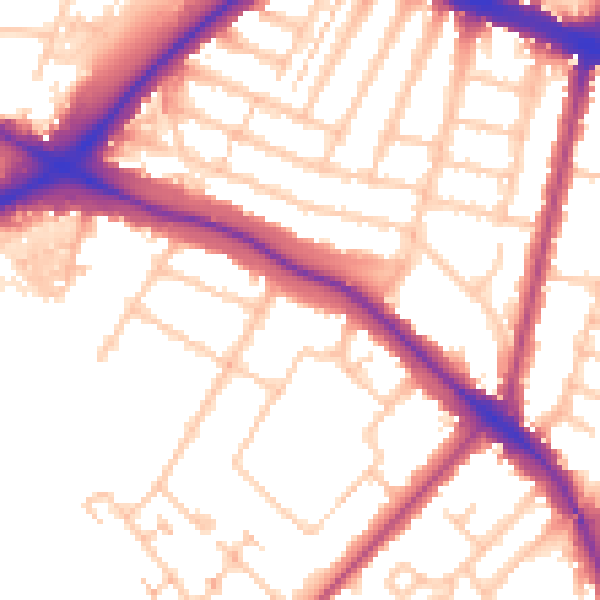
Daytime· 07:00 – 23:00
54.7dB

Night-time· 23:00 – 07:00
45.5dB