19 Torrington Gardens, Haringey, London, N11 2AB
About 19 Torrington Gardens
19 Torrington Gardens is a mid-terrace house in Haringey, London, London (N11 2AB). It has a recorded floor area of 123 m² (around 1324 sq ft), construction records dating it to 1930-1949 and council tax band E. The latest certificate (May 2024) shows a D (score 60), on the cusp of jumping into the C band. The recommended improvements would lift it to B (score 84), a 2-band jump.
Untraded for 20 years, with the last transfer in October 2006. Today's modelled estimate of £813,000 sits 111.2% above the 2006 sale of £385,000. On a £-per-square-foot basis, the last sale (£291/sq ft) was about 36.4% below the postcode norm.
Everything you need to know about 19 Torrington Gardens
The true value, the hidden risks and the full sale history, in one report.
30-day money-back guarantee

The data behind every report


Energy performance
Recommended upgrades on file would lift this property by multiple EPC bands.
EPC Rating
Planning history
19 Torrington Gardens has no planning applications on record.
Notable planning nearby
20applications of note in the surrounding area
We flagged 2 things worth checking at 19 Torrington Gardens
Independent checks surfaced things a buyer would want to understand before offering. The report explains each one in full, with the underlying data and what to ask.
- Signs of HMO activity in the area
- Larger development activity nearby
30-day money-back guarantee
Sales history & valuation
19 Torrington Gardens valuation sits well clear of the typical sold price in this postcode.
£813,000
Modelled from EPC, postcode comparables.
£385,000
Recorded with HM Land Registry.
Sales timeline
19 October 2006Most recent
£385,000
Median price across the last 5 sales in N11 2AB: £885,000 (2025–2020).
Nearby sales in N11 2AB
18 Torrington Gardens, Haringey, London, N11 2AB
Sold Feb 2025
£885,00014 Torrington Gardens, Haringey, London, N11 2AB
Sold Dec 2023
£735,00039 Torrington Gardens, Haringey, London, N11 2AB
Sold Apr 2023
£905,0001 Torrington Gardens, Haringey, London, N11 2AB
Sold Aug 2022
£1,050,0003 Torrington Gardens, Haringey, London, N11 2AB
Sold Dec 2020
£850,000
Versus other Torrington Gardens homes
19 Torrington Gardens outperforms the street on years held by a wide margin.
Price per m²
£3,130
Street avg £5,587
Floor Area
123 m²
Street avg 130 m²
Habitable Rooms
5 rooms
Street avg 6 rooms
CO₂ Emissions
5.4 t/year
Street avg 4.3 t/year
Everything you need to know about 19 Torrington Gardens
The true value, the hidden risks and the full sale history, in one report.
30-day money-back guarantee
The data behind every report
Similar properties nearby
1 Hastings Road, Enfield
N11 2RJ
1 Lancaster Road, Enfield
N11 2TB
1 Bosworth Road, Enfield
N11 2SY
1 Lower Maidstone Road, Enfield
N11 2RU
1 Ollerton Road, Enfield
N11 2JY
1 Passmore Gardens, Haringey
N11 2PE
1 Edith Road, Haringey
N11 2QW
1 Fletton Road, Haringey
N11 2QL
The neighbourhood at a glance
Rail-style transport is unusually close for this postcode.
Crime
5/mo
Rising year-on-year across the wider district.
Nearest stop
0.1 km
Cline Road — bus stop.
Closest school
0.1 km
St Martin of Porres Catholic Primary School. 58 schools nearby.
Go deeper on the local area
The full report breaks down crime, transport links, schools and air quality in depth.
Road noise across the postcode
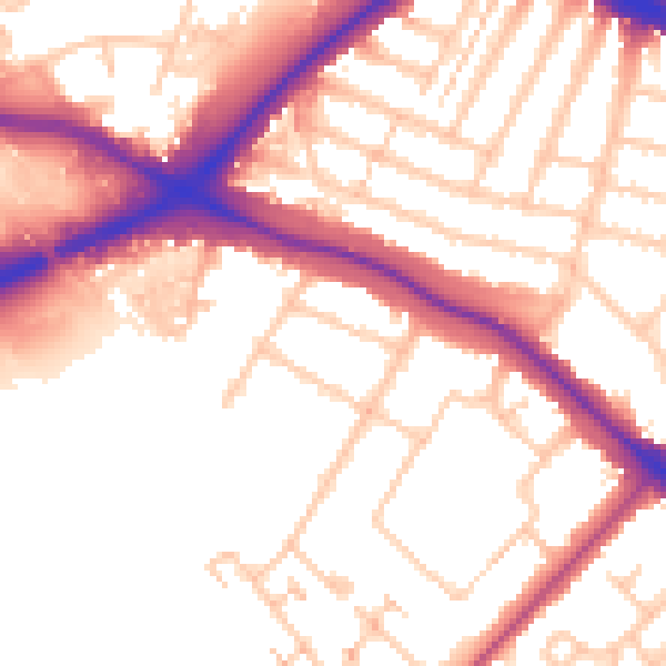
Daytime· 07:00 – 23:00
54.4dB

Night-time· 23:00 – 07:00
45.6dB