41 Moreton Road North, Luton, LU2 9DP
About 41 Moreton Road North
41 Moreton Road North is a two-bedroom detached house in Luton (LU2 9DP). It has a recorded floor area of 64 m² (around 689 sq ft), construction records dating it to 1967-1975 and council tax band A. The latest certificate (March 2014) shows a D (score 62), on the cusp of jumping into the C band. The recommended improvements would push it to C (score 70). The latest certificate is from March 2014, so improvements made since then won't be reflected.
Sold September 2019 for £190,000. Across the public record there are 4 sales, relatively high churn for a single property. Across 1999–2019, sale prices on this property compounded at 8.7% per year. Today's modelled estimate of £217,000 is 14.2% above the 2019 sale price. On a £-per-square-foot basis, the last sale (£276/sq ft) was about 76% above the typical sold price in the postcode.
What this property has
Inside
- Bedrooms2
Outside
- Private gardenYes
- GarageDouble
Everything you need to know about 41 Moreton Road North
The true value, the hidden risks and the full sale history, in one report.
30-day money-back guarantee

The data behind every report


Energy performance
41 Moreton Road North's EPC is over a decade old — improvements since won't be reflected.
EPC Expired
This certificate is over 10 years old and is no longer valid.Expired 04 Mar 2024
EPC Rating
Planning history
41 Moreton Road North has no planning applications on record.
Notable planning nearby
1applications of note in the surrounding area
Sales history & valuation
41 Moreton Road North has more than quadrupled in price since its earliest registered sale in 1999.
£217,000
Modelled from EPC, postcode comparables and a sale-price growth of 8.7% per year over 20 years.
£190,000
Growth on file: 8.7% per year over 20 years.
Sales timeline
26 September 2019Most recent
£190,000
+52.0%over 11 years18 October 2007
£125,000
+4.2%over 2 years24 November 2004
£120,000
+242.9%over 5 years27 May 1999
£35,000
Median price across the last 5 sales in LU2 9DP: £180,000 (2022–2018).
Nearby sales in LU2 9DP
Versus other Moreton Road North homes
Floor Area for 41 Moreton Road North runs comfortably ahead of the street norm.
Price per m²
£2,969
Street avg £2,290
Floor Area
64 m²
Street avg 55 m²
Habitable Rooms
3 rooms
Street avg 3 rooms
CO₂ Emissions
3.1 t/year
Street avg 2.4 t/year
Everything you need to know about 41 Moreton Road North
The true value, the hidden risks and the full sale history, in one report.
30-day money-back guarantee
The data behind every report
Similar properties nearby
1 Chertsey Close
LU2 9JD
1 Chelsworth Close
LU2 9SU
1 Baylam Dell
LU2 9ST
1 Carteret Road
LU2 9JY
1 Barnston Close
LU2 9RZ
1 Byron Close, Ashcroft Road
LU2 9AE
1 Eastcott Close
LU2 9JP
1 Belsham Place
LU2 9UT
The neighbourhood at a glance
Crime
6/mo
Steady year-on-year across the wider district.
Nearest stop
0.3 km
Deep Denes — bus stop.
Closest school
0.2 km
Ramridge Primary School. 30 schools nearby.
Go deeper on the local area
The full report breaks down crime, transport links, schools and air quality in depth.
Road noise across the postcode
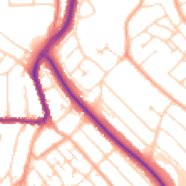
Daytime· 07:00 – 23:00
52.2dB

Night-time· 23:00 – 07:00
41.8dB