41 Brays Road, Luton, LU2 9DD
About 41 Brays Road
41 Brays Road is a three-bedroom semi-detached house in Luton (LU2 9DD). It has a recorded floor area of 79 m² (around 850 sq ft), construction records dating it to 1950-1966 and council tax band B. The latest certificate (June 2017) shows a D (score 64), on the cusp of jumping into the C band. The recommended improvements would lift it to B (score 82), a 2-band jump.
Across 2004–2022, sale prices on this property compounded at 7.7% per year. On a £-per-square-foot basis, the last sale (£347/sq ft) was about 99.4% above the typical sold price in the postcode. Last sale on file: £295,000 in February 2022. That sale was during the post-pandemic price surge, when transactions cleared materially above pre-2020 trend.
What this property has
Inside
- Bedrooms3
- Bathrooms1
- Dining roomYes
Outside
- Private gardenFront
Everything you need to know about 41 Brays Road
The true value, the hidden risks and the full sale history, in one report.
30-day money-back guarantee

The data behind every report


Energy performance
Recommended upgrades on file would lift this property by multiple EPC bands.
EPC Rating
Planning history
41 Brays Road has no planning applications on record.
Notable planning nearby
1applications of note in the surrounding area
Sales history & valuation
Sale price has grown by over 3x since 2004.
£318,000
Modelled from EPC, postcode comparables and a sale-price growth of 7.7% per year over 17 years.
£295,000
Growth on file: 7.7% per year over 17 years.
Sales timeline
18 February 2022Most recent
£295,000
+15.7%over 4 years20 September 2017
£255,000
+211.0%over 12 years21 December 2004
£82,000
Median price across the last 5 sales in LU2 9DD: £285,000 (2024–2020).
Versus other Brays Road homes
On price per m², 41 Brays Road stands well clear of the street.
Price per m²
£3,734
Street avg £2,524
Floor Area
79 m²
Street avg 84 m²
Habitable Rooms
4 rooms
Street avg 5 rooms
CO₂ Emissions
3.7 t/year
Street avg 3.2 t/year
Everything you need to know about 41 Brays Road
The true value, the hidden risks and the full sale history, in one report.
30-day money-back guarantee
The data behind every report
Similar properties nearby
1 Brays Road
LU2 9DD
1 Birtley Croft
LU2 9TR
1 Dovehouse Hill
LU2 9ES
1 Clevedon Road
LU2 9EB
1 Buckingham Drive
LU2 9RA
1 Corbridge Drive
LU2 9UF
1 Ashcroft Road
LU2 9AU
1 Byron Close, Ashcroft Road
LU2 9AE
The neighbourhood at a glance
Crime
6/mo
Steady year-on-year across the wider district.
Nearest stop
0.1 km
Brays Road — bus stop.
Closest school
0.4 km
Sacred Heart Catholic Primary School. 24 schools nearby.
Go deeper on the local area
The full report breaks down crime, transport links, schools and air quality in depth.
Road noise across the postcode
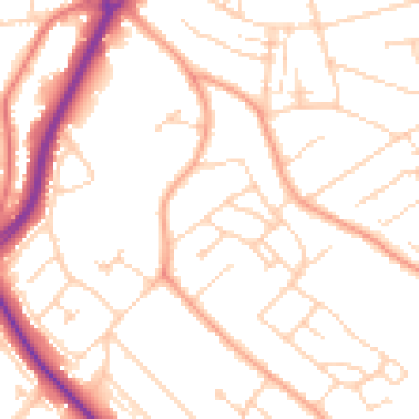
Daytime· 07:00 – 23:00
50.7dB

Night-time· 23:00 – 07:00
40.3dB