6 Dunstable Road, Luton, LU1 1DX
About 6 Dunstable Road
6 Dunstable Road is a two-bedroom end-of-terrace house in Luton (LU1 1DX). It has a recorded floor area of 35 m² (around 377 sq ft), construction records dating it to 1900-1929 and council tax band A. The latest certificate (March 2022) shows a C (score 78), near the top of the C band. The rating has held steady at C across 6 certificates since June 2012. Between certificates, wall efficiency went from Very Poor to Good and lighting went from Average to Very Good.
7 planning records sit against the property, 5 approved, 2 refused. Past consents include an extension, subdivision and HMO conversion, meaningful when judging how the property has evolved.
What this property has
Inside
- Bedrooms2
Everything you need to know about 6 Dunstable Road
The true value, the hidden risks and the full sale history, in one report.
Pick your report · from £14.99
One time fee only - money back guarantee

The data behind every report







Energy performance
6 Dunstable Road's carbon output is low for the local stock.
EPC Rating
Certificate validity
Valid until 23 March 2032
Property Improvements
Changes detected from historical EPC data
More low energy lighting installed
Low energy lighting percentage decreased
Heating controls changed
Cavity wall insulation installed
Roof insulation improved
Heating controls upgraded for better temperature management
More low energy lighting installed

Get a survey for this property
Level 3 Building Survey
Because the property was built before 1919, we believe a Level 3 building survey should be considered.
From £820 · Includes VAT
Planning history
Council records show a subdivision application — the property's legal arrangement has been altered.
7 applications on record at 6 Dunstable Road, Luton, LU1 1DX
- Nov 2007SubdivisionFullOutcome in report
Conversion and change of use from HMO to form 5 flats with refurbishment of existing restaurant on ground floor and alterations to building and conversion of third floor extension.
ExtensionHMO- Documents
- 7 docs on file
- Reference
- 07/01293/FUL
- More recent applications — locked
- SubdivisionApr 2010Decision
- Loft ConversionJan 2010Decision
+ 4 more applications in the report
Unlock 6 Dunstable Road, Luton, LU1 1DX's full planning history
You're seeing the shape of it. The report has the substance.
- Every decision — granted, refused or withdrawn (7 on record)
- All 7 applications on this property in full, plus 21 notable nearby
- The 8 documents, officer reports & conditions
- What the pattern means for extending or converting here
One time fee only - money back guarantee
Sales history & valuation
6 Dunstable Road has no Land Registry sales on file, suggesting it has stayed in the same hands since registration began.
£127,000
Modelled from EPC, postcode comparables.
No sales recorded with HM Land Registry
That can mean the property has never traded since the registry began publishing in 1995, was a new build that hasn't been registered yet, or is held in the same hands long-term.
Everything you need to know about 6 Dunstable Road
The true value, the hidden risks and the full sale history, in one report.
Pick your report · from £14.99
One time fee only - money back guarantee
The data behind every report
Similar properties nearby
1 Cardigan Mews, Cardigan Street
LU1 1RN
1 Butlin Road
LU1 1LB
1 Crown Court, Inkerman Street
LU1 1JB
1 Belmont Road
LU1 1LL
1 Cardigan Street
LU1 1RP
1 Beech Road
LU1 1DW
1 Clifton Road
LU1 1PB
1 Dallow Road
LU1 1NH
The neighbourhood at a glance
Rail-style transport is unusually close for this postcode.
Crime
578/mo
Falling year-on-year across the wider district.
Nearest stop
0.1 km
Liverpool Road — bus stop.
Closest school
0.5 km
Dallow Primary School. 33 schools nearby.
Go deeper on the local area
A Local Area report breaks down crime, transport links, schools and air quality in depth.
Road noise across the postcode
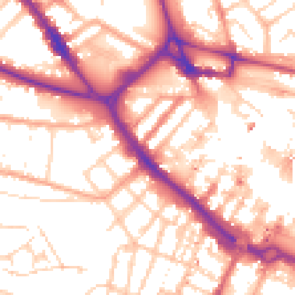
Daytime· 07:00 – 23:00
55.5dB

Night-time· 23:00 – 07:00
45.3dB