82 The Ringway, Queniborough, Leicester, LE7 3DL
About 82 The Ringway
82 The Ringway is a detached house in Queniborough, Leicester, Leicester (LE7 3DL). It has a recorded floor area of 146 m² (around 1572 sq ft), construction records dating it to 1950-1966 and council tax band C. The latest certificate (February 2019) shows a C (score 73). When first surveyed in March 2009 the rating was E, the property has climbed 2 bands since. Between certificates, wall efficiency went from Poor to Average and roof efficiency went from Average to Very Good. The recommended improvements would push it to B (score 82).
At 146 m² the property is well over the postcode median (83 m² across 29 EPCs), placing it in the larger end of the local stock. Its energy rating outperforms most of the postcode (better than 86% of similar EPCs). Sold July 2022 for £390,000. Across the public record there are 4 sales, relatively high churn for a single property. That sale was during the post-pandemic price surge, when transactions cleared materially above pre-2020 trend. One planning record on file: an extension approved in 2009. Past consents include an extension, meaningful when judging how the property has evolved. Across 1998–2022, sale prices on this property compounded at 7.2% per year. Today's modelled estimate of £448,000 is 14.9% above the 2022 sale price. On a £-per-square-foot basis, the last sale (£248/sq ft) was about 25.2% above the typical sold price in the postcode.
Everything you need to know about 82 The Ringway
The true value, the hidden risks and the full sale history, in one report.
30-day money-back guarantee

The data behind every report


Energy performance
EPC Rating
Property Improvements
Changes detected from historical EPC data
Heating controls upgraded for better temperature management
Cavity wall insulation installed
Loft insulation upgraded to recommended levels
Planning history
82 The Ringway has an approved side and rear extension on the planning record.
- Nov 2009ExtensionFullIn report
Extension: Side and rear of property
Erection of extension to side and rear of bungalow, and dormer window to the side.
- Council
- South
- Documents
- 13 docs on file
- Reference
- P/09/1737/2
What's in 82 The Ringway, Queniborough, Leicester, LE7 3DL's planning history?
Refusals, disputes and full decisions on this property and nearby, in the report.
Sales history & valuation
Price for 82 The Ringway has grown more than fourfold since the 1998 starting point.
£448,000
Modelled from EPC, postcode comparables and a sale-price growth of 7.2% per year over 24 years.
£390,000
Growth on file: 7.2% per year over 24 years.
Sales timeline
14 July 2022Most recent
£390,000
+18.2%over 2 years12 September 2019
£330,000
+88.6%over 10 years6 August 2009
£175,000
+133.3%over 10 years6 November 1998
£75,000
Median price across the last 5 sales in LE7 3DL: £310,000 (2023–2022).
Nearby sales in LE7 3DL
24 The Ringway, Queniborough, Leicester, LE7 3DL
Sold Aug 2023
£310,00018 The Ringway, Queniborough, Leicester, LE7 3DL
Sold Apr 2023
£280,00084 The Ringway, Queniborough, Leicester, LE7 3DL
Sold Jan 2023
£435,000108 The Ringway, Queniborough, Leicester, LE7 3DL
Sold Sept 2022
£325,00052 The Ringway, Queniborough, Leicester, LE7 3DL
Sold Jan 2022
£245,000
Versus other The Ringway homes
82 The Ringway outperforms the street on epc rating by a wide margin.
Price per m²
£2,671
Street avg £2,809
Floor Area
146 m²
Street avg 83 m²
Habitable Rooms
5 rooms
Street avg 5 rooms
CO₂ Emissions
4.3 t/year
Street avg 4.2 t/year
Everything you need to know about 82 The Ringway
The true value, the hidden risks and the full sale history, in one report.
30-day money-back guarantee
The data behind every report
Similar properties nearby
1 Citrus Avenue, Barkby
LE7 3AR
1 Barkby Road, Queniborough
LE7 3FE
1 Chestnut Way, East Goscote
LE7 3QQ
1 Chapel Close, Queniborough
LE7 3AE
1 Avenue Road, Queniborough
LE7 3FB
1 Daisy Close, Queniborough
LE7 3AD
1 Cordata Crescent, Barkby
LE7 3AY
1 Campion Avenue, Queniborough
LE7 3GD
The neighbourhood at a glance
Crime
2/mo
Steady year-on-year across the wider district.
Nearest stop
0.2 km
Primrose Way — bus stop.
Closest school
0.2 km
Queniborough Church of England Primary School. 6 schools nearby.
Go deeper on the local area
The full report breaks down crime, transport links, schools and air quality in depth.
Road noise across the postcode
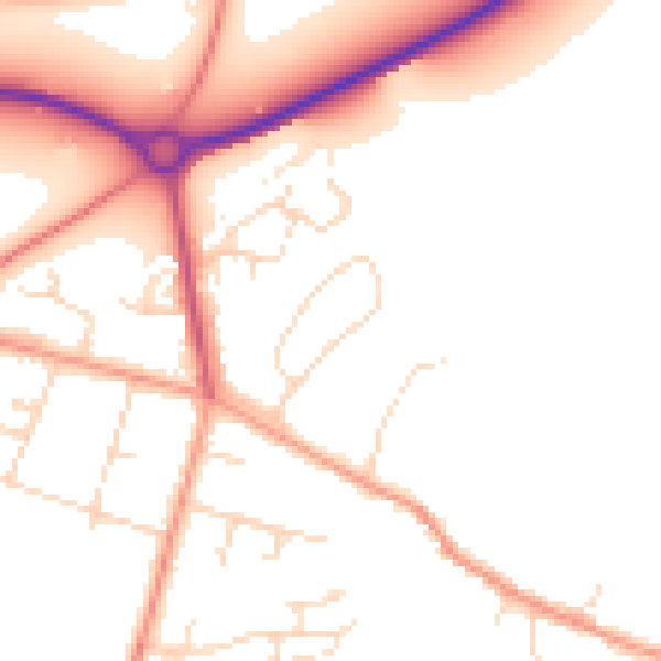
Daytime· 07:00 – 23:00
50.7dB

Night-time· 23:00 – 07:00
41.5dB